Sunday 18/02/2024 Mill Creek Campsite – Cape Hauy Track – Candlestick – Totem Pole – Cape Hauy
Tasman National Park, lutruwita / TASMANIA
Pydairerme clan, Oyster Bay Nation
Participants: Stephen Davies (Photos, Report), Sue Davies
It was yet another gorgeous morning and we attempted to make an early start to walk to Cape Hauy and Mount Fortescue as the walk was recommended in our guidebook (about 18km). Doubts started to set in when we arrived at the trailhead with a sign saying “No access to Mount Fortescue and Mount Pillar”.
Thursday 26/10/2023 Horseshoe Bend Campground – Horseshoe Bend Road – Pomponderoo Hill Road – Pomponderoo Hill
Little Desert National Park, VICTORIA
Wotjobaluk, Jaadwa, Jadawadjali, Wergaia and Jupagulk Country
Participants: Stephen Davies (Photos, Report), Sue Davies
Having kept relatively close to the Wimmera River during our morning walk we headed away from it in the afternoon. Although you can drive to the start of the Pomponderoo Hill walk along Pomponderoo Hill Road, we chose to walk from the Horse Shoe Bend Campsite. As we were walking along Pomponderoo Hill Road a fox made a quick crossing not far in front of us. We arrived at the Pomponderoo Hill Carpark, just as another couple were preparing to start.
Tuesday 10/10/2023 Bainggug (The Piccaninny) Carpark – The Piccaninny Walk – The Piccaninny (448m) – Mount Sturgeon Track – Wurgarri (Mount Sturgeon) (580m) – Grampians Peaks Trail – Wannon River – Dunkeld
Grampians National Park, VICTORIA
Gariwerd Country
Participants: Stephen Davies (Photos, Report), Sue Davies, Trish Law, Dave Whitelaw
As we drove heading north from Dunkeld there was a shroud of low cloud concealing the summit of Mount Abrupt. After parking at Bainggug (The Piccaninny) Carpark we headed off along The Piccaninny Walk towards The Piccaninny. The morning was cool enough to require a warm layer until near midday. We found all the tracks to be in excellent condition, it is apparent that there had been a lot of recent work done on them. Signage appeared new and there were several numbered emergency poles to let emergency services know exactly where you were. Traversing sections have stone walls on their lower side building them up to the horizontal, most having had sandy gravel added as the walking surface. There are cut sandstone block steps on several steeper sections and steel steps and a bridge to the southern side of Mount Sturgeon, all combining to make it easy underfoot.
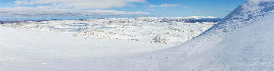
30/07/2022 – 2/08/2022 Guthega Power Station – Guthega Power Station – Munyang River – Disappointment Spur – Disappointment Spur Hut – Schlink Pass Road – Dicky Cooper Creek – Schlink Hut – Duck Creek – Valentine Hut – Valentine Creek – Mawsons Hut – Tin Hut – Dead Horse Creek Saddle – Gungartan Pass – Schlink Pass Road – Munyang River – Guthega Power Station
Kosciuszko National Park, NSW
Ngarigo Country
Distance: 63km Total Ascent: 3,000m Total Descent: 3,000m Time: 22 hours
Participants: Damien Aggio, Stephen Davies (Photos, Report), Tim Hager, Paul Jennings (Leader)
I was keen to join in on Paul’s posted five-day New South Wales Nordic Ski Club trip. He had advertised a very interesting trip entering via Scammels Lookout Road, with a plan to visit Pretty Plain Hut, Grey Mare Hut, O’Keekes Hut and Jagungal. Approaching the start date it became obvious there would be a distinct lack of snow along the proposed route, so he came up with an alternate plan. We all spent Friday night at Paul’s newly purchased property outside of Berridale so we could make an early start on the planned long day skiing from Guthega Power Station to Mawsons Hut.