
18/03/2026 – 20/03/2026 Lee Bay Road – Lee Bay – Mãori Beach – Wooding Bay – Magnetic Beach – Port William – Port William Hut – North Arm Hut – North Arm – Sawdust Bay Campsite – Kaipipi Road – Ryans Creek Track – Main Road – Kairakau / Halfmoon Bay – Oban
Rakiura Track
Stewart Island / Rakiura
Southland Region, NEW ZEALAND (Aotearoa)
Rakiura Country (Ngãi Tahu people)
Distance: 38.6km Total Ascent: 1275m Total Descent: 1296m
Time: 15 hours
Participants: Stephen Davies (Photos), Sue Davies (Report)
Stepping through the great iron chain at Lee Bay felt like walking across the anchor of an ancient story, the bush and sea already sharing their secrets on the wind. The Rakiura Track here is a gentle, well‑benched path, undulating above the rocky shoreline before slipping into deep, damp forest where rimu and southern rātā lean over the track and the air smells of salt and leaf mould. Underfoot it was mostly firm gravel with the odd muddy patch in hollows, never technical but always asking you to watch your step.
Beyond Little River’s tannin‑stained bridge the world opened onto the long sweep of Māori Beach, the sand scoured clean by a cool southerly and short bursts of passing showers. MetService had forecast a run of typical Rakiura weather – fresh south‑westerlies, passing showers and sunny breaks – and that is exactly what arrived: curtains of rain shouldering across Foveaux Strait then tearing away to reveal bright, sharp light on the surf. Between squalls, the swing bridge at the northern end of the beach framed a view of the estuary, its waters the colour of strong tea.
The climb to Magnetic Beach was short but enclosed, a tunnel of dripping green, before the track dropped to the pale sand and the final wander towards Port William/Potirepo. The hut, tucked just back from the shore amongst old gum trees planted by Shetland settlers in the 1870s, felt like a small outpost at the edge of the world, warmed by the chatter of other walkers and the slow pulse of waves in the bay. As dusk fell, the forest grew louder – kiwi rustling somewhere in the shadows, korimako and kākāriki giving last calls – and the sky above Rakiura lived up to its name, glowing softly as cloud and colour shifted over the dark hills.
Day 1: Wednesday 18/03/2026 Lee Bay Road – Lee Bay – Little River – Wooding Bay – Mãori Beach – Wooding Bay – Maori Beach swing bridge – Magnetic Beach – Port William – Port William / Potirepo Hut
Rakiura Track (Lee Bay to Port William section)
Rakiura National Park
Southland Region, NEW ZEALAND
Rakiura Country (Ngāi Tahu, including Waitaha, Ngāti Mamoe and Ngāi Tahu people)
Max elevation: 116 m
Total climbing: 332 m
Total descent: -367 m
Average speed: 3.01 km/h
Total time: 04:18:50
Unexpected sunshine
The Māori name for the island is Rakiura, meaning “land of the glowing skies”.
With the promised forecast of clearing weather, we booked a taxi for 10:00am for the short drive to Lee Bay at the start of the track. As promised, the sun emerged, and we enjoyed pleasant walking conditions all day.

Lee Bay
The track followed the coast near Lee Bay on a good-quality path. The forest was lovely and lush with abundant ferns. We were able to walk along the beaches as fortunately, the tide was low.
We walked along Māori Beach and had lunch at the far end. We then crossed the swing bridge over a tea tree-stained creek.

Maori Beach swing bridge
From here, the trail was undulating through picturesque forest. We then descended to the Port William Hut, where we were booked in for the night.
It was very sociable in the fully booked hut. The afternoon sun was shining, and the water views were stunning. The New Zealanders get excited about seeing deer, which are feral. We just want to see a Kiwi, hopefully tonight!
Unfortunately, we didn’t see any Kiwi, but we heard them. Several people were out from 4:00am, and I went out about 5:30am, but to no avail.
Day 2: Thursday 19/03/2026 Port William / Potirepo Hut – Magnetic Beach – Port William – Log haulers machinery site – North Arm Hut – North Arm
Conservation Area – Stewart Island/Rakiura Forest
Southland Region, NEW ZEALAND
Rakiura Country (Ngāi Tahu, including Waitaha, Ngāti Mamoe and Ngāi Tahu people)
Max elevation: 196 m
Total climbing: 665 m
Total descent: -642 m
Average speed: 2.93 km/h
Total time: 06:15:44
Mud (not so) glorious mud
We set off around 9:00am, and we were almost the last to set off.
We retraced the first few kms from the end of yesterday and then turned towards the track to North Arm Hut.

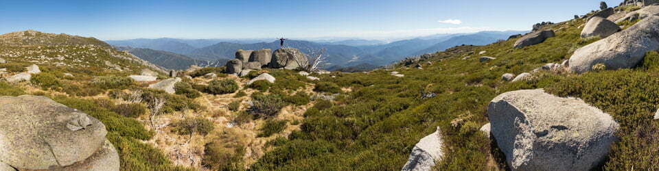
Sue on Rakiura Track behind south end Magnetic Beach
The weather was perfect, and the forest was lovely with abundant ferns and mosses. It was up and down all day with a few steep climbs. Then we hit the much-anticipated mud! Most of my photos were of mud, which was the main theme of the day!
I tried to avoid the mud by walking on trails around the side. At one stage, I was following one of those trails, and it didn’t seem to be linking up with the main trail. When I checked the map, I was heading in the wrong direction!

Muddy Rakiura Track almost midway to North Arm
I rejoined the trail and thought Steve might have passed me. I checked with some walkers heading in the opposite direction, whether they had seen a man with lots of cameras, and he was just ahead of me.
We stopped for lunch on moss-covered rocks. After lunch, I headed off and kept going until I reached the hut. A lovely Fantail bird followed me for quite a distance on the track. It was about a 3-hour undulating walk. I had hoped for a gradual descent over the last few kilometres, but the hills kept coming.
Susan, a fellow walker, had saved us some lower-level bunks for which we were very grateful.
We washed our mud-caked boots at the beach and enjoyed the afternoon sunshine.
At the hut talk at night, the warden told us that we were “lucky” to experience the track today, as it would soon be a boardwalk. I’m not sure I would call it luck, but it will certainly change the experience of the trail.
Amongst other photographically recorded observations during this walk, we were able to confirm sightings of each of the following species: Artist’s Brackets, Reishi, and Allies (Genus Ganoderma), New Zealand Nursery Web Spider (Dolomedes minor)
Day 3: Friday 20/03/2026 North Arm – North Arm campsite – Sawdust Bay Campsite – Gallon’s Sawmill – Kaipipi Bay – Kaipipi Road – Ryans Creek Track – Main Road – Kairakau / Halfmoon Bay – Oban
Kaipipi Scenic Reserve
RakiuraCountry (Ngāi Tahu, including Waitaha, Ngāti Mamoe and Ngāi Tahu people; Rakiura Māori)
Max elevation: 99 m
Total climbing: 420 m
Total descent: -434 m
Average speed: 3.46 km/h
Total time: 04:45:52
Sadly, no Kiwi sightings
After another night sleeping side by side with other snoring trampers, we had an early attempt at Kiwi spotting. No luck again!
I headed off ahead of a large group, hopefully for a sighting of the way out. There was some mud, but nowhere near as bad as yesterday.

Forest past North Arm campsite
It was an undulating route but generally a good quality trail which weaved past bays and up and down between streams.

Looking back across first beach past North Arm
I waited for Steve for a while, but decided to walk on my own with the faint hope of sighting the elusive bird. I arrived at the end of the trail around midday and waited for Steve for the final few kilometres of the walk into town. We had lunch and reflected on the last few days. We had a great group of New Zealanders walking with us and sharing the hut. We had perfect weather, which we were very grateful for. I couldn’t imagine doing this walk in the rain! The forest was really beautiful, but scenic views were limited. I certainly don’t plan on doing any of the longer circuit walks on the island, as these involve negotiating thigh-deep mud. It was a pleasant experience nonetheless, and we have ticked off another Great Walk. Sadly, we didn’t see a Kiwi in the end.

Wild Adventures Facebook Group
Clickable icons on this world map will open the related trip report
A detailed, searchable trip list with links to reports, photo galleries and other content
From New Zealand Department of Conservation Track Guide
TRACK GUIDE This is a circular track and can be hiked in either direction. The track is well marked and signposted but some sections are steep, and may be rough or muddy.
The times are approximate and will vary according to your fitness, direction of travel and the weather. It will take approximately 1.5 hours to walk the 5km from Oban to the start of the track at Lee Bay.
Lee Bay Road to Port William Hut. 3-4hr, 8 km
Passing through the chain-link sculpture at Lee Bay, the track follows the coast to Little River. Once you have crossed the bridge a wellsignposted high tide track continues directly off the bridge. At low tide you can cross the beach to the right where another track heads up the hill to join the main track; this is clearly marked with a DOC orange triangle. The track heads around Peters Point and on to Maori Beach.
The creek at the eastern end of Maori Beach can easily be waded at low tide; at high tide continue along the track until you come to a small footbridge that will lead you back through the campsite to the beach.
Maori Beach campsite is in a grassy clearing close to the beach.
Maori Beach
In 1913 the island’s last timber mill was developed at Maori Beach. By 1920 two sawmills were established. At the historic site behind the campsite you can see and read about the remains of the sawmilling enterprises that lasted until 1931.
A swing bridge spans the tidal stream at the western end of the beach. From here the track climbs a small hill and continues on to intersect with the track to North Arm. Continue straight ahead and you will gradually drop down to the campsite above Magnetic Beach in Port William/ Potirepo. Port William Hut is just 5 min beyond the campsite.
Port William/Potirepo Mãori established hunting camps or kaika at many coastal sites, including Port William/ Potirepo, reached by outrigger canoe. This was the site of the early Mãori settlement of Pā Whakataka. During the 1800s its sheltered harbour was used by sealers, and later as a whaling base. Gold prospecting was unsuccessful but the discovery of an oyster bed proved more lucrative. The eucalyptus (gum trees) are the most notable remains of the attempted European settlement during the 1870s.
Side trip A – Ryans Creek. Additional 2hr return
Ryans Creek track intersects with the main track 15 mins before it reaches Main Road, offering an alternate finish to the hike.
Ryans Creek track follows an old logging road that leads to the site of the historic Ryans Creek mill. At low tide discarded timber from the mill is evident in the creek. The track continues to wind around the coast featuring stunning vistas out across Paterson Inlet before finishing at the sheltered waters of Faith, Hope and Charity islands. The last 15 mins by road will take you over the hill to Oban.
Port William Hut to North Arm Hut 6hr, 13 km
The track to North Arm starts on the hill between Maori Beach and Port William/Potirepo. Trampers usually stay the night at Port William Hut and then backtrack the 40min to the turn-off.
Around 20 min from the intersection, an incongruous sight reminds us of a time gone by. Two log haulers loom out of the undergrowth: the Johnston hauler was used to pull logs out of the bush, and the shaft-driven McAllister machine then lowered ‘bogies’ loaded with the logs down the tramway to the mill site. These haulers are the best examples in New Zealand of machinery of this type that remain in situ.
The track undulates through valleys and forested ridges. The vegetation is varied, including previously milled and virgin podocarp forest.
A campsite, with shelter and toilet, is located above North Arm Hut.
North Arm Hut to Main Road/ Fern Gully car park
4-4 hr 30 min, 11 km
This section of track provides access to the shores of Paterson Inlet/Whaka a Te Wera.
A moderate and undulating hike takes you through kamahi and rimu trees with stunning vistas across the inlet. The track follows the coast down to secluded bays, passing a number of historic mill sites. Sawdust Bay has tidal mudflats, making it a great spot to watch wading birds feed at low tide. Kaipipi Bay is a perfect place for a picnic. There s a small grassy knoll on the water’s edge with a view across this sheltered waterway. The track ends at the Main Road/Fern Gully car park. From the track end it is another 2 km (20 – 30 min walk) along the road to get back to Oban township.
Paterson Inlet/Whaka a Te Wera The sheltered waters of Paterson Inlet/Whaka a Te Wera were used early in the 19th century by whaling boats. The first large-scale industry was timber, beginning in 1861 with the opening of sawmills at Kaipipi. In the 1920s and 1930s, a Norwegian whaling company ran a repair base in Prices Inlet, where chaser boats were serviced in preparation for the Antarctic summer.
Side trip B – Ulva Island/ Te Wharawhara
Make the most of your island escape and explore Ulva Island, a predator-free sanctuary just a short boat ride from Golden Bay. The island is home to many rare and endangered native birds and there are easy walking tracks you can explore. Listen out as you walk around, and you may spot bellbirds/korimako, riflemen/tititipounamu, or saddlebacks/tieke. Rare South Island kakã are readily seen on Ulva Island – their noisy calls and colourful plumage make for easy identification.
Track history
The Mãori name for the island is Rakiura, commonly translated as ‘land of the glowing skies’, possibly in reference to the vibrant sunrise, lingering sunsets and occasional night-time glow of the aurora australis. One of the earlier Mãori names for the island is Te Puka o Te Waka o Mãui. This refers to the story of Maui, who used the South Island as his waka or canoe, to fish up the North Island while usir Rakiura as his anchor stone. The chain link sculptur at Lee Bay, which marks the entrance to the Rakiura National Park, is in recognition of this legend. Archaeological excavations have shown evidence of Maori habitation around Stewart Island/Rakiura from the 13th century. Hunting camps or käika were established at many coastal sites including Port William/Potirepo and Freshwater River, and were reached by outrigger canoe.
The livelihoods of the island’s 400 permanent residents are today based around conservation, fishing, aquaculture, tourism and associated servic
Welcome to the Rakiura Track, one of ten unforgettable journeys.
Escape on an island adventure and relax in peaceful surroundings with the bush, birds and beach at your side. Follow this leisurely circuit track along open coastline, through forest and along Paterson Inlet’s sheltered shores. There are sites of historical interest and many sea and forest birds. This journey links the past and present – Stewart Island/Rakiura is steeped in history.
Plants and wildlife
Kiwi – the Rakiura tokoeka, or Stewart Island kiwi, has an estimated population of 15,000 birds. Their distinctive calls are often heard during the night, and occasionally they can be seen on the track during the day. Check kiwispotting guidelines in the huts.
Little penguin/kororā – the world’s smallest penguin stands at just over 25cm and weighs about 1 kg. Their plumage is slate-blue with a bright white belly. They can be spotted along the coast during the summer months. Islands around Rakiura are important breeding sites.
New Zealand sea lion/rāpoka or whakahao, the world’s rarest seal, can often be found resting on the beaches around the Rakiura Track and Ulva Island. These large mammals can move surprisingly fast on land when disturbed, so be sure to keep at least 20 metres away.
Coastal birds – look out for sooty shearwaters/titi, shags/kawau (pictured) and Buller’s mollymawks/toroa. Paterson Inlet/ Whaka a Te Wera hosts a variety of wading birds including dotterels/tüturiwhatu, oyster catchers/torea, herons/matuku-moana and bar-tailed godwits/kuaka.
Orchids – a variety of native orchids can be seen along the track, such as greenhood/ tutukiwi, which flowers from November to January and is found popping out along the banks; and Easter orchid/raupeka (pictured), which has a distinctive strong sweet scent and flowers in late summer and autumn.
Aurora australis – due to Rakiura’s southerly latitude the night skies light up from time-totime with the streaks and glows of the aurora australis (southern lights). At other times the outstanding profusion of stars and clarity of the sky delights star gazers. The island is an International Dark Sky Sanctuary.
See on the track
1 Lee Bay is a good place for viewing New Zealand sea lions/rapoka or whakahao during the summer.
2 In summer, Maori Beach swing bridge is an excellent spot to see the red flowers of southern rata.
3 During the descent to Port William, look for the giant 500-year-old rimu trees that escaped the mill.
4 At Port William and North Arm, take the time to check out the coast and marine life.
5 Visit two log haulers, the best on-site examples of machinery of this type remaining in New Zealand.
Gallon’s small water-powered sawmill site, which operated from 1861 to 1867.
The local landscape features, geology, scenic highlights, flora, fauna, Indigenous history, white history and other nearby walks in the area (Perplexity AI Model)
Landscape and geology
The landscape around Lee Bay, Māori Beach, Magnetic Beach and Port William is a compact expression of Stewart Island/Rakiura’s coastal character: low, forested hills dropping steeply to rocky headlands and broad arcs of pale sand. The underlying geology is dominated by ancient granite and related intrusive rocks that form rounded ridges, scattered outcrops and resistant headlands such as Peters Point, while pockets of softer materials have been reworked into dunes, beaches and small estuaries at Little River and the northern end of Māori Beach. Over time, marine erosion, heavy rainfall and dense vegetation have carved short, steep catchments that feed the tannin‑stained streams crossing the track, creating a pattern of spurs and gullies that the Rakiura Track sidles and crosses rather than climbs directly.
Scenic highlights
Scenic highlights along this section of the Rakiura Track include the initial view from the chain sculpture at Lee Bay, where the sweeping line of the bay meets the open waters of Foveaux Strait, and the intimate coastal forest sections immediately beyond. The approach to Māori Beach is particularly striking, as the track rounds Peters Point and suddenly releases you onto a long, gently curving beach backed by low dunes and regenerating forest, with the swing bridge and estuary framing the northern end. Magnetic Beach offers a quieter, more enclosed scene, a narrow strip of sand and rock beneath forested slopes, while Port William/Potirepo widens out again into a sheltered bay where the hut, campsite and wharf sit among tall gum trees with outward views to the open strait.
Local flora
The forests flanking the track are characteristic of Rakiura National Park’s coastal podocarp–broadleaf assemblages, with tall rimu and southern rātā forming much of the upper canopy, and kamahi and other broadleaf species filling in the mid‑storey. In summer, Māori Beach is noted as a good place to see the red flowers of southern rātā, which colour the forest edge above the beach and provide nectar for native birds. The understorey is generally dense and damp, with tree ferns, mosses and ground ferns, especially in the small gullies that cross the route between Little River, Māori Beach and Magnetic Beach. Around Port William, the native vegetation is interrupted by mature gum trees planted during nineteenth‑century settlement, which now tower above the hut and grassed clearings and give the site a distinctive mixed character of bush and old homestead.
Local fauna
Stewart Island/Rakiura is renowned for its birdlife, and this coastal section offers frequent encounters with forest and shore species, even close to the built infrastructure of the Great Walk. Walkers commonly report hearing or seeing forest birds such as kākāriki, korimako and other native species in the bush above the track, while along the beaches and rocky shorelines you may see seabirds riding the stiff winds off Foveaux Strait. Lee Bay is noted as a good place to view New Zealand sea lions during summer, and their presence underlines the ecological productivity of these cool, nutrient‑rich coastal waters. The broader island is also famous for its kiwi, and although sightings are never guaranteed, the combination of dense forest, low human density and extensive protected area around the Rakiura Track gives these nocturnal birds space to persist.
Indigenous history
Indigenous history around Stewart Island/Rakiura is deep and layered, reflecting centuries of occupation, resource use and cultural connection centred on the sea and coastal landscapes. Oral traditions record that the first Māori associated with Rakiura were Waitaha, followed by Ngāti Mamoe and later Ngāi Tahu, whose descendants today collectively identify as Rakiura Māori and hold mana whenua over the island and its surrounding islands. The name Rakiura, often translated as “glowing skies”, refers to the southern lights and speaks to the importance of celestial and seascape phenomena in local narratives, while the wider Māori framing of the island as Te Punga o Te Waka o Māui is materialised at Lee Bay in the large chain sculpture marking the gateway to Rakiura National Park. Today, the rohe around the island sits within the takiwā of Ngāi Tahu, with several papatipu rūnanga having authority that includes Rakiura, and contemporary conservation and predator‑free initiatives place local iwi and Rakiura Māori at the centre of long‑term ecological restoration aspirations.
European/White history
European engagement with Stewart Island/Rakiura began with sealers and whalers in the early nineteenth century and was followed by attempts to establish farming and timber enterprises along the more accessible coasts, including the area around Port William. Timber milling was particularly important from the 1860s to the 1930s, and Māori Beach still preserves relics from this era, including the rusting steam boiler reached by a short side track above the beach. Port William itself became the site of an intended settlement populated by Shetland Islanders in the 1870s, and although little remains apart from old gum trees and subtle clearings, written accounts and interpretive material in the hut record this episode and its eventual failure in the face of wet climate, heavy forest and difficult access. The creation of extensive reserves from the late nineteenth century, culminating in the establishment of Rakiura National Park in 2002, reflects a shift from extraction to conservation; the Great Walk infrastructure, including Port William Hut and associated tracks, now supports a steady flow of visitors experiencing a landscape where human histories are present but visually subordinate to regenerating forest and persistent coastline.
Clickable icons on this world map will open the related trip report
A detailed, searchable trip list with links to reports, photo galleries and other content
![]()