
Wednesday 11/03/2026 Kaka Point Bush Walk
Kaka Point Scenic Reserve
The Catlins
Otago Region, NEW ZEALAND (Aotearoa)
Kāi Tahu* (Ngāi Tahu people)
Participants: Beth Davies, Stephen Davies (Photos, Report), Sue Davies, Pablo Ureña Vega
We parked at the campground and stepped onto the Kākā Point Bush Walk on a mild, partly cloudy March day — cool in the shade but warm where the sun broke through. The track is a well-formed, compacted gravel loop of about 1.6 kilometres, wide and flat throughout. It’s more of a stroll than a hike, and very easy underfoot with only gentle undulations.
Max elevation: 51 m
Total climbing: 97 m
Total descent: -93 m
Average speed: 4.00 km/h
Total time: 01:01:44
The path slips into the forest almost immediately, the town disappearing behind a screen of trees. Tall rimu and tōtara rise above a mixed broadleaf understory, with ferns, mosses and fallen timber carpeting the forest floor. The canopy is dense in places, filtering the light to a soft green glow, while in younger sections of the forest, the light breaks through more freely. Birdsong was constant — clear calls echoing through the trees and birds flicking across the path. Now and again, something rustled in the undergrowth, though we never caught sight of what was moving.

Track behind Kaka Point
The loop threads quietly behind the back of the township, but the houses and streets are barely visible from the track. The only human sounds were faint and distant — a passing car, a few voices from the campground — quickly muffled by the forest. A short, easy walk, but a lovely pocket of coastal podocarp forest right beside the sea. Well worth a stop if you’re passing through Kākā Point.
Thursday 12/03/2026 Kaka Beach
A quick stroll down to the beach for sunrise.

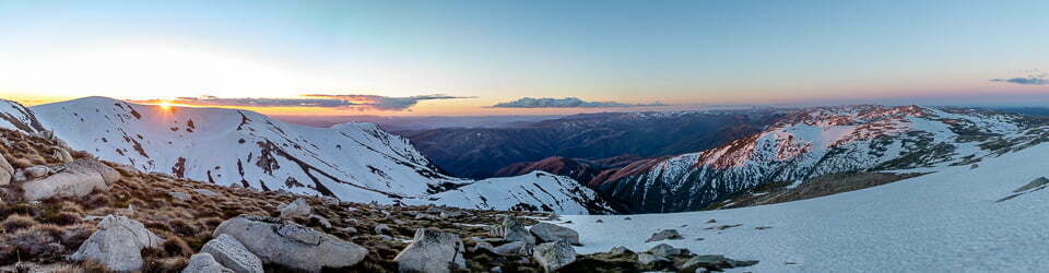
Sunrise at Kaka Point
Wild Adventures Facebook Group
Clickable icons on this world map will open the related trip report
A detailed, searchable trip list with links to reports, photo galleries
Information on Parks signage along the way
What is special about Kaka Point?
Kaka Point is named after a rare native parrot and its distinctive kaa-kaa call, The place was important to the earliest inhabitants, the Waitaha people, followed by the Ngati Mamoe, and later the Ngai Tahu tribes, for food gathering and seasonal camps. It was a place of interchange between Maori and the first European settlers. Activities were based on whaling, sealing, fishing and harvesting bull kelp bladders to be used for preservation of mutton birds.
The village’s European history as a permanent settlement really starts with the demise of nearby Port Molyneux. In 1878, a huge storm changed the Ciutha/Mata-Au River’s course to the north west so that it no longer entered the harbour, meaning boats and ships could not reach the port, which had silted up.
Port Molyneux
Port Chalmers became Otago’s main port, and the city of Dunedin became a major settlement in the region, and Port Molyneux, once a thriving port town, faded into insignificance.
Kaka Point, with its commanding views of the coast and a safe swimming beach, began to develop as a settlement and seaside holiday destination.
Who lived here first?
Te iwi o Waitaha no Whawhapo I te tau: A Waitaha family, are pictured below at the site of the Kaka Point Fire Station, in 1893. The elder in the centre holding a tewhatewha, is chief Haimona Rakiraki when he was about 95 years old. On his right is Puao Rakiraki and left, Kere Rakiraki. Back row from left, Kurupohatu Ruru, Koronuku Ruru, Penamine Rakiraki, Piri Ruru, Hore Rakiraki, Tuku Rakiraki and Maku Rakiraki; Front row from left, Tira Rakiraki, Maiharoa Rakiraki, Mere Putakaraki, Pii Rakiraki, Witaka Rakiraki and Simon Rakiraki.
The Waitaha people are the original inhabitants. Ngai Tahu history tells us that the name Waitaha refers to the people who were in the south prior to the migration and invasion of the northern tribes from the 16° century onwards. For centuries, they frequented the Port Molyneux – Kaka Point area and were descended from the ancient South Island Rapuwai and Waitaha tribes.
The Waitaha can trace their history back to Rakaihautu and his son Rokohuia who first landed the Uruao waka in about 850 AD, and a later migration in the Takitimu of about 1350 AD. Waitaha history describes their people as nomadic and like many southern tribes, moved seasonally throughout the South Island following the food source. Many of the place names still in use today are original or a blend of the names given in later times, such as Tokata Point (Nugget Point) and Te Karoro (Willsher Bay). Parauriki was the Maori name for Kaka Point and the area was originally known as Wairawaru. The villages of Port Molyneux were called Murikauhaka, Otupatu and Mataipipi.
Generally as a group, the Waitaha were described as peaceful people, living ip family units and often in seclusion to keep themselves safe from invaders, who were likely to come by river or sea.
From family and official histories, it is probable that during those years of invasion and wars, Waitaha people lost their hunting grounds in the west to European settlement and gravitated east towards Kaka Point to take up more permanent residence amongst a growing number of settlers who were arriving via Port Molyneux and taking up land.
One of the most prominent residents was Waitaha chief Haimona Rakiraki (pictured, and in family photo). Born in 1800, he came down the Clutha River from Wanaka in about 1830 with a remnant of his iwi or family, “to see the sun rise from the other side” *. His family have a proud history of education at the Reomoana School (which means school by the sea), that was set up ta brow of Makatu behind the cemetery, the urupa land gifted by Rakiraki to enable Native Affairs (now Mãori Affairs) to build a school. Later they. gifted the land at Port Molyneux for a school.
The Waitaha learned English, giving up their own language, but retaining a strong cultural identity. Rakiraki was baptised at Karoro in about 1836 and.was known to be a particularly devout christian. His descendants maintain strong ties to the district.
How many Mäori were there when Cook arrived?
At the time of his first voyage in 1769, Captain Cook estimated that about 100,000 Mãori people lived in New Zealand.
By 1840, the population was numbered between 70,000 and 90,000 and by 1858 it had decreased o about 60,000 because of the introduction of European diseases such as measles and nfluenza and the high number of casualties rom the intertribal conflicts.
Across the bay from Port Molyneux and Kaka Point is Measly Beach near Wangaloa, where here are hundreds of graves, which bear witness to the epidemics that decimated the Soath Island Maori population from 30,000 to about 3,000 people.
By then, the Maori population in the villages had shrunk to about 40 adults of mixed tribes. The group included chief Rakiraki, with the Ruru and Potiki families being the principal inhabitants.
The local landscape features, geology, scenic highlights, flora, fauna, Indigenous history, white history and other nearby walks in the area (Perplexity AI Model)
Landscape features
The Kākā Point Bush Walk lies within a low‑lying coastal landscape, where a gently sloping terrace rises from the Pacific shoreline into a backdrop of rounded hills. The track itself winds through a remnant of coastal forest set just behind the township, with subtle undulations rather than steep slopes and a series of shallow gullies and ridges that add variety without demanding strenuous climbing. Beyond the reserve, the land falls away towards a broad sandy beach at Kākā Point and then steps out into more rugged coastal forms at nearby Nugget Point, where cliffs and headlands shape the meeting of land and sea. This transition—from settled shoreline, through sheltered forest, to exposed promontories—illustrates the close interlocking of human habitation and relatively intact natural environments along this part of the Catlins coast.
Geology
The wider Catlins region is underpinned by some of Aotearoa New Zealand’s oldest sedimentary rocks, laid down in a marine setting roughly 200 million years ago and later uplifted and folded into the distinctive pattern known as the Murihiku Syncline. These rocks, dominated by sandstones and related materials, weather into the rolling hills and parallel ridges that characterise the area, with valleys trending north‑west to south‑east and providing natural corridors for both waterways and vegetation. Along the coast, cliffs and headlands expose these strata, and features such as the nearby Nugget Point headland and other coastal outcrops show faulting and erosion that continues to shape the coastline. The Kākā Point Scenic Reserve sits on the more subdued fringes of this geological structure, where the rock is mantled by deep soils and forest, but it still forms part of the same long geological story that ties the Catlins to the ancient continent of Gondwana.
Scenic highlights
Although modest in scale, the Kākā Point Bush Walk offers several quietly impressive scenic qualities. The most immediate is the sense of immersion in mature podocarp forest so close to the sea and the settlement, with tall trees and dense understorey enclosing the track and muting outside sounds. Light filtering through the canopy creates a varied play of shade and brightness, highlighting the textures of bark, ferns and mosses and giving the forest a layered, almost architectural feel. In a broader visual context, the proximity of the golden sand beach at Kākā Point and the more dramatic seascapes at Nugget Point means that walkers can pair the enclosed green of the bush with open coastal vistas within a very short distance, making the area particularly rewarding for visitors seeking variety without long travel.
Local flora
The forest surrounding the track is typical of lower altitude mixed podocarp forest in the southern Catlins, with large, long‑lived conifers rising above a dense broadleaf canopy. Ancient podocarps such as rimu, tōtara, mataī and kahikatea emerge above layers of species like kāmahi and rātā, forming a multi‑tiered canopy that supports ferns, perching plants and a well‑developed shrub layer. The understorey includes a rich array of tree ferns, smaller ferns, and shrubs, along with groundcover plants and mosses that thrive in the damp, shaded environment typical of this region. In combination, these elements make the Kākā Point Bush Walk a representative example of the coastal and lowland vegetation that once covered much larger areas of the Catlins before widespread clearing for agriculture.
Local fauna
The Catlins is well known for its birdlife, and even within this relatively small reserve, birds are a prominent feature of the soundscape and visual experience. Forest birds occupy different layers of the canopy and understorey, their calls carrying through the trees and providing a continuous sense of movement and presence in the bush. Along the nearby coastline and beaches, marine mammals and seabirds are also part of the wider ecological setting, making the area surrounding Kākā Point a meeting place between forest‑dwelling species and those that rely on the sea and shore. The closeness of the forest to the township and beach allows visitors to encounter this diversity of animal life over very short distances, moving from garden edges to bush and coast in a single outing.
Indigenous history
Kākā Point and the surrounding Catlins lie within the rohe of Kāi Tahu, also known as Ngāi Tahu, the principal iwi of the southern South Island whose territory extends across coastal Otago and into the wider region of Te Waipounamu. For centuries, Māori communities travelled extensively along this coast and inland routes, establishing seasonal encampments and using the abundant marine and forest resources for food, tools and cultural practices. Middens and other archaeological traces throughout the Catlins testify to regular occupation and movement, especially near sheltered inlets and along accessible shorelines where fishing, shellfish gathering and bird hunting were central activities. Forested areas such as those preserved at Kākā Point would have provided timber, fuel and plant resources, as well as protected pathways between coastal and inland sites, embedding the bush within a wider network of cultural and economic connections.
White history
European settlement in the Kākā Point area followed broader patterns in Otago and the Catlins, with pastoral farming, timber extraction and later tourism shaping the landscape from the nineteenth century onward. Clearing of lowland forest for grazing and small townships significantly reduced the extent of native vegetation, leaving pockets such as the Kākā Point Scenic Reserve as important remnants of the original forest cover. Over time, the natural appeal of the Catlins—its forests, waterfalls and rugged coastline—helped shift regional emphasis towards conservation and recreation, with walking tracks developed to provide public access while protecting remaining habitats. Today, Kākā Point is recognised not only as a small coastal settlement and holiday destination but also as one of the northern gateways to the Catlins, where visitors can experience both the human history of settlement and the enduring presence of native forest and seascapes in close proximity.
Clickable icons on this world map will open the related trip report
A detailed, searchable trip list with links to reports, photo galleries
![]()