
Saturday 6/06/2026 Western Tracks
Hamilton Island, QUEENSLAND
Ngaro Country (Nargo people)
Participants: Stephen Davies (Photos), Sue Davies (Report)
After completing the 7:00am parkrun there was still plenty of time to hit the trails. There are 20km of trails on the island and it’s our aim to complete all of these during our stay.
Max elevation: 191 m
Total climbing: 328 m
Total descent: -320 m
Average speed: 3.46 km/h
Total time: 03:23:05
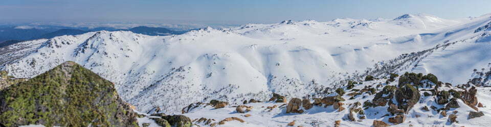
From the resort area we climbed up to the Resort lookout for views across the small airport and down to the resorts. From here we climbed up to Saddle Junction and down to Coral Cove for views of the stunning aquamarine waters.
Returning to Saddle Junction we decided to take the steep descent to Hideaway Bay and then followed the gravel road back to the resort. It was a good introduction to the walks on the island.

Chequered Swallowtail (Papilio demoleus)
Amongst other photographically recorded observations during this walk, we were able to confirm sightings of each of the following species: Laughing Kookaburra (Dacelo novaeguineae), Chequered Swallowtail (Papilio demoleus), Sulphur-crested Cockatoo (Cacatua galerita), Agile Wallaby (Notamacropus agilis)
Wild Adventures Facebook Group
Clickable icons on this world map will open the related trip report
A detailed, searchable trip list with links to reports, photo galleries
From Hamilton Island Visitor Guide
WALKING TRAILS
Over 20km of scenic walks and private beaches to explore
WALKING TRAIL DESCRIPTIONS
Coral Cove Starting from the Scenic Trail Entrance via Saddle Junction, Coral Cove is a secluded, peaceful and relaxing beach where you can enjoy views south to Lindeman Island. This is where you will find the giant swing.
Grade 3 Moderate walk
Escape Beach
From the Scenic Trail Entrance, continue through Saddle Junction to Escape Beach. Here you’ll find clear waters lapping onto a sandy beach protected by huge rocky outcrops as well as a giant hammock: These spectacular features create a secluded and charming retreat. For the adventurous, this walk cam also include South’East Head and Passage Peak before returning back to Saddle Junction.
Grade 3 Moderate walk
Flat Top Hill Lookout
Start from the Resort Trail entränce and continue to the Resort, Lookout Junction. Walk along the Saddle Junction Trail for 100m where a left turn will take you onto the Flat Top Hill Trail. From there, it is only a short walk to the Flat Top Hill Lookout, where you can sit back and relax, taking in the magicalview’s to the north and south.
Grade 3 Moderate walk
Hideaway Bay
Like the name suggests, this hidden beach, is just a, short stroll away from the Scenic Trail entrance. Discover this secluded bay, where you can enjoy the tranquil waters and views towards Whitsunday Island.
Grade 3 Moderate walk
Middle Head Trail
Starting from Turkey Nest Junction, this trail takes you along a landscape rich in Australian native flora. Middle Head trail ends at the top of a hill with glimpses of the Whitsunday islands and waters to the south.
Grade 3 Moderate walk
Passage Peak
It is recommended that the Passage Peak walk is commenced from the Scenic Trail Entrance. This is a spectacular but challenging walk. Once you have negotiated the final steep section of this trail you will be rewarded with breathtaking views of the Whitsundays from the highest point on Hamilton Island, Passage Peak.
Grade 3 Challenging walk with many steps
Resort Lookout
This is an excellent introduction to our island walks, taking you through typical Whitsunday bushland starting at the Resort Trail Entrance. The Resort Lookout is the second-highest point on Hamilton. Island. It drops off to sheer cliffs and allows an excellent panoramic view of the resort, Marina Village, airport and surrounding islands. The Resort Trail Entrance is at the eastern end ofthe Conference Centre.
Grade 3 Moderate walk
Saddle Junction
Starting from the Scenic Trail Entrance, follow the Scenic Trail to Saddle Junction, which is the main junction for the Passage Peak, South East Head, Escape Beach, Middle Head and Corat Cove Trails.
Grade 3 Moderate walk
South East Head
Trail Dense bush gives way to exposed, rocky features and sharp cliffs on this trail. Abundant native grasstrees and stunning views of the Lindeman group of islands awaits you at the end of this walk. This is also where the giant chair is located: For the adventurous, include a walk via Passage Peak or Escape Beach before returning to Saddle Junction.
Grade 3 Moderate walk
GUIDED WALKING TRAIL TOURS
Discover the island on a spectacular guided walk with our resident tour Discover the island on a spectacular guided walk with our resident ove information. leader. These walks are seasonal, visit the Hamilton Island App for more.
Irukandji Jellyfish: A transparent jellyfish – present in the waters of the Whitsunday Islands predominantly during the summer months. They are more commonly found in deep water, however there have been an increased number of occurrences in shallow waters recently. Symptoms of an Irukandji sting include severe pain, muscle constriction and breathing difficulties, which require immediate medical attention. For this reason, we recommend that you avoid swimming in secluded beaches. If you choose to swim in the ocean instead of one of the many pools – we recommend you wear a stinger suit and swim in the presence of others so assistance can be given if needed. We would strongly advise that small children and guests who are pregnant, have a heart or pre-existing medical condition, only swim in our pools.
Gympie-Gympie Stinging Tree: Gympie-Gympie has broad oval or heart-shaped leaves with saw-tooth edges and white or purple-red fruit. They are covered in stinging hairs which appear furry. Brushing against the tree will cause the hairs to embed into the skin and cause an extremely painful stinging sensation. If stung, do not rub, the area, and seek urgent medical attention. Please stay on marked trails to avoid contact with the plant.
Sharks: Hamilton Island is part of the Whitsundays marine ecology and sharks frequent the waters in the region. Whilst the risk of attack is very low, it does exist. We recommend that you don’t swim at dawn, dusk or at night or in unclear water. Always swim with others. Leave the water quickly and calmly if you see a shark or if fish begin to gather in large schools, jump out of the water or behave erratically.
For more info, contact the Tour Desk on 07 4946 8305 or ext 68305
Information on Walking Trail Map
RESORT TRAIL ENTRANCE – WALKING TRAIL MAP
Hideaway Bay Access via Scenic Trail Entrance
Like the name suggests, this hidden beach is just a short stroll away from the Scenic Trail entrance. Discover this secluded bay where you can enjoy the tranquil waters and views towards Whitsunday Island.
Grade 3 (Moderate) walk – Shared Trail.
Saddle Junction 1.8km | 45min (one way)
Starting from the Resort Trail Entrance, follow the Resort Trail to Saddle Junction, which is the main junction for the Passage Peak, South East Head, Escape Beach, Middle Head and Coral Cove trails.
Grade 3 (Moderate) walk – Walking Trail.
Flat Top Hill Lookout 1.2km 30min (one way)
Sit back and relax at the Flat Top Hill viewing area where you can take in the magical views to the north and south of Hamilton Island. Please note, ATV tours visit this location.
Grade 3 (Moderate) walk – Shared Trail.
Passage Peak 2.7km | 1hr 15min (one way)
This is a spectacular but challenging walk. Once you have negotiated the final steep section of this trail you will be rewarded with breathtaking views of the Whitsundays from the highest point on Hamilton Island, Passage Peak.
Grade 3 (Challenging) walk – Walking Trail.
Middle Head 3.1km | 1hr 15min (one way)
Starting from Turkey Nest Junction, this trail takes you Head trail ends at the top of a hill with glimpses of the along a landscape rich in Australian native flora. Middle
Whitsunday islands and waters to the south.
Grade 3 (Moderate) walk – Shared Trail.
Coral Cove 3.1km |1hr 15min (one way)
Starting from the Resort Trail Entrance via Saddle Junction, Coral Cove is a secluded, peaceful and relaxing beach where you can enjoy views south to Lindeman Island.
Grade 3 (Moderate) walk – Walking Trail.
Escape Beach 3.3km| 1hr 30min (one way)
Discover clear waters lapping onto a sandy beach protected by huge rocky outcrops. These spectacular features create a secluded and charming retreat. For the adventurous, include South East Head and Passage Peak before returning back to Saddle Junction.
Grade 3 (Moderate) walk – Walking Trail.
Escape Beach via South East Head 5.6km | 2hr 15min (one way)
Resort Lookout 1.7km | 45min (one way)
The Resort Lookout is the second highest point on Hamilton Island. It drops off to sheer cliffs and allows an excellent panoramic view of the resort, marina village, airport and surrounding islands. Please note, ATV tours visit this location.
Grade 3 (Moderate) walk – Shared Trail.
South East Head 4.4km | 1hr 45min (one way)
Dense bush gives way to exposed, rocky features and sharp cliffs on this trail. Abundant native grasstrees and stunning views of Lindeman Island awaits you at the end of this walk. For the adventurous, include a walk via Passage Peak or Escape Beach before returning.
Grade 3 (Moderate) walk – Shared Trail.
The local landscape features, geology, scenic highlights, flora, fauna, Indigenous history, white history and other nearby walks in the area (Perplexity AI Model)
Landscape features
The western trails of Hamilton Island traverse a compact but varied landscape of steep hills, narrow saddles and deeply indented coastline. The Resort Lookout and adjacent ridgelines form a high spine running roughly north–south, with slopes falling away to sheltered coves such as Coral Cove and Hideaway Bay, where low, forested hills meet narrow arcs of sand and clear, shallow water. From elevated points, walkers observe a classic drowned-river landscape, with the irregular shoreline of Hamilton Island mirrored by the silhouettes of neighbouring islands rising from the Coral Sea.
Geology
Hamilton Island is part of the Whitsunday Group, which represents the eroded remnants of ancient volcanic and intrusive rocks uplifted and dissected over millions of years. The island’s steep gradients and rugged headlands testify to this resistant bedrock, with thin, skeletal soils on upper slopes giving way to slightly deeper colluvial deposits in gullies and lower hillsides. The present coastline reflects prolonged marine inundation associated with post-glacial sea-level rise, which transformed former hilltops into islands and submerged valley floors, creating the complex pattern of bays, headlands and channels that characterises the modern seascape.
Scenic highlights
The Resort Lookout provides one of the most striking vantage points on the island, combining expansive views over the resort precinct, marina and airstrip with a sweeping panorama of the surrounding Whitsunday Islands. From here, the contrast between built infrastructure and densely vegetated hills is particularly evident, underscoring the narrowness of the developed coastal strip. At Coral Cove and Hideaway Bay, scenic interest shifts to an intimate scale: visitors encounter sheltered, tree-lined beaches, gently shelving sand and clear, often turquoise water, framed by rocky points that interrupt longshore views and create a sense of enclosure and seclusion.
Local flora
Vegetation along the western trails reflects a mosaic of dry coastal and hill communities typical of the central Queensland tropics. Lower slopes and gullies carry relatively dense woodland and forest dominated by eucalypts and other hardy trees, with a well-developed understorey of shrubs and grasses that stabilise soils and provide habitat complexity. As the track climbs towards the Resort Lookout and Saddle Junction, canopy cover thins and plants adopt more drought-tolerant forms, with scattered trees, sparser shrub layers and ground cover adapted to high exposure, shallow soils and periodic water stress. In the immediate hinterland of Coral Cove and Hideaway Bay, the vegetation grades into coastal communities capable of withstanding salt-laden winds and sandy substrates.
Local fauna
The near vicinity of the western trails supports a diverse assemblage of birds, reptiles and mammals associated with coastal forest and woodland environments. Birds are particularly conspicuous, with large, vocal species such as kookaburras and cockatoos sharing the canopy with smaller insect- and nectar-feeding species that move rapidly through flowering shrubs and upper foliage. Macropods, including wallabies, utilise the ecotone between forest and more open areas, often emerging near track margins in the early morning and late afternoon. The structural complexity of leaf litter, fallen timber and rocky outcrops provides shelter for reptiles and invertebrates, which in turn form part of the prey base for higher-order predators using elevated perches and thermal currents along ridgelines.
Indigenous history
Hamilton Island lies within Ngaro Country, and the Ngaro people maintain deep cultural connections to this island and the broader Whitsunday seascape. Their maritime culture reflects long-standing expertise in navigating complex networks of islands, reefs and channels, and in managing the seasonal availability of marine and terrestrial resources. Archaeological and oral-historical evidence across the Whitsundays attests to a rich tradition of story, ceremony and practical knowledge embedded in prominent landforms, sheltered bays and travel routes, and contemporary recognition of Ngaro custodianship continues to shape interpretive material and management approaches in the region.
White history
Non-Indigenous engagement with the Whitsunday Islands intensified in the nineteenth century through exploration, pastoral activity and maritime industries, followed by progressive development of tourism infrastructure in the twentieth century. Hamilton Island, in particular, underwent substantial transformation from a relatively undeveloped island to a major resort destination, with construction of accommodation, marina facilities and an airport reshaping the coastal fringe while leaving much of the steeper interior in a more natural state. The establishment and promotion of walking trails such as the Resort Lookout, Coral Cove and Hideaway Bay routes reflect a contemporary emphasis on nature-based tourism, in which scenic and recreational values are foregrounded, often with limited but growing incorporation of Ngaro perspectives and histories into visitor information.
Clickable icons on this world map will open the related trip report
A detailed, searchable trip list with links to reports, photo galleries
![]()