
Friday 13/03/2026 Waipapa Lighthouse Road – Waipapa Point Lighthouse – Waipapa Point
Waipapa Point Coastal Walk
The Catlins
Southland Region, NEW ZEALAND (Aotearoa)
Murihiku Country (Ngā Tahu people)
Participants: Beth Davies, Stephen Davies (Photos), Sue Davies (Report), Pablo Ureña Vega
We drove to the end of Waipapa Lighthouse Road on a cool, calm March morning with high cloud lifting and light winds — perfect conditions for this exposed stretch of coast. From the road, the track is a broad, firm and almost level loop across low grass, sand and coastal scrub towards the white lighthouse tower. It’s more of a stroll than a hike, but the setting is striking.
Max elevation: 11 m
Total climbing: 8 m
Total descent: -8 m
Average speed: 2.31 km/h
Total time: 00:10:17
The lighthouse, with its red door and timber cladding, stands out against the muted colours of dune and scrub. It was first lit in 1884, built in the wake of the Tararua disaster to guard this treacherous coastline.

New Zealand Sea Lion (Phocarctos hookeri) below Waipapa Point Lighthouse
We followed the loop towards the edge of the point, where wind-sculpted grass gives way to low cliffs and a sweep of golden sand stretching east and west. A New Zealand Sea Lion (Phocarctos hookeri) was resting on the beach below — these animals can sometimes be seen along this stretch of coast, so a respectful distance is essential. Seabirds worked the surf, and the long, slow swell rolled in from Foveaux Strait.
On the return, we detoured past the site of the former keepers’ houses, imagining families living out here through gales and fog. An easy, atmospheric walk to a beautiful and historic lighthouse. Well worth a stop on any Catlins itinerary.
Amongst other photographically recorded observations during this walk, we were able to confirm sightings of each of the following species: New Zealand Sea Lion (Phocarctos hookeri)
Wild Adventures Facebook Group
Clickable icons on this world map will open the related trip report
A detailed, searchable trip list with links to reports, photo galleries
Information on Parks signage along the way
Waipapa Point lighthouse
The 13.4 metre (44 feet) tower is clad in a double skin of kauri and totaramuch of the vertical exterior cladding is in single lengths. In the 19th century, wooden lighthouses answered the need to be relatively cheap to build and able to endure fierce coastal conditions. The lower wall cavity was filled with local stone for ballast (weight). Waipapa Point and Northland’s Kaipara North Head (December 1884) were the last major® timber towers built in New Zealand, both to identical designs. Construction of Waipapa Point lighthouse cost close to 6,000 pounds sterling.
The lantern room is made of bronze, copper, cast iron and glass, manufactured by James Milne & Son, Scotland. It was constructed in sections that were delivered by sea and assembled in place.
This is normal:
• Weepy eyes help to repel flies
• Young seals are left alone for several hours while the mother fishes • Males challenge each other by fighting during the breeding season
Close encounters with New Zealand sea lions and fur seals
During your visit to Waipapă Point you may be lucky enough to meet seals. The New Zealand sea lion/rapoka is one of the world’s rarest sea lions and endemic to this country. Both sea lions and fur seals/kekeno use Waipapā Point’s beach and coastal turf to rest.
The local landscape features, geology, scenic highlights, flora, fauna, Indigenous history, white history and other nearby walks in the area (Perplexity AI Model)
Landscape features
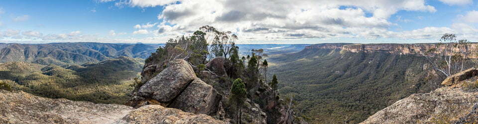
Waipapa Point occupies a low rocky promontory on the southern edge of The Catlins, where gently rolling coastal terraces meet the open waters of Foveaux Strait. The Waipapa Point Coastal Walk traverses the short distance from the road‑end carpark across grassed dunes and low relief ground to the lighthouse and adjacent cliff tops. From the point there are wide views along a south‑facing beach that extends eastward, backed by sand dunes and pasture, and westward towards more rugged segments of coastline. The landscape is comparatively open and exposed, with limited tree cover, allowing walkers to experience the full force of wind, light and sea even on this modest, accessible route.
Geology
The Catlins coast, including Waipapa Point, forms part of the Murihiku terrane, a belt of Triassic and Jurassic sedimentary rocks accreted to Gondwana over 150–200 million years ago. These sandstones and mudstones, often feldspar‑rich, weather into strike ridges and low escarpments that structure the parallel hill ranges and coastal platforms of the region. At Waipapa Point, this older bedrock is mantled by coastal sediments, including dunes and beach sands transported and reworked by wind and wave action along the south‑facing shoreline. Marine processes, particularly high‑energy storm waves, continue to erode the point and adjacent beaches, shaping low cliffs, boulder patches and offshore reefs that contributed to historic navigational hazards.
Scenic highlights
Scenic interest at Waipapa Point arises from the combination of an historic lighthouse, sweeping beaches and an exposed, often dramatic seascape. The approach along Waipapa Lighthouse Road and the short coastal walk frame the lighthouse against a backdrop of sea and sky, its white tower and red detailing standing out from the muted tones of grass and sand. From the lighthouse and nearby viewpoints, visitors can look east along a broad arc of golden beach and west towards more irregular rock platforms and headlands, with the curvature of the coast emphasised by long lines of surf. On clear days the horizon is sharp and expansive; in rougher weather, shifting clouds, spray and swell produce a dynamic, layered scene. The presence of sea lions on the sand and seabirds working the nearshore waters further enriches the visual experience.
Local flora
Vegetation around Waipapa Point reflects both harsh coastal conditions and an extended history of pastoral land use. The immediate surroundings of the lighthouse and walkway are dominated by short grass and low herbaceous cover maintained by mowing and former grazing, with only scattered shrubs able to persist in the salty, wind‑exposed environment. Behind the dunes and along the wider Catlins coast, remnants of native forest and shrubland include species associated with cool, moist conditions, such as rimu, kamahi, rata and beech, though these are more extensive inland than at the point itself. Dune systems and back‑beach areas in the region have been modified by introduced grasses and past management practices, but ongoing conservation work seeks to stabilise sands and protect native plant communities where they remain.
Local fauna
Waipapa Point is well known for regular sightings of New Zealand sea lions, which often haul out on the nearby beaches and among the rocks below the lighthouse. The wider Catlins coast supports other marine mammals and a range of seabirds, including penguins, fur seals, dolphins and coastal birds that utilise surf zones, tidal flats and rocky platforms. Visitors are advised to maintain generous distances from sea lions and other wildlife, both for safety and to minimise disturbance, as these animals use the beaches for resting and moving between sea and land. Inland and along sheltered sections of coast, forest and shrubland habitats provide resources for bush birds and invertebrates, contributing to the broader biodiversity values that underpin The Catlins’ reputation as a wildlife destination.
Indigenous history
The Catlins and Waipapa Point lie within Murihiku Country, part of the wider rohe of Ngāi Tahu, whose ancestors have long associated this coast with travel, food gathering and narrative traditions. Archaeological and oral histories indicate that the broader region was used for hunting and fishing, with camps situated near river mouths, estuaries and productive coastal margins. The sea and its resources, including marine mammals, fish and shellfish, formed important components of local economies and identities, while inland forests provided timber and other materials. Contemporary treaty settlements and iwi–Crown agreements recognise these enduring relationships, embedding Ngāi Tahu values in conservation and tourism management across Murihiku and The Catlins.
White history
European engagement with Waipapa Point intensified in the late nineteenth century, framed by maritime trade, shipping routes and the hazards of Foveaux Strait. The wreck of the passenger steamer Tararua on reefs off the point in April 1881, with the loss of 131 lives, prompted national concern and led directly to the decision to construct a lighthouse to improve coastal safety. The wooden Waipapa Point Lighthouse and associated keepers’ houses were built between 1883 and 1884, with the light first lit on 1 January 1884, making it one of the last wooden lighthouse towers erected in New Zealand. Automation in 1975 ended permanent staffing, and subsequent technological upgrades introduced solar power and modern beacons, while the tower itself remained as a prominent heritage structure. Today, Waipapa Point functions both as an active aid to navigation and as a visitor destination within The Catlins, where interpretation emphasises the intersection of maritime history, coastal hazards, wildlife and conservation.
Clickable icons on this world map will open the related trip report
A detailed, searchable trip list with links to reports, photo galleries
![]()