Tag Archives: Mann Bluff

Guthega – Pounds Creek – Watsons Crags – Twynam West Ridge – Mount Anderson – Verandah Creek – Watsons Creek – Mount Anton – Tate East Ridge – Gills Knobs – Guthega Pondage – Mount Tate – Mann Bluff

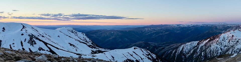
29/09/2019 – 4/10/2019    Guthega – Pounds Creek – Watsons Crags – Twynam West Ridge – Mount Anderson – Verandah Creek – Watsons Creek – Mount Anton – Tate East Ridge – Gills Knobs – Guthega Pondage – Mount Tate – Mann Bluff

                                               Kosciuszko National Park, NSW

                                              Ngarigo country

Distance: 55km   Total Ascent: 3,880m   Total Descent: 3,900m   

Time: 26 hours                                               Track Info

Participants: Damien Aggio (Leader), Stephen Davies (Photos, Report), Paul Davis, Murray Gibbs

Originally I had planned to arrive at the Pounds Creek campsite Damien had organised before anyone else, as I was going to connect my Charlotte Pass trip with his and avoid a trip home. I had 11 days of food and the rest of my gear packed and ready to go. However, my Mount Townsend day had consequences in the form of blisters on both heals from being clueless on how to adjust my new boots, I also ended up with a throat infection and lower back problem from consecutive long days. My better half also had suffered a bad cold for the last two weeks and had broken her fifth metacarpal (hand) so it was certainly best I drove home. Once everything settled enough I was heading back much later than first planned to connect with Damien’s now also finished trip. As it turned out I was still somewhat before par and had a low activity trip.

Continue reading

Loading

Guthega – Guthega River – Consett Stephen Pass – Mount Tate – Mann Bluff

24/09/2011 – 27/09/2011   Guthega – Guthega River – Consett Stephen Pass – Mount Tate – Mann Bluff

                                                Kosciuszko National Park, NSW

                                                Ngarigo country

Participant: Stephen Davies


Day 1: Saturday 24/09/2011   Guthega – Upper Guthega River

This route was reconstructed from memory using Google Earth Pro and GPS Visualizer.

Total distance: 6.76 km
Max elevation: 0 m
Total climbing: 0 m
Total descent: 0 m
Average speed: nan km/h
Download file: 20110924.gpx                         Track Info


Left Barrack Point 7:07am arrived Guthega about 2:00pm. Was overcast with occasional showers.

Bruce Easton at Wilderness Sports recommended Guthega, so I bought a map and was off. Changed and packed at Island Bend campsite. Dropped off my pack at Guthega before driving 1km back to the overnight carpark and walked back. Looking forward to my first trip on with new skis, boots and skins. Continue reading

Loading