
Monday 19/02/2024 Cape Raoul Track Carpark – Cape Raoul Track – Cape Raoul Lookout – Cape Raoul – Seal Lookout – Cape Lookout
Tasman National Park, lutruwita / TASMANIA
Trouwunna Country
Participants: Stephen Davies (Photos), Sue Davies (Report)
We awoke to drizzle which was the first rain we had had on this Tasmanian trip in more than three weeks. We decided to have a slow start, first stopping off for morning tea before arriving at the trailhead after 10:30am.
Max elevation: 436 m
Total climbing: 576 m
Total descent: -575 m
Average speed: 4.46 km/h
Total time: 05:28:16
Along the road to the Cape Raoul walk we were flagged down by a young woman who had a flat battery and asked if could we help. Steve was very excited because he had the opportunity to try out his new gadget, a jump starter box. It’s such a compact device but it proved very effective and Danni was soon on her way. We would catch up with Danni several times along the trail during the day.
The trailhead was quite busy with a large guided group who were doing the lodge-based “three-day cape experience”. We were glad we weren’t in that group because they didn’t seem that excited about the trip and really didn’t linger for very long to enjoy the incredible surroundings we were in.
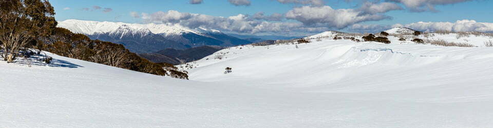
This trail was also of a high standard like Cape Hauy. The climb was more gradual over a compressed dirt surface, some boardwalk and hewn sandstone steps. After about half an hour we passed the turn-off to Ship Stern Bluff and Tunnel Bay. The trail continued to climb gradually through open forest until we reached the Raoul Lookout. At this stage, the weather was still a bit misty and dull but the rain had stopped. We had views looking down on Ship Stern Bluff below us. The vegetation through this section is mainly heathland and she-oak forest.

Cape Rauol from Cape Raoul Lookout
From this point, there was a long gradual descent until we reached the plateau-like section of the Cape. There are many viewpoints that display the extensive coastal dolerite cliffs, today with pounding surf at the base. We stopped and lingered to enjoy those views. There are two lookouts at the end of the cape, one for the end of Cape Raoul proper and one overlooking a seal colony far below. Today there were several of those at home for us to view from our distant vantage point.
From Cape Raoul we retraced our path, re-stopping at all the viewpoints along the way as the light was more favourable this afternoon. Another cape was completed for us and it was an excellent day walk.
Information on Parks Tasmania signage along the way
TASMAN NATIONAL PARK
Visitor information
WALKING TRACKS Walk times are for average walkers, with no rest stops
Cape Raoul
CAPE RAOUL LOOKOUT 1.5 hr return
CAPE RAOUL 5 hr return
Meander gently uphill through eucalypt forest to the Cape Raoul lookout for stunning views east to the distant cape and west to Bruny Island.
From Cape Raoul lookout, the track soon descends steeply through the magnificent rainforest. You’ll emerge in a cliff-side sheoak forest before opening onto the windswept escarpment of the cape and its extraordinary dolerite pillars.
NOTE: Take great care in strong winds, especially gusting updrafts and downdrafts at cliff edges, and while on the exposed escarpment. Strong gusts have been known to lift bushwalkers off their feet.
Unfenced sheer sea cliffs along the track. Supervise children closely.
Shipstern Bluff & Tunnel Bay
SHIPSTERN LOOKOUT 1.5 hr return
SHIPSTERN BLUFF 4 hr return
TUNNEL BAY 4 hr return
Enjoy the relaxed walk through fragrant eucalypt forest to the lookout. On a clear day, you’ll be rewarded with spectacular views to the bluff and beyond to Bruny Island. And on days when the surf’s up, you’ll witness extreme surfing in action.
From Shipstern Lookout, descend through coastal heath to a track junction. Turn left to descend on timber steps toward the base of the sandstone Shipstern Bluff, or turn right to continue down to the cobbled cove of Tunnel Bay.
NOTE: Due to a significant rockfall at the shoreline below the bluff, do not proceed beyond the installed hazard sign.
Unfenced sheer sea cliffs along the track. Supervise children closely.
THREE CAPES TRACK – MULTI-DAY EXPERIENCE
PORT ARTHUR HISTORIC SITE TO FORTESCUE BAY 4 days, 3 nights
Australia’s premier coastal walk. A magnificent journey along a wide, beautifully graded track, through a spectacular landscape of forests, heathlands and moorlands to Australia’s highest sea cliffs. Accommodation is in eco-cabins with host rangers.
To book, go to www.threecapestrack.com.au
“..we hurried forth to the extremity of the world. The scenery of this coast is extremely striking. We passed under two headlands: Cape Raoul and Cape Pillar, which are rendered remarkable not only by their bold and lofty appearance but also by their columnar formation which is as regular as if it were constructed by the hand of art.”
The local landscape features, geology, scenic highlights, flora, fauna, indigenous history, white history and other walks in the area (Gemini)
Landscape Features and Geology: A Dolerite Masterpiece
Cape Raoul’s dramatic topography is sculpted by dolerite, a fine-grained, dark igneous rock formed millions of years ago when molten magma cooled slowly underground. This resistant rock has weathered the relentless battering of the Southern Ocean, resulting in:
Towering dolerite columns: Reaching over 300 meters, these columns, known as the Tessellated Pavement, rise majestically from the churning sea, resembling a giant’s causeway.
Sea-sculpted arches and caverns: The relentless waves have carved out impressive features like the Cathedral Arch, a natural bridge framing the vast ocean vista, and the Doomed Rock, a precariously balanced dolerite block.
Windswept headlands: The cape’s exposed position allows for panoramic views of the rugged coastline, offshore islands, and the vast expanse of the Southern Ocean.
Scenic Highlights: A Feast for the Senses
Cape Raoul offers a plethora of scenic wonders:
Sunrise over the ocean: Witnessing the first rays of light illuminate the Tessellated Pavement and paint the sky in fiery hues is an unforgettable experience.
Furneaux Group islands: On clear days, these islands, remnants of a sunken landmass, create a breathtaking backdrop against the azure ocean.
Wildlife encounters: Look out for whales breaching in the distance, seals basking on sun-drenched rocks, and seabirds soaring on the thermals.
Diverse vegetation: From salt-tolerant coastal scrub clinging to cliff faces to pockets of lush rainforest in sheltered gullies, the plant life adds vibrant colour and texture to the landscape.
Local Flora: Adapting to the Harshness
The harsh coastal environment and dolerite-derived soils have fostered a unique plant community:
Coastal heathland: Dominated by low-lying shrubs like tea-tree (Leptospermum scoparium) and coastal rosemary (Olearia axillaris), adapted to wind and salt spray.
Scrub communities: Diverse pockets of scrub harbour wattles (Acacia spp.), banksias (Banksia marginata), and sheoaks (Allocasuarina verticillata).
Rainforest pockets: In sheltered gullies, pockets of cool temperate rainforest harbour towering eucalypts (Eucalyptus obliqua), tree ferns (Dicksonia antarctica), and lush understory plants.
Cape Raoul provides habitat for a diverse range of fauna:
Seabirds: Witness gannets plunge-diving for fish, shearwaters gliding effortlessly on the wind, and penguins waddling ashore after a day at sea.
Land birds: Listen to the melodious calls of honeyeaters flitting amongst the flowers and spot parrots squawking overhead.
Marine mammals: Look out for pods of playful dolphins, majestic whales breaching in the distance, and seals hauled out on secluded rocks.
Reptiles and amphibians: Keep an eye out for geckos basking in the sunshine and frogs chirping in the damp gullies.
Indigenous History: A Deep Connection to Country
The Palawa people, the traditional owners of Lutruwita (Tasmania), have a deep and enduring connection to Cape Raoul. Archaeological evidence suggests they inhabited the area for over 40,000 years, utilizing its abundant resources for food, shelter, and spiritual connection.
Sadly, the arrival of European colonizers in the 18th century resulted in the dispossession and marginalization of the Palawa people. However, their cultural heritage and deep understanding of the land continue to inspire respect and a commitment to reconciliation.
White History: A Legacy of Exploration and Exploitation
While Cape Raoul served as a navigational aid, its rugged terrain and harsh environment did not attract extensive settlement. However, its resources were not entirely overlooked.
Seal hunting: In the early 19th century, sealers exploited the abundant fur seal populations around the cape, decimating these colonies within a few decades.
Timber felling: Dolerite columns were quarried for building materials in the late 19th century, leaving scars on the landscape that are still visible today.
Tourism: With the development of Tasmania as a tourist destination in the 20th century, Cape Raoul became a popular site for scenic walks and wildlife observation. This led to the creation of the Tasman National Park in 1937, offering protection for the natural and cultural heritage of the area.
However, the colonial narrative surrounding Cape Raoul often ignores the devastating impact it had on the Palawa people. Dispossession of their land, massacres, and forced removal from their traditional ways of life inflicted immense suffering and loss. Today, there is a growing recognition of this dark chapter in Tasmanian history, and efforts are underway to acknowledge and respect the Palawa perspective and ensure their stories are shared.
Other Walks within Cape Raoul: Exploring Further
The Cape Raoul Track, a renowned 14km round trip hike, offers diverse experiences:
Tessellated Pavement: Witness the dolerite columns up close and marvel at the power of the ocean that sculpted them.
The Arch and Lookout: Enjoy panoramic views of the coastline, offshore islands, and the vast Southern Ocean.
Shipstern Bluff: For experienced hikers, a detour leads to this world-renowned surfing spot with breathtaking coastal vistas.
Several shorter walks cater to different abilities and preferences:
The Remarkable Cave Track leads to a stunning sea cave adorned with colourful formations.
The Waterfall Bay Track offers a sheltered walk through coastal scrub to a secluded beach.
The Doomed Rock Track provides a shorter option with dramatic clifftop views.
Exploring these trails offers a deeper understanding of Cape Raoul’s diverse landscape, geology, and ecological significance.
Clickable icons on this world map will open the related trip report
A detailed, searchable trip list with links to reports, photo galleries and other content
![]()