
Friday 22/09/2023 Charlotte Pass Village – Wrights Creek – Trapyard Creek – 1903m – (Porcupine Rocks)
Kosciuszko National Park, NSW
Ngarigo Country
Participants: Stephen Davies (Photos, Report), Sue Davies
This was our last day for the 2023 edition of New South Wales Nordic Ski Club’s annual Charlotte Pass gathering, a week where the club takes over the Southern Alps Ski Lodge and tries to get out for as much backcountry skiing as possible. Due to the rapidly decreasing snow cover and the fact our daughter and son-in-law had arrived home to Jindabyne from a European holiday yesterday, we thought we would catch up with them for the weekend before heading home. With that in mind, a morning walk towards Porcupine Rocks was in order before our 2:00pm departure.
Max elevation: 1899 m
Total climbing: 503 m
Total descent: -503 m
Average speed: 3.84 km/h
Total time: 03:19:21
After 11mm of overnight rain, we headed off from Charlotte Pass just after 9:00am, the track commencing near the low point in the road, next to the creek. Initially tracking along Spencers Creek on a mix of stony pathways and earthen tracks, raised metal boardwalks and metal bridges with surrounding alpine and subalpine plant communities. After crossing Wrights Creek the track heads up onto the hillside in amongst the snow gums where it largely follows the contours around to cross Trapyard Creek before turning sharply towards the east a further 200m on. From here it continues towards the east-north-east until it reaches a hill peaking at 1903m, from which there are great views over the Thredbo Valley to Paddy Rushs Bogong, Knob Hill and Moonbah Ridge to the south and south-east.

Looking back along Thredbo Valley
The overnight rain had left the track slightly damp in places today, without being wet. By the time we had reached the furthest point just past the 1903m hill, we had crossed a large snow drift before deciding we would fall well short of time to get to Porcupine Rocks and make it back in time for our 2:00pm ride.
The easy call was made to head back to Charlotte Pass, after a very pleasant morning stroll.
The 2023 Snow Depths from Snowy Hydro 
The local flora, fauna, geology, history and some other walks (Bard)
Flora
The local flora of this area of Kosciuszko National Park is dominated by alpine and subalpine plant communities. The alpine herbfields are characterized by a diverse range of flowering plants, including snow daisies (Leucochrysum alpinum), alpine sunray (Senecio pectinatus), and purple eyebright (Euphrasia collina). At lower altitudes notable plant species include snow gums (Eucalyptus pauciflora) and mountain ash (Eucalyptus regnans).
At lower altitudes, the subalpine woodlands are dominated by snow gums, with a variety of understory shrubs and herbs. Some common understory species include bogong moth bush (Aciphylla glacialis), mountain pepper (Tasmannia lanceolata), and mountain snowberry (Gaultheria appressa).
Fauna
The local fauna of the area is diverse. Some of the most common bird species include ravens (Corvus coronoides), magpies (Gymnorhina tibicen), and kookaburras (Dacelo novaeguineae). Other notable bird species include the endangered regent honeyeater (Xanthomyza phrygia) and the vulnerable spotted quail-thrush (Cinclosoma punctatum).
Common mammal species include wombats and echidnas (Tachyglossus aculeatus). Other notable mammal species include the endangered mountain pygmy-possum (Burramys parvus) and the vulnerable broad-toothed rat (Mastacomys fuscus).
Geology
The region traverses a variety of geological formations. The most common rock type is granite, which was formed from the cooling and solidification of molten magma.
The area has been shaped by glacial activity during the Pleistocene epoch (2.58 million to 11,700 years ago). Glaciers carved out valleys and lakes, and deposited large amounts of moraine (glacial rubble). The Snowy River is one of the most notable examples of glacial erosion in the area.
Indigenous history
The traditional custodians are the Ngarigo people. The Ngarigo people have a deep connection to the land, and their culture is rich in stories and traditions about the area.
The Ngarigo people used the area for hunting, fishing, and gathering food and medicinal plants. They also used the area for ceremonial purposes. For example, the summit of Mount Carruthers is a sacred site for the Ngarigo people.
White history
The first European to explore the area around was explorer Edmund Strzelecki in 1840. Strzelecki was the first European to climb Mount Kosciuszko, the highest mountain in Australia.
In the late 19th and early 20th centuries, the area was used for grazing sheep and cattle. However, grazing was discontinued in the 1950s, and the area was declared a national park in 1977.
Walks
The Main Range Walking Track is a popular hiking trail in Kosciuszko National Park. The track is approximately 22 km long and takes about 8 hours to complete. The track is well-maintained and suitable for hikers of all fitness levels.
The track starts at Charlotte Pass and finishes at Rawson Pass. Along the way, the track passes through a variety of landscapes, including alpine herbfields, subalpine woodlands, and glacial valleys. The track also offers stunning views of the Snowy Mountains and surrounding areas.
Other popular walks in the area include:
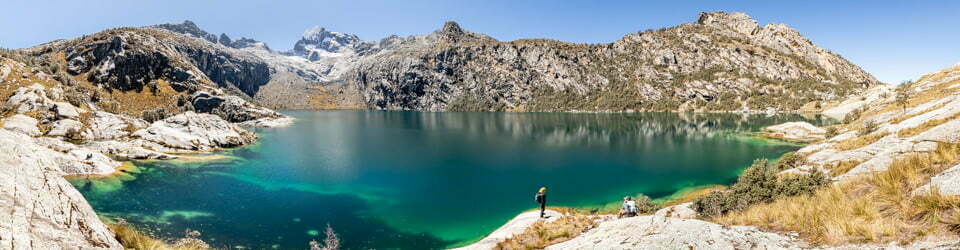
- The Blue Lake Lookout walk: This short walk offers stunning views of Blue Lake, one of the most iconic lakes in Kosciuszko National Park.
- The Mount Kosciuszko Summit Walk: This challenging walk takes hikers to the summit of Mount Kosciuszko, the highest mountain in Australia.
- The Thredbo River Track: This scenic walk follows the Thredbo River through subalpine woodlands and alpine herbfields.
Clickable icons on this world map will open the related trip report
A detailed, searchable trip list with links to reports, photo galleries and other content
![]()