
26/08/2022 – 4/09/2022 Munyang Power Station – Schlink Pass Road – Schlink Pass – Schlink Hut – The Kerries – Mawsons Hut – Valentine River – Geehi River – Strumbo Range – Strumbo Hill – Straight Creek – Grey Mare Trail – Bogong Swamp – Tooma River – Derschkos Hut – Pugilistic Creek – Toolong Range – Hell Hole Creek – Mount Toolong – “West” Bogong Creek – Round Mountain Trail – Tooma River – Tumut River – Australian Alps Walking Track – Meteorological Station – Hut Creek – O’Keefes Hut – Jagungal – Bogong Creek – Jagungal Saddle – Jackys Lookout – Doubtful Creek – McAlister Saddle – Geehi River – Tarn Bluff – Mailbox Hill – Cup and Saucer – Valentine Creek – West of Tin Hut above Valentine Creek – Kerries Ridge – Gungartan Pass – Dicky Cooper Creek – Schlink Pass – Schlink Pass Road – Guthega Power Station
Kosciuszko National Park, NSW
Ngarigo Country
Distance: 146km Total Ascent: 5,550m Total Descent: 5,550m Time: 52 hours
Participants: Stephen Davies (Photos, Report), Tim Hager (Leader), Paul Jennings
We arrived at Guthega Power Station to find the small visitor carpark full, so parked on the side of the road a little further back up the road. Here we faced our first dilemma. I had placed all of my last-minute items into a plastic bag in order to transfer them to Tim’s car at Jindabyne. To my dismay, I found my new gas bottle was not in the bag. My planned ten-day trip, without gas, wouldn’t work. [I would leave Tim and Paul’s five-day New South Wales Nordic Ski Club trip early on day four to complete my longer trip alone]
Day 1: Friday 26/08/2022 Munyang Power Station – Schlink Pass Road – Schlink Pass – Schlink Hut – The Kerries – Mawsons Hut
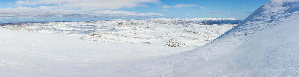
Max elevation: 1957 m
Total climbing: 1264 m
Total descent: -815 m
Average speed: 4.69 km/h
Total time: 07:51:25
I came up with two options, to return to Jindabyne or shorten my trip to match the five days Tim and Paul had planned. A drive back to Jindabyne would mean we could not reach our planned destination today. As a long shot, I asked another skier who happened to be preparing to leave, if she happened to have any spare gas cylinders. She did, and very generously offered me two partially full bottles. Thank you Karen, your generosity made it possible for us to keep to our plan.
We departed Guthega Power Station at 10:00am under a clear blue sky with no wind. There was no snow on the road until the end of the zig-zags. From there, with skis on, we started plodding further up the hill under our heavy loads.

Paul and Tim completely outnumbered
Not much further along, with me concentrating too closely on the tracks under my nose, I looked up to see the route looking very different to what it should. I had followed tracks that were leading up to the aqueduct route. I turned around and with a 200m retreat, had myself back on track. Lost inside the first 2km! As I had been ahead of Tim and Paul, they were a little puzzled when I skied up from behind them!
On the rest of the way to Schlink Pass, we encountered a lot of people, including a school party of about 25 who had been camping next to Horse Camp Hut for several days.
From Schlink Pass, we followed the road to Schlink Hut where we stopped for a late lunch after 2:00pm. With the weather still perfect but with time slipping by quickly, we elected to head across The Kerries to Mawson Hut instead of continuing to our original destination, Valentine Hut.

Just past Schlink Pass
The climb up onto The Kerries included some patches of light crust and very hard south-facing sections. As my next mistake for the day, I elected to put my skins on near the top to complete the climb and being rather lazy, left them on for most of the flatter route on top of Kerries Ridge. The views were superb today but due to our required rate of progress, we rarely paused to take them in.
By the time we started our descent through the trees to Mawsons Hut the shadows were very long and the day was nearly gone. The snow was now very firm and on our tiring legs, our final run to the hut was rather cautious. We arrived at the hut just before sunset and still had just enough time to collect water before it got dark. Tonight we were to have no company.
I was somewhat unhappy at day’s end to find blisters on both heals. This was a little puzzling, as I had already spent 14 days this season skiing in them with a heavy pack over longish daily distances.

Day 2: Saturday 27/08/2022 Mawsons Hut – Valentine River – Geehi River – Strumbo Range – Strumbo Hill – Straight Creek – Grey Mare Trail – Bogong Swamp – Tooma River – Derschkos Hut
Max elevation: 1808 m
Total climbing: 420 m
Total descent: -614 m
Average speed: 4.78 km/h
Total time: 07:21:12
A day of flat light obscuring many a bump or hollow. And a day when we encountered no one else along the way bar the fading remnants of a couple of tracks.
This morning we got a much better start, before 9:00am, aiming to reach Derschkos Hut before dark. It was another still cloudless day. We were not yet underway when Paul announced he couldn’t find his sunglasses, he thought they were likely to be at the bottom of his pack. It took a little convincing but eventually, he accepted my offer for him to borrow my snow goggles for the day.
The early snow was again very crisp and firm after a good overnight freeze. Once down to Valentine Creek we scouted along its banks to the west for a crossing point which we found around a kilometre downstream. Paul came out the other side with a bloody shin, after being hit by a large, thin sheet of ice floating downstream into his leg.

Paul bloodied by drifting icesheet
From here we headed a little further along Valentine Creek before turning right up a wide valley marked by a small obelisk at the top of the saddle. We got a good quick ski down the other side to the lake/stepping stone crossing over Geehi River but opted to cross over a low, icy snow bridge.
Now across and being 11:00am we stopped briefly for morning tea before continuing up a wide, gentle creek bed towards Strumbo Range, once on top we turned west and aimed for Strumbo Hill. Here, there were differing opinions as to which way we should go, at one point we were all going our own way.
In the end, we hit the saddle on the eastern end of Strumbo Hill before aiming to go down the north-facing, upper stretch of Straight Creek, as on a trip in 2019 I had noticed it appeared to be quite open and seemed at the time to look a lot easier to where I was siddling around Strumbo Hill through lots of trees.
This proved to be a good route with just a couple of minor obstacles. We stopped at the bottom in a nice sheltered spot for lunch. Here I noticed the bellows section of my left Garmin Excursion boot had split along almost its full length. Tim had some handy advice on this problem, as he had the same boots with a similar problem in the same place. His solution was to bind the bellows section with gaffer tape. His boot had been like that for years. I unwound some gaffer tape from my ski pole and fashioned a quick repair, what next?
After lunch, we got ourselves up onto the Grey Mare Trail and headed north. The steep descent to Bogong Swamp was quite challenging. The trail is narrow, with many bumps and patches of bare ground. It made for an interesting descent. Fortunately, the snow was nice and soft and allowed good control.
After our boots off crossing at Bogong Swamp, we headed along the Tooma River instead of Grey Mare Trail. Along here it is largely wide open spaces with no trees and has only a few small creeks to cross. We noted the build-up of clouds to the west, in line with the forecast for showers tomorrow. Where the Tooma River turned to the east we turned to the west to cross a small saddle just above Derschkos Hut. From here a right-hand turn had us at Derschkos Hut very soon after at 4:30pm.

Paul and Tim skiing the upper Tooma River
At Derschkos Hut we found we had company. Graeme Little, out for ten days by himself had had a great day out on the Toolong Range today. On his recommendation, we elected to do the same tomorrow. As Paul unpacked, he found his sunglasses in the top pocket of his packet, I’m so glad I’m not the only one who does that sort of thing.
Later in the day, I noted my Aarn pack digging into my hip and found the sheath on a lower cord that holds a vital metal tube in place had failed. Another problem to solve and I’m not halfway into my trip yet and the blisters are certainly not getting any better!
Derschkos Hut Logbook 1/2/2018 – 27/8/2022
Day 3: Sunday 28/08/2022 Derschkos Hut – Pugilistic Creek – Toolong Range – Hell Hole Creek – Mount Toolong – “West” Bogong Creek
Max elevation: 1667 m
Total climbing: 743 m
Total descent: -745 m
Average speed: 4.58 km/h
Total time: 07:39:59
We headed out this morning at about 9:00am aiming for Mount Toolong after last night’s discussions with Graeme, who had dicompleted it yesterday and raved about the views from the summit. As none of us had done this trip before it was an easy choice. The potential to follow Graeme’s tracks if necessary was a bonus.
Out of Derschkos Hut, we headed across several bits of Pugilistic Creek, with our first couple of crossings requiring some exploration to find a spot that didn’t involve getting our feet wet. This proved a successful exercise throughout the day but there were also several very small and flimsy snow bridges to cross and sometimes the skis came off so we could jump across.
After initially following creeks and crossing low treeless saddles we reached a point about two-thirds the way along the Toolong Range where we felt we needed to head up through the trees to reach our next waypoint. Of course, this gets completed at a slower pace, as you are continuously searching for the route with minimum obstacles to overcome. Coming out of the trees to our last saddle before Mount Toolong we finally ran into Graeme’s tracks. As this section down to the top of Hell Hole Creek seemed fairly heavily treed, we opted to follow his route. This worked a treat and had us to the base of Mount Toolong in good time.

Mount Toolong from Toolong Range
From here we again followed Graeme’s tracks up through the heavily tree slope. His route had plenty of twists and turns and there were plenty of snowy undulations, not a great combination when combined with tight;y paced trees. To our relief, the trees thinned out as we approached the top. None of us was looking forward to the ski back down.
Now on top, we completed a circumnavigation of the summit plateau taking in the vast views in front of us in all directions. Graeme was spot on, the views are epic if not a little distant. We had phone reception on top so reported our progress to home base and checked the updated weather forecast.
Tim made a great observation which had us head off the summit more towards the south. Although there were still plenty of trees to negotiate it wasn’t nearly as steep as the route up. Even better, halfway down we followed the creek on an even gentler gradient to the base, it even had great snow cover and almost no trees. This was vastly easier than the route Graeme had taken.
As we began our ascent of the first bump on the Toolong Range after Mount Toolong, we needed to put our rain jackets on, as it had begun to rain lightly. This was not surprising as it had been heavily overcast all day and some showers had been forecast. What was surprising was it stopped five minutes later and that was the last of it all day.
We retraced our steps up the hill and once on top opted to drop straight down the other side where it was open terrain all the way to “West” Bogong Creek below. This ensured we missed another downhill run through the neighbouring heavily treed slope that we had skied through on our way in.
We now continued our way back, again following open creek lines and crossing over the saddles which separated them.
For our final crossing of Pugilistic Creek, we opted to find and cross at the bridge on Round Mountain Trail. Shortly later we were back at Derschkos Hut just on 5:00pm after another solid day out.

Cutting firewood outside Derschkos Hut
Tim and Paul soon after our return started replenishing the fire wood stocks whilst I chased some dusk photos. Not long after I noticed the protective cover of my original, highly treasured, 44year old compass had broken off, yet another gear failure!
Derschkos Hut has double-glazed windows and a centrally located pot belly stove. This creates a very warm hut, so much so that during the evening we left the front door slightly agar to help regulate the inside temperature.
Day 4: Monday 29/08/2022 Derschkos Hut – Round Mountain Trail – Tooma River – Tumut River – Australian Alps Walking Track – Meteorological Station – Hut Creek – O’Keefes Hut
Max elevation: 1714 m
Total climbing: 373 m
Total descent: -387 m
Average speed: 7.27 km/h
Total time: 02:58:09
Based on yesterday’s weather forecast for the arrival of late morning rain, strong wind and possible thunderstorms I decided to make a dash to O’Keefes Hut for a change of scenery and to better position myself for the rest of my trip. As Tim and Paul had planned for a five-day trip we said our goodbyes at Derschkos Hut as I departed at 8:30am.

Paul, Tim and Stephen in Derschkos Hut
With the ground still frozen I walked to the top of the hill behind the hut with the aim of following the trail before adorning skis. Unfortunately but not surprisingly there were no visible signs of any trails or ski tracks across the upper Tooma River, so some map and compass navigation was required (I do cheat though, as this is all done on my iPhone – I use Memory Map Topo). My first on-ground confirmation was two signs at the trail junction which were just above the snow.
From here it was simply a matter of joining the Australian Alps Walking Trail and heading to O’Keefes Hut. Well, at least, that’s how it goes in theory.
In many places, it was far from obvious where the trail was, at one spot very early on I needed to put my climbing skins on to get a little higher through thick tree cover to rejoin the trail. At least now there was one old, almost gone set of tracks that someone had made recently.
With recent snow melt and flat lighting, a lot of care was required to safely negotiate the very frequent lumps, dips and drops, many over a metre in height. On top of this, there are numerous small creeks that cross the trail, each of which had carved out a snow-free path across the trail. All required considerable care having steep drop-offs, which at times were barely visible under the heavily overcast sky. The downhill stretches were also slow as the holes and bumps often snuck up on me, only to be seen at the last moment.
I kept a close eye on the weather as the clouds continued to build, and was hoping all along I had got the timing right to arrive at O’Keefes Hut dry.
I picked up more ski tracks at the Meteorological Station below Mount Jagungal and again tried to use them to guide my way. Again, they were not always visible, nor was the trail direction obvious, so the GPS mapping got repeated usage.
I picked up 4G (Telstra) reception 1km from O’Keefes Hut and checked on the updated forecast before achieving the day’s objective three hours after starting. I was still dry and very happy to be near a shelter.

O’Keefes Hut
Despite tracks around the hut and evidence of recent wood cutting activity, there was no one home. Having been fortunate to have avoided the arrival of the rain and wind I got straight to work collecting plenty of water and firewood. I got halfway through chopping the firewood as the rain arrived and I retreated inside for lunch.
O’Keefes Hut offers 3 bars of 3G reception inside, next to the windows. So I again updated home base as to my progress before settling in for an afternoon of reading, frequently wondering if I would have some wet guests arrive later and how Tim and Paul were going. I did note on the weather radar that there was far heavier and more widespread rain occurring just to the north.
Day 5: Tuesday 30/08/2022 O’Keefes Hut
I stirred several times during the night to the sound of very strong winds outside as the forecast potentially damaging front moved through with a good quantity of rain. By morning the grassy patches around the l hut had turned into miniature wetlands. The cloud base was under 100m overhead but the rain had turned to an occasional drizzle and the wind had greatly decreased. I again wondered how Tim and Paul were faring on their way out. I had no doubt that I would be content to have a hut day.

Bleak day at O’Keefes Hut
With phone reception, I got to download and read today’s paper before turning my attention to the almost full hut log book. There are snippets of many great-sounding trips throughout and a few good suggestions as well, including how to manage the fire to avoid it smoking out the hut, a problem repeated by many. Not sure it is such an issue now as the only thing I did was leave the door slightly ajar at times to allow some air into it. Thanks heaps to my friends Jenny, Les and Claire Dawson for their sharing of the results of their experimentation.
Judging from my reading of the logbook there are few winter visitors, although I know not everyone records their visit. For example, there are only 16 names recorded for the winter of 2016.
By a stroke of good fortune, the emergency cord I was carrying was the same diameter as the cord that had failed in my Aarn pack’s support system, so I managed to get that fixed today but will still likely need adjusting once I try it out.

Self portrait at O’Keefes Hut
I attempted to do some solar charging by hanging my panels over a window. They did indicate they were charging but there was no evidence it was anything other than a trivial amount, this was not surprising as the cloud cover was heavy all day and the panels were behind glass.
During the afternoon there were more showers and the cloud base was only a couple of metres above the hut. I was really glad to have spent the day inside.
There is a shovel hanging outside next to the front door which rings each time it gets hit by a strong enough gust of wind and bashes against the hut wall, of which there were numerous overnight as the strong change passed through. The shovel itself is needed to clear the door of snow after heavy falls, as the hut tends to have it build up on that side.
O’Keefes Hut Logbook 6/4/2016 – 21/8/2022
Day 6: Wednesday 31/08/2022 O’Keefes Hut – Australian Alps Walking Track – Hut Creek – Jagungal
Max elevation: 2047 m
Total climbing: 681 m
Total descent: -681 m
Average speed: 5.15 km/h
Total time: 06:05:26
What a difference a night makes! The rain, wind and most of the clouds are gone. The area around the hut has become a wetland after yesterday’s rainfall.
I was in two minds as to what to do today but decided to visit Jagungal via Farm Ridge and maybe return via Bogong Creek if it looked any good. I didn’t even make it to Bogong Creek before I changed my mind. As I approached Bogong Creek I observed a distinct lack of snow along its banks and behind it on Farm Ridge. The descent to the creek crossing was also bare.
I turned around and headed part way back along the Australian Alps Walking Track before descending towards Hut Creek. From the ridge, I could see what looked like a good route up through most of the trees towards Jagungal. As today was as much above taking some good photos as reaching any particular destination I didn’t particularly mind where I ended up. Hut Creek provided some good foreground views up to Jagungal so there were plenty of stops. There was also plenty of rotten snow after all the rain that I mostly successfully avoided as when I didn’t it frequently collapsed under my weight.

Jagungal from Hut Creek
Once up to the trees some zigzagging to avoid obstacles was required but it wasn’t very far before the trees thinned out significantly to provide easier route finding. The climbing itself, however, was surprisingly tuff, I was not sure if it was the old, heavy snow or the day and a half of sitting around. Whatever it was I was stopping much more often than at any other time in the trip, and this time I was only carrying a daypack! Up through the trees, I also noticed a set of rather large paw prints.
As you climb Jagungal the views get better and better but today the snow got worse. It looked like the rain had carved into an icy surface and left it covered with a myriad of connected icy fragments, so the skis didn’t grip very well, even after putting skins on. For the summit hump, it was skis off and walk.

Jagungal summit
There was still a band of clouds out to the west and the Main Range was largely obscured but it is still an awesome view. Interestingly, on the summit there were small pools of water in rocky depressions and icicles elsewhere, I could have filled my water bottle.
Just below the summit, there was a grassy patch where I had a long lunch trying to identify each of the features of the landscape beyond.
The return ski was much better than the ascent, even though I did not attempt to leave any respectable telemark tracks. On the north-facing slope, it was very heavy and my skis and boots were not. Out alone, I always try to minimise any risk. The return to the track was better than the ascent as looking down on the terrain it is easier to plan a route to avoid the trees.
I arrived back at O’Keefes Hut at 4:00pm, just in time to swap out the batteries being charged by my solar panels. As I was planning to do a night time-lapse I was disappointed to find it had clouded over after sunset, will try again tomorrow night.
I saw no one else today but did see some very old tracks on Jagungal and the remains of some more on the Australian Alps Walking Trail which were there on my way in two days ago.
Day 7: Thursday 1/09/2022 O’Keefes Hut – Bogong Creek – Jagungal Saddle – Jackys Lookout
Max elevation: 1873 m
Total climbing: 536 m
Total descent: -369 m
Average speed: 4.19 km/h
Total time: 05:32:12
The clouds that rolled in late yesterday had built up and lowered overnight completely obscuring the top half of everything in sight. As the forecast was partly cloudy with very little chance of rain I was a little surprised and disappointed. I decided there was no hurry and I would just wait to see what happened.
Around two hours later it was lifting and not looking so dark so I began getting ready to depart. I gave the hut a good clean and tidy up and got away at 11:15am. I decided to follow David Pollard’s logbook suggestion to go straight up behind the toilet but had other ideas simmering as well. There are more trees for longer on this route than that I followed on the way back yesterday.
I departed from the remnants of David’s track after gaining about 150m elevation to pursue my earlier aim of collecting some views. This still presents some challenging manoeuvring around trees but brought me out at the tree-line amongst some nice granite tors which I explored for a short time. It now felt like I had left the foothills behind and entered the mountains.

Bogong Creek
Once above the tree-line, I continued around the side of the ridge about 1km to the west above Bogong Creek. As hoped this provided plenty of views over Bogong Creek and across to Farm Ridge.
A late, quick 2:00pm lunch was had after donning two extra layers and huddling behind some boulders due to a very cold breeze. The clouds had been continuing to lift so the views were great, although there was rarely the sight of blue sky.
After the recent rain, the snow conditions remained challenging, very wet and heavy with little structural integrity so there were plenty of opportunities to have it fall away under your weight. It made progress slow and energy-sapping.
I reached Jagungal Saddle around 3:00pm and immediately began setting up camp. I selected a spot nestled amongst a small grove of trees as that very cold breeze was still blowing.
By 4:00pm I put the skis back on and headed along the top of Farm Ridge to get some late afternoon views. It was now pretty bare towards the east. There was a lot more snow there in June when Damien and I skied through. There are plenty of ups and downs, trees and rock outcomes along here to negotiate before you reach Jackys Lookout, which had been my objective. The views are excellent and extensive from here and I was really glad I managed to fit this side trip in.

Granite tors on Jagungal
I returned to camp via a lower, much clearer route below the trees, an obvious choice when seen for Jackys Lookout. It was much faster than the outward leg, on the way I collected my night’s water supply from the head of Bogong Creek just below Jagungal Saddle.
After such a late start, it still turned into to be another great day out. With the tent pointing east I got to enjoy a half-hour show of colour in the clouds with a hot drink as the sun went down. Again there was too much cloud cover to try any night sky photography.
Day 8: Friday 2/09/2022 Jagungal Saddle – Bogong Creek – Mount Jagungal
Max elevation: 2052 m
Total climbing: 644 m
Total descent: -644 m
Average speed: 5.77 km/h
Total time: 06:12:26
A bit too cloudy again early this morning so I again wasn’t in any great hurry. As I lingered the clouds thinned and patches of blue sky emerged sufficient to warrant setting up the solar panels using my skis to get good orientation.
As I prepared for the first of my two planned day trips the clouds cleared even more and began to offer some real warmth. I was heading down Bogong Creek for a sightseeing trip soon after moving the solar panels to the guys on the back of my tent.
It had become cold enough last night for a good surface freeze again, so the skiing was fast and enjoyable. The turns were easy and fun. I dallied a lot along the way looking for scenes of interest to photograph.
Bogong Creek
About 2km down the flat, open, snow-covered Bogong Creek the basin narrows at the same time you reach the tree line. From here a very short climb and turn towards the west has you heading around one of the ridges not far from O’Keefes Hut. I declined to proceed around any further once the snow became very patchy. Taking this route to O’Keefes Hut will have to wait for another day. It should be noted that the higher route I followed yesterday had no bare patches to worry about this route certainly did.
I returned upstream close to Bogong Creek itself, at one stage contemplating following it further downstream along it’s eastern bank. There were a few spots crossable but in the end, I decided against it.
Back at camp by 12:00pm, I was happy to get into the tent and warm up whilst I had lunch.
Around 1:15pm I was on my way out again aiming to summit Mount Jagungal for a second time this trip, this time via an eastern approach. From camp I headed straight up through the trees, it wasn’t long before I was above them and looking at a couple more steep slopes that needed to be climbed. On each of these I selected the most gradual route but also took numerous side trips as I noticed potential viewpoints and some great-looking granite tors. This resulted in several awesome panoramas, which when viewed on a large screen makes you feel like you are there in person.
As I had been climbing the weather had begun to change, the clouds were building again and it had become distinctly colder, forcing a stop to put the windproof Goretex jacket on.
I dropped my skis and pack just below the summit again and took advantage of the footsteps I had made on Wednesday to summit. On top I noted what looked like showers towards the Main Range and my west. I confirmed this by reference to live weather radar.

Showers approaching Main Range viewed from Jagungal
It was now very cold, I had noted on the climb up the snow was refreezing, and having left stuff out back at camp I decided to get back as quickly as I could.
As the refreeze was still underway, the skiing was treacherous. I declined the opportunity to try any telemarks as the skis were very reluctant to turn. Lots of angling down the slopes and step turns got me back to the tent before 4:00pm. However, even by 7:00pm, there had been no showers and by 5:30pm I was above the cloud base, completely enveloped in moist cloud. Tomorrow could be very interesting.
In order to best prepare for what could potentially be a long challenging day tomorrow, I prepared as much gear as I could and sent time adding potentially very useful gpx tracks from my recent K2K trip to my MemoryMap app.
Day 9: Saturday 3/09/2022 Jagungal Saddle – Doubtful Creek – McAlister Saddle – Geehi River – Tarn Bluff – Mailbox Hill – Cup and Saucer – Valentine Creek – West of Tin Hut above Valentine Creek
Max elevation: 1894 m
Total climbing: 394 m
Total descent: -297 m
Average speed: 4.44 km/h
Total time: 05:55:29
What a difference a night makes. Although there was a cold breeze blowing early there was now barely a cloud in the sky. I don’t know why I was so worried last night but at least I was prepared for the worst.
A cold night of around -6C had been forecast and it felt at least that cold, even with the extra layer I had worn to sleep.
Another icy surface to ski on awaited me as I was forced to put on all my rain gear as I made final preparations to leave, as it was way too cold without. I was away by 10:0am with my skins on for some extra control across the ice. The first large bowl I crossed took me across the headwaters of Doubtful Creek up a very gentle incline to McAlister Saddle. Today my aim was to end up near Tin Hut but I was in no hurry to get there so managed a few small diversions along the way.
From McAlister Saddle there is a long, gentle descent along the Geehi River. I was amazed today to find how downgraded the snow cover was compared to both my June and July trips out this way. There was now significant open water along all the rivers and creeks so I needed to be careful with my route finding. Although there were a lot of sunken snow bridges, it was cold enough to have confidence in them if they were needed. Descending the Geehi I noticed two other skiers heading southbound along the north-flowing tributary about 700m away, they both spent an amount of time skating but were not carrying packs. These were the first people I had seen in over five days.

Snow bridge across Geehi River
From here I passed Tarn Bluff then headed up through the gap between Mailbox Hill and Cup and Saucer Hill. Just past Cup and Saucer Hill, it was extremely disappointing to find multiple sites that had been visited by Brumbies, their hoof prints leaving deep depressions, usually through to the snow grasses and interspersed with bountiful fresh, pungent droppings.
Past this point along the Brassy Mountains, I spent some time checking out the granite tors before dropping down to Valentine Creek and following it upstream. Again, there were long stretches of open water, steep snowy banks and snow bridges to explore along the way. From afar I saw another pair of skiers heading downstream. Later from camp, I was to see them returning towards Tin Hut.

Sunset view north from campsite
At the last moment, I decided not to head to Tin Hut as I had been there twice already this season. Instead, I headed up the ridge between the upper two arms of Valentine Creek and selected a campsite with views back towards Jagungal amongst some granite tors. I had high hopes, yet again, of getting some night sky photos but as on every other night of this trip, the weather and clouds failed to cooperate. Around a kilogram of extra gear carried and not used!
Day 10: Sunday 4/09/2022 West of Tin Hut above Valentine Creek – Kerries Ridge – Gungartan Pass – Dicky Cooper Creek – Schlink Pass – Schlink Pass Road – Guthega Power Station
Max elevation: 1995 m
Total climbing: 464 m
Total descent: -1024 m
Average speed: 7.35 km/h
Total time: 04:00:23
I had been planning to spend Sunday and Monday skiing and camping around The Rolling Ground with my daughter Beth and her partner, however, Pablo’s work commitments scuttled that plan in the immediate lead-up. Disappointed, I decided to head home a day early.
Today began under calm, blue sky conditions after a cold night of around -9C. With such a strong overnight freeze I was in no hurry to leave, allowing time for a bit of surface thaw to provide better skiing conditions for my last day.
I left camp at 11:00am and headed straight up the ridge towards the headwaters of Valentine Creek, the snow was ideal for quick and easy travel, hard underneath but softened on top, providing good grip and good glide. As such it was an easy ski up to Gungartan Pass and a great run down the other side. For much of this trip I had been forced to ski very conservatively to minimise the risk of injury but today’s run back to Schlink Pass Trail saw me putting in more telemark turns than I had for the rest of the trip combined. It’s amazing the difference the snow quality makes!

View towards Gungartan Pass from ridge to east of upper Valentine Creek
Whilst climbing towards Gungartan Pass I noticed a lone snow-shoer ahead, however, he headed more towards Gungartan than the pass so I didn’t catch up with him. It was a good run down from Giungartan Passs and along the creek to the road. Once onto the road, it was a quick ski up to Schlink Pass where I stopped for lunch. Here, thinking I heard the distant sounds of chime-like music I thought I had probably been out by myself for just a little bit too long. Turning around I was relieved to see the snowshoer heading my way, listening to music as he walked. It was pleasing to find I wasn’t imagining things! We had a quick chat before he continued on his way towards Whites River Hut.
The snow along the road was really good for a change, despite the usual saturation coverage of ski and boot tracks. The afternoon snow was soft enough so that these irregularities didn’t steer my skis places I didn’t want to go like they often do.
The snow held up well enough until descending to the Munyang Creek crossing. From here there was a lot of dirt and gravel with just a few short stretches of snow, most too short to warrant putting skis back on.

End of the snow
At the Horse Camp Hut turnoff sign, I caught up with a mountain bike rider. He had just ridden up from the power station for a short afternoon ride.
From here it was mostly walking back to Guthega Power Station. My ride back to Jindabyne arrived a mere five minutes after I did. Another great adventure completed.
Clickable icons on a world map which open the related trip report
A detailed, searchable trip list with links to reports, photo galleries and other content
![]()