
2/5/2019 – 11/5/2019 Kagbeni – Chele – Syanboche (Shyangbochen) – Ghami (Ghemi) – Chrang (Tsarang) – Lo Manthang – Choser – Ghami (Ghemi) – Samar – Kagbeni
Upper Mustang Valley, NEPAL
Distance: 177 km Total Ascent: 10,050m Total Descent: 10,050m Time: 46 hours
Participants: Subin Basnet (Porter), Pawan Dai (Assistant Guide), Stephen Davies (Photos), Sue Davies (Report), Giorakh “Kaka” Dulal (Porter), Prabin Karki (Guide), Saideh Kent, Ralston Keyt, Sarah Keyt, Mohan Khaimrange (Porter), Ravi lal Phuyal (Porter), Kerrie Stewart, Lisa Stewart
Mustang, formerly the ancient Kingdom of Lo is a remote and isolated region of the Nepalese Himalayas. The Upper Mustang was a restricted demilitarised area until 1992 and is one of the most preserved regions of the world with a predominantly Tibetan culture. It’s status as a kingdom ceased in 2008. The influence of the outside world, especially China is leading to changes in the lives of these previously isolated inhabitants.
The region is cool and semi-arid being in the Himalayan rain shadow. Tourists have been allowed in the region since 1992 but visits remain highly regulated. It is considered a rare privilege to trek in this region and to experience the way of life of the true mountain people.
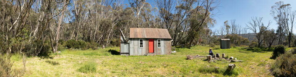
Kagbeni marked the end of our just completed nine day trek of the Annapurna Circuit and a well earned rest day around Kagbeni yesterday.
Day 11: Thursday 2/5/2019 Kagbeni – Chele (3050m)
Max elevation: 3102 m
Total climbing: 1681 m
Total descent: -1467 m
Average speed: 4.83 km/h
Total time: 08:33:59
The first day of our Upper Mustang Valley extension of the Annapurna
We climbed high soon after leaving Kagbeni with great views down the river valley. A small dog from the town lead us all the way to our morning tea stop and then collapsed with exhaustion. We were looking for fossils and some prize specimens were found. There were rocks and more rocks as far as the eye could see. The scenery was quite stark and desert like with impressive conglomerate rock spires and pinnacles. Yellow flowers on bushes made a lovely foreground for photos.
We were mainly walking on a gravel road most of the day with a few buses and jeeps passing and stirring up the dust. We stopped for morning tea at a lovely tea house enroute to Chusang village at the confluence of the Narshing and Kali Gandak. Here, we enjoyed a delicious lunch in a well decorated dining room. From this village our destination for the night was in sight.

Chhuksang (Chhusang) on Kali Gandaki Nadi
We continued to follow the Gandaki and its wide almost dry river bed with steep sided ochre coloured walls. Sue, unfortunately, was hit on the head by a falling rock after thinking this was a distinct possibility given the unstable nature of the rock. Fortunately, it was a very small stone. We started to think about sky burials which are still sometimes practiced in this area. The dead are taken to a hill top and chopped into pieces so that the eagles can carry them to the sky. Quite macabre but environmentally friendly. Sue decided she didn’t want a sky burial.
We stopped to visit the Cave Monastery where in the 10th century people from Manang brought a statue of a female Buddha to a cave in the mountain and slept the night there. They built a monastery around the statue and to this day each night one family goes there to light a torch which they believe keeps them safe. One of six local families does this every night for a year at a time.
We met the Nepalese army at the steel bridge over the Kali Gandaki who held us up while they took selfies balancing their semi automatic machine guns.
It was then a climb via switch backs to the town of Chele and our teahouse for the night.
We enjoyed playing cards with the boys (porters) who are really starting to come out of their shell.
After dinner with beers celebrating Sarah and Ralston getting approval for their house loan we discovered it was Mohan’s birthday! Double celebration! Even more claps when Prabin explained to the boys the reason we were celebrating. More beer and and the kitchen whipped up a chocolate cake in 20mins and we sang a rounding rendition of happy birthday. In Nepal they do not celebrate birthdays and with all the beer and cake the locals were left wondering why not. It was a fun night.
Day 12: Friday 3/5/2019 Chele – Syanboche (Shyangbochen) (3800m)
Max elevation: 3988 m
Total climbing: 2780 m
Total descent: -2069 m
Average speed: 4.32 km/h
Total time: 08:17:54
We had an early start, soon after 7:00am as a tough day of walking was anticipated. On leaving our accommodation we started climbing straight away and this ended up being the theme of the day. The scenery was grand and outstanding, a bit like the Grand Canyon, The Badlands in Alberta and Canyonlands all rolled into one. The difference was the towering snow capped peaks in the background.

Mustang Khola past Chele
Today was a day of three passes, the first being the easiest at 3624m. Of course doing three passes entailed walking over the pass and down the other side just to climb up again. Luckily, the grandeur of the views was a welcome distraction.
Again we were tag tailing the army men in training with their semi automatic weapons and rocket launchers. They were surprisingly friendly.
We had lunch at Samar and tasted a local buckwheat bread. It was quite cold and as we sat inside waiting for lunch we noticed that sleet was coming down outside. Luckily for us, it didn’t last long. There were two passes after lunch, the third being the highest. Then it was down hill and on the flat to the village of Shyangbochen to our basic accommodation for the night. A hot bucket shower was very welcome as was an earlier finish than expected to our trekking day.
It was quite cold in the evening and Sarah and Ralston were kept awake by rats running around the cloth ceiling in their room. This was our most basic accommodation yet and it seemed that dust was everywhere. We had to go outside onto the street to brush our teeth.
Day 13: Saturday 4/5/2019 Syanboche (Shyangbochen) – Ghami (Ghemi) (3520m)
Max elevation: 3987 m
Total climbing: 919 m
Total descent: -1127 m
Average speed: 3.87 km/h
Total time: 05:20:27
It was another clear morning as we left the village of Shyangbochen with trucks revving and spewing black smoke as we walked by. It was a gradual climb to Syangboche La (3,870m). We had great views of snow capped peaks in the background and the barren desert like terrain of the Upper Mustang. As we walked the scenery constantly changed. The army were once again in formation ahead of us. It was good to know the security forces were close at hand.
Our second pass for the day was an uphill climb to Nyi La (4020m). While we were resting at the prayer flags some tourists pulled up in a jeep, dressed in their nice clothes, walked 10m up to the high point of the pass and started celebrating the highest pass of their trip by vehicle. They were singing and taking photos and it was very amusing for us.

Chhunggar Chorten
As we descended the pass the scenery changed dramatically with the stunning “flaming mountains” of ochre, grey and red providing a scenic backdrop to the village of Ghemi.
Ghemi was our destination for the evening and when we reached the hotel we were offered the option of an upgrade for 1500 rupees (about $20). We decided to go for it and we were thrilled with our choice. We had a sit down toilet with toilet paper provided, a double bed a hot shower and a fluffy towel. It was the best hotel in Nepal yet!
In the afternoon we visited the local monastery and learnt that the sign Hitler highjacked for his evil agenda actually meant auspicious and good deeds. We enjoyed the afternoon in our comfortable room.
Our evening meal was spent in the kitchen with the resident family and all the boys. It was a very clean stainless steel kitchen and it was interesting to watch the food preparation and the family interactions. Despite being in such a nice hotel there was still electricity blackouts and the toilets didn’t flush but both were restored by the morning.
Pawan just couldn’t get Steve’s name. He wrote it down as David then Dived and he couldn’t believe it when Sarah told him his name was not David. He was able to remember it once he wrote it in Nepalese.
Day 14: Sunday 5/5/2019 Ghami (Ghemi) – Chrang (Tsarang) (3560m)
Max elevation: 3870 m
Total climbing: 1042 m
Total descent: -1203 m
Average speed: 10.79 km/h
Total time: 03:46:48
From Ghemi it was a fairly continual climb uphill to the pass. We passed the deserted Japanese hospital and a very long chorten, a memorial to local people who had died. Climbing upward with ever changing views we reached the pass Tsarang La (3870m) in about two hours.
A gentle descent followed and the meandering on the flat until we reached the quiet village of Tsarang before lunch. Apparently, most of the inhabitants were out working in the fields given the time of year. They mainly grow barley, grains and potatoes.
After lunch we headed to the monastery where local monks had assembled for two weeks of daily chanting (from 9 to 5) each day. Some local young nuns were also in attendance. We learnt that the monks who have a shaven head are committed and may not marry. Those with long hair may marry and can leave the order at will.

Chrang Monastery
The town was also interesting for people watching. There is a fair bit of construction going on and people seem to be moving baskets of sand and rocks from one place to another. The village itself is also visually appealing with large chortens painted in the colours of the surrounding hillsides, ochre, grey and red.
There was also a visit to the old royal palace which was more like a museum. In it was the kings armoury and a 750 year old hand and a yeti hand. The human hand was the king’s artist and architect who designed the palace. Once it was completed the king ordered that his hand be chopped off so his work could not be replicated.
Our evening was spent in basic accommodation, Sarah and Ralston had to contend with rat wars in their rafters and we endured petrol like fumes of unknown origin. We were happy to wake up in the morning. The workers started their manual handling and machines by 6:00am.
Day 15: Monday 6/5/2019 Chrang (Tsarang) – Lo Manthang (3810m)
Max elevation: 3965 m
Total climbing: 830 m
Total descent: -588 m
Average speed: 3.73 km/h
Total time: 05:10:37
Leaving behind Tsarang with it’s rats and fumes the trail headed down to the river. We enjoyed more incredible desert scenery with rock spires, natural caves on sheer cliffs and a variety of wind sculptured formations. There was quite a grand stupa along the way at crossroads but not near any town. People apparently visit site this during their journeys.

Old monastery outside Chrang (Tsarang)
We walked passed an army training base where no photos or camping is allowed. A heavily armed soldier came out to greet us but Pawan knew him and we were all good.
We continued on climbing our pass for the day and to a vantage point which looked over Lo Manthang. We climbed to a high point where there was a film crew who were shooting. We climbed up to 4,000m and got some good shots of the colourful barren landscape.
The boys got selfies with the Nepali film stars and we descended to the semi deserted town. It is an ancient city with 9 metre high walls. The accommodation at Hotel Peace was pleasant but there was no electricity or hot showers unfortunately.
After lunch we visited the three monasteries from the 14th and 15th centuries but unfortunately the palace was closed following the 2015 earthquake. It was gusty in the afternoon and so far we have avoided walking in the strong winds that this area is renowned for.
Our skinny trail dog who had followed us since Chele nearly got into a fight with the big, well fed monastery dogs. She looks so sick and frail. We felt protective of her although we had never encouraged her to follow us.
Day 16: Tuesday 7/5/2019 Lo Manthang – Choser and return
Max elevation: 3961 m
Total climbing: 914 m
Total descent: -916 m
Average speed: 4.77 km/h
Total time: 06:30:39
We took a day trip from Lo Manthang to explore the village of Choser which is close to the Tibetan border. Tibetans had fled to this area as refugees from 1950.
We left at 7:30am in an attempt to beat the wind on our return journey as this area is know for its dust and gusty afternoon winds. We headed northeast and descended to cross the almost dry Chhorak Dokpa Khola. We climbed the other side for great views looking back on the red walls of the old city.
Sati, our trail dog (“Settee” meaning white in Nepali) was still with us and joined us on the day trip. The boys had fed her dahl baht for breakfast and after a few hours it was clear she was having some digestive issues.
We followed the dirt road along the diminishing waters of the river for about two hours before we reached the village of Choser and the red monastery of Nyphu set in the rock face beyond.
First we visited the Sija Jong cave and the walk to the entrance was through incredibly scenic surroundings. The caves were estimated to be 3,000 years old and artefacts were found by the most recent inhabitants around 250 years ago. These Tibetans were fleeing from the Chinese army and hid in the cave. As they had a source of water they lived here for some time. Apparently they drank Rakshi (local alcoholic drink) before breakfast. Given the harsh existence this is understandable. There are apparently 108 rooms and we crawled through a few of them.

View from Jhong Cave
We the visited two monasteries, Lo-Nifu Gumba (The cave of the sun) and Lo-Gurfu Gumba. Both seemed very keen on sponsors for their monk school to feed and educate young people predominantly from the Gorka region. Some were orphans from the earthquake. The 1,000 rupee entry fee for the three places may perhaps help with their efforts.
As the wind was starting to increase we decided to head back. Sarah and Ralston set a cracking pace as the wind and dust swirled around us and we arrived back at Lo Manthang within 1.5hours for a late lunch.
Parwan went out to feed Sati dahl baht at night but she was nowhere to be seen. Perhaps the tough trip back in the wind was too much for her as we did not see her again. Parwan seemed sad she had left us.
Day 17: Wednesday 8/5/2019 Lo Manthang – Ghami (Ghemi) (3520m)
Max elevation: 4288 m
Total climbing: 1235 m
Total descent: -1499 m
Average speed: 3.85 km/h
Total time: 08:36:02
We set off early with the aim of beating the wind which increases in ferocity every afternoon. We were now on our return journey but we were to travel via Ghar Gompa instead of via Tsarang. This was enjoyable as we were on trails rather than roads and we virtually had it to ourselves. The walk was scenic and varied the whole way with a fair bit of Nepali flat (continuous undulations) thrown in for good measure.
Our first pass of the day was the highest on this trek, Chongo La at 4,320m. We all seemed to be quite well acclimatised at this stage. We saw a hare bouncing rapidly up the hillside, perhaps running from the army who never seemed to be too far from us.

Looking back towards Tibet from Chogo La (4280m)
We then entered marmot (or mountain rabbit as the boys called them) country and managed to see a few of the tan coloured animals as well as some ground dwelling pheasants.
We stopped at the village of Lo Gekar to see the monastery of Ghar gomba. We continued on to climb our second pass of the day, Mui La at a mere 4170m.
On our descent from the pass the view changed dramatically and a panoramic landscape was revealed. There were snow capped mountains in the background, huge conglomerate spires and eroded valleys. The scenery just got better as we approached our lunch stop in the village of Dhakmar. This village is backed by towering red cliffs and the sun was lighting them up revealing incredible vistas. It was hard not to take multiple photos. We then launched our final push for the day to the town of Ghemi. The wind was starting to increase and dust was flying in all directions as we entered Ghemi, back to our nice hotel with ensuite facilities and fluffy towels!
Day 18: Thursday 9/5/2019 Ghami (Ghemi) – Samar (3660m)
Max elevation: 3986 m
Total climbing: 3930 m
Total descent: -3896 m
Average speed: 7.33 km/h
Total time: 10:01:06
We discussed the previous night that we would take the longer route to visit the Chungsi cave although we knew it would result in a longer day. As it turned out, it was well worth it.
It certainly was the day of descents and ascents, Nepali flat at it’s best! Leaving Ghemi which was great for street watching, cute babies, yaks and frisky horses. We climbed up and up for the first of four passes of the day. We watched horses being herded high on the barren hillside.
Before lunch we stopped briefly by a tea house in Tamagaon where a woman had a gorgeous baby swaddled against her back. We asked if we could take photos and she said in exchange we could have the baby! It must have been a tough night!

Tamagaun
Syangboche was our lunch stop and we soon left as we knew it would be a long afternoon. We descended into a stunning gorge with huge red coloured steep walls. Down and down we descended until we reached a stream and the path to the Chungsi Cave. More steep steps up to the cave monastery of Guru Rinpoche. The Lama was not there so we were free to explore around the cave with it’s Buddhist artefacts.
After stopping for a regulation selfie on after leaving the cave, down to the stream we went, then it was a long unrelenting climb to the top with panoramic views all the way. We finally reached the top to the realisation of the huge descent ahead of us.
Down, down we walked with some slippery and rocky sections. We had two more gullies to cross so there was yet more up and down until we finally reached Samar at 5:45pm. Incredibly on the last hill Saidah, whilst in front, decided to race Mohan to the top. Mohan with his full load of 25+kg caught on and sprinted up the hill to beat her. It is amazing he still had any energy left. It had been a very long but rewarding day. Prabin shouted us and the porters a shot of Raksi to celebrate the day’s achievement.
Day 19: Friday 10/5/2019 Samar – Kagbeni (2810m)
Max elevation: 3638 m
Total climbing: 1089 m
Total descent: -1743 m
Average speed: 4.60 km/h
Total time: 03:32:20
This was a relatively easy day, given the previous day had been pretty tough and we had decided to hire a bus for the final section of the road.
We enjoyed walking the gradual descent to Chele past the towering sedimentary rock cliffs. There was another enthusiastic front end loader driver who was hurling debris and huge rocks down the cliffside close to where we were walking. A steeper route down was taken to avoid potential injury!
We continued downward to have morning tea where we stayed at Chele over a week ago. We then set off for the final push, our lunch stop and a bus to take us to Jomson.
We descended to the Kali Gandaki (black river) gorge just as the wind started to pick up which confirmed that we had made the correct decision to take a bus on the final leg.
There were a lot of people working along the way, manually bending metal pipes, twisting wire for rock reinforcements and carrying rocks from one area to another. They were more than happy to pose for photos, unlike the people of the Upper Mustang.

Road work crew near Chele
We enjoyed a great lunch at Chhuksang, best pakodas of the trip! This was our final stop and our journey was over!
Kagbeni – Jomson (2720m)
We walked a short distance to the bus and this was the start of yet another adventure, a bit more white knuckled than before. The bus driver was very good and did not speed but the condition of the road in places was poor with large drop offs while also trying to negotiate around other vehicles. The road was rocky, sandy and we drove through shallow rivers. We saw one water logged car but the locals came to the rescue. At least the ride wasn’t too long. As we stepped off the bus in Jomson we felt our first drops of rain of the trip. As we settled into our room the rain fell and we even heard thunder. How fortunate we had been to have no rain, minimal wind and clear sunny skies day after day!

Hillside views on drive along Kali Gandaki Nadi
The bus trip after completing the Upper Mustang Valley trek. A rough, dusty ride from Kagbeni to Jomson.
We enjoyed a party at night where we all had drinks and dinner together and our appreciation was expressed about a wonderful trip with kind caring staff. Then the dancing started! It was hard to believe that our journey was over.
Day 20: Saturday 11/5/2019 Fly Jomson – Pokhara
An early morning flight from Jomsom to Pokhara had us flying along the Kali Gandaki valley with towering mountains above us on both sides. Once in Pokhara we were transferred to Hotel Barahi by private vehicle and spent the day resting and exploring Pokhara.

Views to west on Jomson to Pokhara flight
Upper Mustang Valley Photos by Other Participants
Clickable icons on a world map which open the related trip report
A detailed, searchable trip list with links to reports, photo galleries and other content
![]()