
12/10/2017 – 18/10/2017 Thredbo – Mount Kosciuszko – Mount Townsend – Mount Alice Rawson – Wilkinsons Creek – Abbott Ridge – Northcote Creek – Lake Albina – Little Austria
Kosciuszko National Park, NSW
Ngarigo country
Distance: 92km Total Ascent: 4,630m Total Descent: 4,630m Time: 40 hours
Participants: Stephen Davies (Photos, Report)
My previous week had been spent waiting patiently for a multi-day window of descent weather, so with the next six days after Thursday forecast to be cool, dry and very calm it was now time to act. The trip objective being to camp high on Abbott Range or Mount Townsend or thereabouts and make good use of the two heavy DSLR cameras, two lenses, tripod and multitude of other camera gear I had decided to take. There was also a brand new GoPro to christian and learn how to use. Hopefully some epic day to night time lapses, telemark runs and worthwhile photos will be recorded.
Day 1: Thursday 12/10/2017 Thredbo – Snowy River
Max elevation: 2143 m
Total climbing: 1279 m
Total descent: -1138 m
Average speed: 3.98 km/h
Total time: 02:50:22
The morning spent driving had me at Thredbo Overnight carpark 1 by 1:00pm, finalising packing and making my way to the chairlift. The bad news was that Kosciuszko Express was closed for maintenance and the alternative would add 100m vertically to the trip, the good news was getting a Seniors discount on the lift ticket.
Thursday’s forecast early morning rain had cleared but the wind was a little tardy in easing off. With the temperature just over zero it felt pretty cool. The walk up the cleared road from the top of Snowgums lift was very uninteresting. Arriving at Eagles Nest the wind was very strong, often throwing me off balance as gusts hit. With skins on I was off straight into this solid cool breeze.

Just beyond Kosciuszko Express top station
A lot of extended grass patches had me guessing the best route, at times removing skis and walking or doing stretches of grass skiing. No other ski tracks were to be seen along this, the main route but there were plenty of foot prints. The wind didn’t let up all the way to Rawson Pass which I reached via Etheridge Gap and Swampy Plain River. It had proven to be hard and uncomfortable work as I haven’t quite figured out the adjustments on my new Aarn Load Limo pack.
Left the skins on for the run down the Snowy River, finishing up next to a grassy patch right on the 2000m contour. Water was fished out of (with a 5m length of cord and ski pole) an opening directly below camp. No photos tonight as the clouds have enveloped the area.
Day 2: Friday 13/10/2017 Snowy River – Mount Kosciuszko – Mount Townsend
Max elevation: 2229 m
Total climbing: 1145 m
Total descent: -1152 m
Average speed: 5.06 km/h
Total time: 07:07:45
Awoke to being enveloped in clouds with a light breeze and very low visibility. A good opportunity for a lazy breakfast.
Finally ready to head out around 10:00am shortly after observing the cloud starting to break up, by the time I was on ski there was plenty of blue sky so I headed up the Snowy River on already softened snow to Rawson Pass. From here it was up onto Mount Kosciuszko. The summit area was devoid of snow and lots of grass areas were evident on most west facing ridges.
A slower than usual run back down, especially after descending lower into the Snowy River valley. Two runs were enjoyed just upstream of camp before it was back to the tent for lunch.
As the aim for tomorrow was to move further west I decided to head over that way and establish a good track to Muellers Pass out of the Snowy River valley, between the cornices. Once this track was set I continued onwards to the foothills of Mount Townsend, only being forced to cross about 20m of grass (with careful route selection). All this time the clouds had been hanging around the western peaks but as I arrived they gradually thickened and lowered to the point that when about 400m from Mount Townsend there was 20m or less visibility. There was now only one thing to do, turn around and follow my own tracks back to camp.
Once reaching Muellers Pass on the return it had cleared enough for me to ski up to the top of Muellers Peak. Some good views down into Lake Albina but not anything beyond. After collecting the obligatory photos it was back to camp. Despite a decent incline the snow was heavy and slow, so once back at 5:00pm it was time to call it a day.

Evening sky between Muellers Peak and Mount Northcote
The evening produced some nice colour in the evening sky and at times crystal clear views of the stars. It was a little disappointing for the time lapse I was shooting however, as a fog had rolled in without me noticing, covering the camera and lens in dew.
Timelapse from camp above the Snowy River
Day 3: Saturday 14/10/2017 Snowy River – Mount Townsend – Mount Alice Rawson – Lake Albina
Max elevation: 2179 m
Total climbing: 789 m
Total descent: -631 m
Average speed: 4.41 km/h
Total time: 07:02:50
Clear blue skies with an occasional light breeze was the order of the day. An overnight freeze made for a early absence of yesterdays heavy conditions. Today saw my move out further to the west, without being exactly sure where I would end up. After a water run and completing the packing I was finally on my way just after 10:00am. The carefully set tracks of yesterday proving very useful, it was easier climbing out of the Snowy River fully laden on the set track on firm snow than yesterday setting those same tracks in soft heavy snow.
I followed my tracks of yesterday to their conclusion and ended up selecting a campsite a couple of hundred metres further on, with stupendous views to the north taking in Alice Rawson Peak, Watsons Crags, Jagungal and Carruthers Peak amongst many more, as well as overlooking Lake Albina.

View to north and east from near camp
After establishing camp I climbed Mount Townsend. Here I met an impressive middle aged woman who had left Thredbo Village at 6:15am, walked to the top and headed off on her quest to bag Australia’s ten highest peaks in the day. Mount Townsend was her seventh.
She and I then skied across to Alice Rawson Peak before enjoying a fantastic run down to Lake Albina. From here I ventured downstream a little to find some open flowing water and fill my water bottles before completing the 280m ascent back to camp by a more direct route.
I passed the rest of the afternoon exploring the Alice Rawson Ridge and taking photos. Another time lapse was set up before sunset facing north towards Jagungal. This taking in the lengthening shadows, fading light and colourful transition into night before the stars came out in force. A gentle breeze keeping any dew formation at bay until shortly after 9:00pm when it dropped right off. I finally retrieved the camera around 11:00pm.
Day 4: Sunday 15/10/2017 Mount Townsend – Wilkinsons Creek – Abbott Ridge
Max elevation: 2154 m
Total climbing: 1068 m
Total descent: -1082 m
Average speed: 5.54 km/h
Total time: 06:56:16
Todays weather was a repeat of yesterdays as forecast. I departed camp around 9:30am heading straight down to Wilkinsons Creek, the snow was fast and firm initially as this slope doesn’t get the early morning sun.

Wilkinsons Creek
The first creek water was seen adjacent to the snow poles and from here the gentle open downhill incline of the creek was followed. Increasingly open water with sheer 2m snow walls along the creek edge, lots of stress fractures and some interesting snow bridges of varying sizes made a very scenic tour. Towards the end of Abbott Range the incline increases with some water races and small waterfalls. Reaching the 1700m contour the valley had somewhat narrowed, with a lot of rocky sections and snow gums to negotiate amongst the thinning snow, it was now time to turn back.
From here I followed the creek back upstream a short distance, filled my water bottles and ascended to the top of the southern end of Abbott Range. I spent a while meandering around the rock formations to the south and west before crossing back to the eastern side just before reaching Byatts Camp.
From here a couple of telemark runs were enjoyed on softened snow before fishing out some more water and heading back to camp. The fatigue up the last climb told me I’d had enough for the day so it was into the tent and out of the sun at 4:30pm.
Day 5: Monday 16/10/2017 Mount Townsend – Lady Northcotes Creek – Little Austria
Max elevation: 2162 m
Total climbing: 1115 m
Total descent: -954 m
Average speed: 5.61 km/h
Total time: 06:23:13
Still clear blue skies to start the day. Off down into Lady Northcotes Creek for the first few telemarks of the day at 9:30am with this east facing slope catching the early sun and being softened nicely after its overnight freeze. I did however forget to start the GPS tracking until I was most of the way down this first run.
A short descent down along the creek to fill up water bottles was followed with a climb up the other side of the valley, before sidling further around to the top ridge to the west of Mount Lee. A second telemark run was enjoyed out to the limit of skiable snow along that ridge. I ligered here for a while to take in the fantastic panoramic views before skiing off the eastern face of the ridge into the creek below, now being located in the midst of Little Austria. Here I followed the creek downstream for a short distance to check out the views where it turned sharply to the west. I wasn’t disappointed. There are many fantastic runs into this creek from both sides, definitely a great spot to spend many hours sometime in the future.

View down into Little Austria
The climb back out up along the creek to the ridge-top proved to be very hot in the cloudless perfectly calm 16 degree day which had ample heat reflecting back off the concave shape of the valley.
After a quick run back down towards Lake Albina I had another hot climb back up to my Alice Rawson Ridge campsite for lunch.
The afternoon was taken up with a couple of runs down towards Wilkinsons Creek before capping the day off with another visit to the summit of Mount Townsend. Although back to camp just after 4:00pm my old body was demanding some down time, who was I to argue.
Day 6: Tuesday 17/10/2017 Mount Townsend – Lake Albina – Abbott Range
Max elevation: 2166 m
Total climbing: 974 m
Total descent: -988 m
Average speed: 5.36 km/h
Total time: 07:06:46
As forecast, another blue sky day with the occasional very gentle breeze. The first run of the day at 9:30am saw me descend down to Lady Northcotes Creek to refill water bottles again. From here a tour around Lake Albina to take in the views and get some photos before the 280m climb back up to the tent.
 Lake Albina
Another ascent of Mount Townsend followed, before heading over to the Abbott Range for a planned series of runs. The first descent proved very disappointing on very slow and heavy snow, even on the chosen south facing hill. As multiple runs were not going to provide any joy I quickly re-evaluated my plans.
Skiing across to Wilkinsons Creek for a lunch stop on a grassy patch and fishing expedition for more water I decided plan B would be to follow the creek back upstream and enjoy to scenery and picture taking opportunities for a seconf time. Still snow banks a couple of metres thick in places along the creek, as well as a few icebergs drifting downstream.
After so many days out skiing I was happy to be back to the tent for a while before I put in a final effort, an exploration of the ridge out to Alice Rawson Peak, before calling it a day. The second day running in which I saw no one else, even off in the distance. Mid-week in this part of the world can be very quiet!
Day 7: Wednesday 18/10/2017 Mount Townsend – Thredbo
Max elevation: 2127 m
Total climbing: 307 m
Total descent: -622 m
Average speed: 5.97 km/h
Total time: 03:06:31
Clear blue skies again this morning but with a slight breeze. The forecast for tomorrow has changed, with the predicted rain now expected to arrive in the morning rather than evening. After a week of dry conditions I had no inclination to get everything wet, so it was pack up time. The aim of of the day was to get most of the driving out of the way before the kangaroo hazard appeared around dusk.
I was intentionally not away until 10:30am to allow a little thaw time, this worked a treat. It was a quick and easy ski around to Muellers Peak, here the snow was just right, just as well with the heavy load back on. About 30m of grass skiing was needed just prior to the pass, which was expected and not bad considering the very bare appearance of the rest of this west side of the ridge.

Muellers Peak, Muellers Passs and Mount Kosciuszko
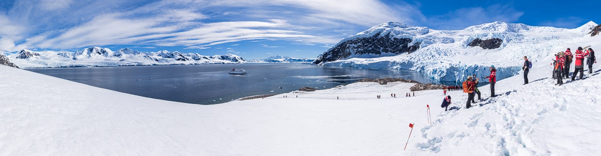
Once over the pass, right up through the Snowy River to Rawson Pass there was ample snow cover. To this point I hadn’t seen another person, even in the far distance, since Sunday. On reaching Rawson Pass, however, there was a steady stream of people on their way to the summit of Mount Kosciuszko. This included one school group of about 60 students. All the way back to Thredbo, however, there was not one other person on skis or with multi-day pack.
From Rawson Pass conditions were very different. Most of the trip back to the Snow Gum chairlift (Kosciuszko Express was still closed for maintenance) was spent walking on the raised steel path, with just the occasional short patch of snow worth putting the skis on to cross. I was back to the chairlift around 1:30pm.
Overall a sensation week out.
Clickable icons on a world map which open the related trip report
A detailed, searchable trip list with links to reports, photo galleries and other content
![]()