
11/12/2017 – 15/12/2017 Kangaroo Island Wilderness Trail
Flinders Chase National Park, SOUTH AUSTRALIA
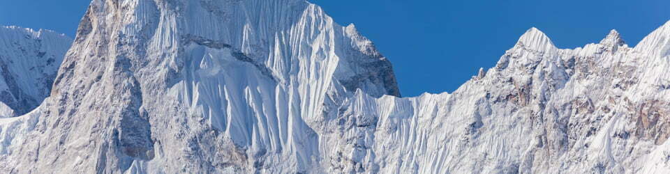
Karta pintingga
Distance: 81km Total Ascent: 1270m Total Descent: 1180m Time: 23 hours
Participants: Stephen Davies (Photos), Sue Davies (Report)
The Kangaroo Island Wilderness Trail (KIWT) opened in October 2016. It offers walkers access to many of the key features within Flinders Chase National Park. The trail is of a high quality with good signage and excellent campground facilities, elevated camping platforms, large cooking shelters with sinks and running water.
The KIWT website has good information about the various ways to do the walk as well as transportation options. The campground even offers a service to move packs between campsites to eliminate the need to carry a heavy pack.
Key features include encounters with the unique wildlife of the island, stunning coastal scenery, the amazing Remarkable Rocks and limestone caves.
As a huge anniversary treat we stayed at the Kangaroo Island Wilderness Retreat and were transported each day to beginning of the trail and picked up at a prearranged point. This was done for us individually so we did not need to walk with a large group.
Day 1: Monday 11/12/2017 Rocky River – Snake Lagoon
Max elevation: 85 m
Total climbing: 267 m
Total descent: -287 m
Average speed: 4.28 km/h
Total time: 04:28:46
We were dropped off around 8:30am and our pick up time was 1:30pm so this allowed us plenty of time for a leisurely first days walk.
There was a lot of signage in the first few kilometres so we stopped and read about the fascinating animals and plants of the area. The tall eucalyptus trees were impressive but we didn’t spot any koalas (introduced from the mainland).

Rocky River Waterhole
We lingered around the platypus waterholes but we doubted we would be that lucky to see one of these introduced species in the tannin stained water. We did see many birds, Tammar wallabies and several Rosenberg monitors.
Day 1 on the Kangaroo Island Wilderness Trail from Rocky River to Snake Lagoon
The trail followed the Rocky River with it’s many tannin stained pools, these didn’t quite tempt us for a swim despite the heat of the day.
Before long we arrived at the well appointed Cup Gum Campground and waited for our lift back to our accommodation, feeling a little guilty as we had never done this type of trip before.
Day 2: Tuesday 12/12/2017 Snake Lagoon – Cape du Couedic
Max elevation: 149 m
Total climbing: 803 m
Total descent: -707 m
Average speed: 3.89 km/h
Total time: 05:18:25
After being dropped off at the campground we followed the trail as it continued along the Rocky River. Later crossing over the river and climbing up a hill for great views of the mouth of the river and our first sight of the Great Southern Ocean. Here the tannin stained river-water seeped into the expanse of the ocean and quickly dissipated.
Kangaroo Island Wilderness Trail – Snake Lagoon to Cape du Couedic
Soon we headed down to the beach and followed the aquamarine coastline. Here we reached a sheltered spot with crystal clear water and dived in for a refreshing swim.
Along the beach we observed a pair of hooded plovers, a threatened species with only 200 pairs remaining on Kangaroo Island. They were displaying distractionary behaviour, pretending to nest in numerous spots, so as to conceal the true location of their eggs.

Hooded plover (Thinornis rubricollis)
The walk along the beach was enjoyable but soon we were back up on the cliffs and the heat of the day was increasing. The lighthouse which was in the far distance eventually looked much closer. Above the cliffs we heard the barking of seals but we could not sight them on the rocks below. Before long we arrived at Hakea Campground where we relaxed for an hour before our lift arrived.
Day 3: Wednesday 13/12/2017 Admirals Arch – Sanderson Bay
Max elevation: 153 m
Total climbing: 689 m
Total descent: -688 m
Average speed: 4.21 km/h
Total time: 06:30:01
Today, we were dropped off at Admirals Arch about 8:00am, before the crowds arrived. We spent quite a lot of time watching and photographing the seal families, including young pups. It was very entertaining!

Fur Seals at Admirals Arch
Once we returned to the main trail there was a fairly long flat section through the bush without many views. We saw a few Rosenberg Monitors but not much else. We reached Remarkable Rocks around lunch time and spent some time exploring these very impressive granite formations.
We enjoyed some pleasant coastal scenery along the cliffs towards Sanderson Beach which looked like it would be a good place for a swim.
We arrived at the Banksia Campsite just before some rain started to come down. Thus we were pleased to be heading back to our accommodation at Kangaroo Island Wilderness Retreat for a shower and nice meal. After all it was our 30th wedding anniversary!
Day 4: Thursday 14/12/2017 Sanderson Bay – Grassdale
Max elevation: 63 m
Total climbing: 388 m
Total descent: -394 m
Average speed: 4.23 km/h
Total time: 05:32:34
Soon after setting off we reached the coast and were walking along the cliffs looking down over limestone cliffs to the aquamarine waters below. Looking back we could see Remarkable Rocks in the distance.
We took some time to take a short side trip to explore the limestone and granite outcrops of Cape Younghusband. The smooth granite on the waters edge was a sharp contrast to the upper limestone layer. As we approached the waters edge we saw some seals frolicking in the water. Sue did not realise there was a fur seal concealed between boulders close behind her. Feeling cornered it came out towards her barking! A quick retreat by the human and it was seal 1, Sue 0.
Here we spent some time carefully observing the seals, whilst keeping our distance, while the seals entertained us with their antics. It seemed they were just as interested in us as we were of them.

Long-nosed fur seal (Arctocephalus forsteri) just off Cape Younghusband
From here the trail then headed back inland to skirt around the exclusive Southern Ocean Lodge, set on a patch of privately owned land. At $1500 and up a night we didn’t think they would want us to drop in for a cuppa. Along this section the vegetation changed from low coastal heath to dense mallee and tea trees.
Further along there is a fixed boat to allow an easy crossing of the South West River. This was a bit of fun and came with detailed safety instructions. We were now entering the Cape Bouguer Wilderness Protection Area.
Kangaroo Island Wilderness Trail – Sanderson Bay to Grassdale
From here we headed down to the beach and Hanson Bay. The bay and the beach were equally beautiful with white sand and clear blue/green water. From the beach side we were able to look towards the Cape Bouguer Wilderness Protection Area.
After lunch we headed back to and along the main trail and past the historic Grassdale property, and onto the Tea Tree campground where we were to be picked up at the end of our days walk.
Day 5: Friday 15/12/2017 Grassdale – Kelly Hill Caves
Max elevation: 62 m
Total climbing: 204 m
Total descent: -170 m
Average speed: 4.94 km/h
Total time: 01:49:16
We had a later start today as Steve was up in the wee small hours taking time lapse photos. Soon after starting we reached the Wilderness and Grassdale Lagoons, a refuge for wildlife.
It was a pleasant walk through sugar gum and old growth banksia woodlands in the Kelly Hill Conservation area. Before we knew it we were at Kelly Hill Caves and the end of our walk.

Sue and Sue at the end of the track at Kelly Hill Caves
It was a really enjoyable five days with a variety of scenery, stunning coastline and close encounters with native wildlife. There is so much native bush on Kangaroo Island which equates to large areas of habitat for native animals, so seeing them seems to be much more frequent here. This of course enhances the experience of the trip.
Raptor Domain
With an early finish for the walking day we headed off to Raptor Domain, a private bird and reptile park. Here injured and orphaned animals are rehabilitated and released back into the wild if they recover well enough. Some are trained up for the bird show, where you get the chance to get very close!

Black Kite
Seal Bay Conservation Park
After the bird show we headed down to Seal Bay Conservation Park run by National Parks where entry fees apply. You can elect to stick to the Boardwalk behind the beach and take your time observing the seals or join a park guide for an informational tour a bit closer onto the beach. Both these options are far removed from our last visit 30 years ago when there was free and open access.

Australian sea lion (Neophoca cinerea) at Seal Bay Conservation Park
Seal Bay Conservation Park Photos
Kelly Hill Caves
Tour times and opening hours meant we missed missed the Friday Kelly Hill Caves tours. We did however get back the following day for our “free” guided tour (including in the park fees we paid to do the Kangaroo Island Wilderness Trail). This was outstanding as there was no one else in our tour group!

Kelly Hill Caves
Clickable icons on a world map which open the related trip report
A detailed, searchable trip list with links to reports, photo galleries and other content
![]()