
7/07/2012 – 8/07/2012 Long Point – Shoalhaven River – Bungonia Creek return
Bungonia National Park, NSW
Gundungurra country
Participants: Ted Booth (Report), Sue Davies (Leader), Steve Davies (Photos)
Day 1: 7/07/2012 Long Point – Shoalhaven River – Bungonia Creek
So you thought it would be too cold? A pleasant 10 degrees outside and 22 inside Steve and Sue’s (trip leader) Davies car as we wound our way up Jamberoo Pass. Ninety minutes later the three of us climbed out into a crisp 5 degrees at the Long Point car park.
Max elevation: 620 m
Total climbing: 369 m
Total descent: -845 m
Average speed: 0.00 km/h
The 500m descent over 2.5km into the Shoalhaven River Gorge via Long Point is as gentle as any of the three major access routes (Badgerys Spur, Long Point and Bungonia via Mt Ayre) from the west.
A short scramble down from the track marker on a ‘goat track’ to Barbers Creek had us at the river level in 90 minutes. The 2km walk upstream on the northern bank was mostly clear and pleasant under the Casuarinas. A grove of sand paper trees was located just east of Louise Reach flat. This is an extensive high and flat sandbank approximately half way between the two creeks. Ted remembered it from a Senior Scout Bungonia Venture in about 1960.
The best campsite, at the junction of the Shoalhaven and Bungonia Creek, is located on small grassy island approximately 400m upstream from the junction. Camp was established at noon and lunch eaten under a filtered sun.

Campsite fireplace
The afternoon was set aside to explore Bungonia Creek and the Canyon. The Creek was running at a much higher level to the dribble noted in late January this year on a John Murray walk from the Block Up.
Four crossings were required before we reached the huge limestone boulders that were spewed out of the gorge in earlier geologic time. We tried to scrabble and crawl through the northern flank [right hand side] but were frustrated by a deep pool I had not experienced on an earlier trip several years ago. Wet feet and shoes were not considered an option by the trip leader!

Wet Feet? No thanks

There must be an easier way
Retreating, we tried with more success on the southern bank and were still in the boulder maze and 70m before the gorge entrance when our return time of at 3:20pm was reached. Sue slipped on a creek crossing on the return and did the full lower body emersion into the near freezing water which resulted in two very damaged fingers. A short rest and some pain relief ensured she was able to complete the last 30 minutes back to camp and a dry set of clothes.
The campsite was great. There was an established but clean fire place with logs and plenty of quality firewood. Dinner was gourmet. There was a clear sky with a full canopy of stars. We made it to 9:00pm. My light tarp was a little draffy but I didn’t, as expected, freeze!

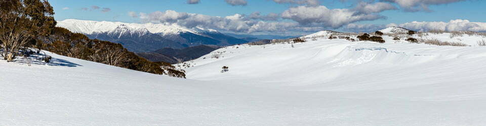
Our route along the Shoalhaven
Day 2: 8/07/2012 Shoalhaven River to Long Point
Max elevation: 626 m
Total climbing: 681 m
Total descent: -189 m
Average speed: nan km/h
Sue’s finger needed some professional attention so were decided to leave the canyon for another trip and head back. Heavy mist enshrouded the valley. The walk out was pleasant with the sighting of several grey kangaroos and recent wombat diggings.
Several false summits were unexpected and not welcome on the ninety minutes walk up. Just before the final ridge the sun broke through in shafts of rainbow infused light. By the time we reached the final walk to the parking area at noon, we were bathed in full sun. The ice had not melted in the Eski with the cold drinks!
So you thought it was too cold to go walking? The thermostat in the car must have become stuck! It still read 5 degrees as we headed back to the main road and a warm afternoon on the coast.
PS While Sue had no broken fingers, the heavy bruising will take time to heal.
Clickable icons on a world map which open the related trip report
A detailed, searchable trip list with links to reports, photo galleries and other content
![]()
Hi Stephen and Sue,
I am writing on behalf of an Art Department for a short film, we would like to use your image on this page with the caption ‘campsite fireplace’. This image would be used as background dressing, so it would not be a focal point. Please let me know as soon as possible if you are interested.
Regards,
Monique
—
Monique Langford
Graphics Assistant
NOISY – Hear Me Roar Productions Pty Ltd
ABN: 24 649 679 943
E: [email protected] | M: 0448332866
Address: ABC Studio Ground level office
Studio Building. 6-8 Lanceley Place, Artarmon.
Thanks for asking, you are welcome to use that photo with appropriate acknowledgement