
31/07/2017 – 5/8/2017 Hrafnfjordur – Furufjordur – Hesteyri – Smiojuvik – Latravik – Hafnarnes – Buoir – Hesteyri
Hornstrandir Peninsula, ICELAND
Distance: 91km Total Ascent: 4200m Total Descent: 4200m Time: 40 hours
Participants: Jenny Asquith, Andrew Burns, Sharon Burns, Stefano Cacioppo (Guide), Stephen Davies (Photos), Sue Davies (Report), Tony Fitzpatrick, Simon Marlton, Jenny Woods
This walk was is located in the Hornstandir Peninsula, an isolated area of north western Iceland. We were on a guided walk for this trip which made transportation to and from the end point much easier. The trails were mainly of a good standard but unmarked. Navigation would not present a problem with a map.
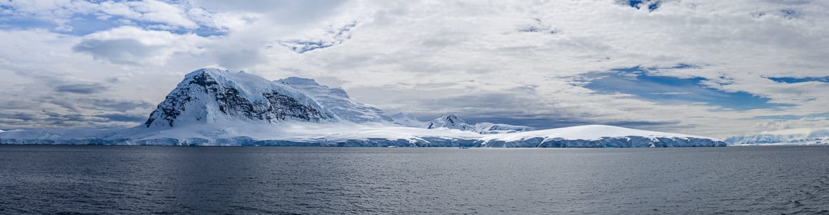
The walk took us through areas of dramatic volcanic coastal scenery in an area of Iceland that few tourists get the opportunity to see. We had close encounters with wildlife especially the inquisitive arctic fox, seals, meadows of wildflowers and a multitude of bird life.
Day 1: Monday 31/07/2017 Hrafnfjordur – Furufjordur
Max elevation: 273 m
Total climbing: 283 m
Total descent: -375 m
Average speed: 3.27 km/h
Total time: 03:33:06
We had an early breakfast and we were in the jeep by 7:00am for transport to the airport. We were on the regional flight to Isafjordur which took about one hour. We had good views leaving Reykjvik as we flew north. The plane held about 30 passengers and the male hostess impressed us with his multi skilling, we thought that he might also fly the plane.
A mini bus was waiting for us at the airport to drive us the short distance to the next village of Bolungarvik. Here we had a 90 minute wait for our boat transport. The small cafe offered a great apple cake and hot drinks and friendly locals who filled us in on a bit of local history.
The boat trip was nearly two hours and was pretty bumpy at times. We crossed our first fjord, Isafjaadarjup, I was pleased to avoid sea sickness. Hence we continued p along a second fjord, Hrafnfjodur, until we reached its end. Here the boat stopped and we were transported by zodiac to shore. In all, five forms of transportation before lunch time.
We felt we were in good hands as six of our group were doctors and another an emergency nurse.
The weather had cooled considerably and we huddled around old hut for lunch. This consisted of a variety of breads, smoked salmon, brie and rockmelon. Finally we started to walk at 2:45pm.
This started with a gradual slope, which looked back at the U shaped glacial valley and finished at a small pass which revealed lake Skorarvaln. Here our guide Stefano gave us a lesson on the geology of Iceland while we froze in the wind. We walked a little further and soon the view opened up to reveal our route down to the coast. Along the way we spotted an arctic fox scurrying away and a variety of birdlife.

Walking along Skorardalur
There was a gradual descent to the Furufjorddur with meadows of wildflowers on display along the meandering creek. The ground was very boggy in sections and all our boots became soaked. We reached the beach and our camp after about 3.5hours of walking. Light rain started just as we set up the tents.
We gathered driftwood for a fire but after dinner two large and scary Icelandic men from the house just beyond our campsite came to complain about us having the fire. They informed us that it was illegal to burn driftwood in Iceland without a license, only available to locals. With the advantage of hindsight this made a lot of sense since Iceland had been denuded of trees by the early Viking settlers, so the only available source of would was what washed up after drifting across the North Atlantic.
We had a great sleep despite the fact it doesn’t really get dark at night at this time of year. We were glad we carried our eye shades but questioned ourselves as to why we had brought our head torches.
Day 2: Tuesday 1/08/2017 Furufjorddur – Smiojuvik
Max elevation: 500 m
Total climbing: 933 m
Total descent: -914 m
Average speed: 2.93 km/h
Total time: 08:58:46
The weather was mild when we awoke with no breeze and that brought out the midges. They were just annoying as they didn’t bite.
We were walking around the rocky headland by 9:00am to catch the low tide. Ambling around the rocky shore we admired the volcanic formations, one stack named Drangur and U shaped bays. We crossed a stream onto the beach (Bolungarvik) and then commenced our climb of Skardos-fjall, our first hill of the day. The weather was pleasant, overcast with mist covering the higher peaks. We ascended into the mist and reached the pass. Light rain and wind had started. We decided to descend to eat lunch.

Sea stack near Drangur
Fully fuelled, we continued our descend to cross a river and then climb again. We were rewarded with great views of an abrupt green cliff line. After a short descent we found a lovely campsite overlooking Smiojuvik.
After dinner we wandered over to the cliffline which looked spectacular in the evening light. We watched the nesting gulls who appeared conscious of our presence.
We woke at 2:30am and went outside the tent and were impressed by how light it was at that time.
Day 3: Wednesday 2/8/2017 Smiojuvik – Latravik
Max elevation: 371 m
Total climbing: 650 m
Total descent: -647 m
Average speed: 2.93 km/h
Total time: 06:29:06
Our departure from camp was delayed by the arrival of an extremely cute arctic fox. It caught our attention for a good half hour. It wasn’t very concerned by us but was wary of the trekking poles!

Arctic Fox (Blue Morph)
Todays distance was only about ten kilometres but the coastal scenery was spectacular. There were dykes, waterfalls flowing into the ocean and dramatic cliffs with nesting birds feeding their young.
We had lunch at a high point overlooking several dykes which formed vertical sea stacks in the ocean.
After a short descent we were at the automated lighthouse at Latravik. It has a small cafe which is open for just five weeks of the year. They told us they were open until midnight but it was pretty hard to get a coffee in the afternoon as the owners went out to sea fishing. We had a surprise when hot showers were on offer, no one declined!
We enjoyed the afternoon absorbing the remarkable scenery and resting up for the days to come. There were many arctic fox cubs frolicking around the grassy hills near the lighthouse. The lighthouse owners came in with a huge haul of fish after a short fishing trip just off shore.
Day 4: Thursday 3/08/2017 Latravik – Hafnarnes
Max elevation: 525 m
Total climbing: 983 m
Total descent: -998 m
Average speed: 3.12 km/h
Total time: 09:25:28
We headed off before the 10:00am coffee was available at the lighthouse and headed further along this amazing coastline. The weather has remained constant over the last four days, with low cloud and overcast skies.
Jenny, Stefano, Sue and Steve headed out onto a narrow grassy promentary for fantastic views of cliffs, waterfalls and soaring birds.

Stefano, Jenny and Sue – Blakkibas
As we headed along the coast the scenery did not disappoint. It was hard not to keep taking photos with the lovely display of wildflowers in front of dramatic coastal scenery with vertical rock gardens complete with nesting birds. After lunch we dropped our packs and climbed up to a high lookout (Miofell) with spectacular views in all directions with the end of the Horn in sight.
We then descended towards our planned campsite for the night. It didn’t look too far away but there was the Hafnaros river in the way. This proved to be more difficult than we first thought as the river mouth was too deep and dangerous to cross. We walked around to a shallow area and crossed after removing our pants, looking like a semi naked bush walking group.
It was then a stroll across some sand dunes to the campsite at Hafnarnes at which we found several other groups campers. We were very impressed that there was a flushing toilet here, it really was a thing of beauty.
Later that night the weather started to clear and we had a pleasantly coloured evening sky to admire around 10:30pm.
Day 5: Friday 4/08/2017 Hafnarnes – Buoir
Max elevation: 488 m
Total climbing: 685 m
Total descent: -690 m
Average speed: 3.04 km/h
Total time: 06:48:41
We headed off after a light breakfast that included our individual ration of one and a quarter pieces of pumpernickel bread and three digestive biscuits.
The day started with short scrambling section at the end of the first beach. Not far beyond we started the climb up to Hvannadalsskar pass, just as the weather started to clear. The next section was like a moonscape broken up by the odd stream with brilliant green moss. We reached our second high point of the day where we had lunch enjoying sweeping views of the peaks and Haelavik below. The sun was out by now and we really enjoyed its warmth.

Heading around Trollakambur
Next was a gravelly descent and then onto the beach where we saw spotted Harbour Seals. Onto camp at Buoir and a final river crossing, which involved a balancing act whilst crossing on a narrow log.
The campground here is in a great spot just behind the beach. Most people in the group could not resist taking a cold, very refreshing ocean plunge.
It was a lovely campsite and we enjoyed the afternoon sunshine. I awoke at midnight for a toilet stop and I was impressed with the sinking sun, just below the horizon and how light it was. I guess this is the land of the midnight sun.
Day 6: Saturday 5/08/2017 Buoir – Hesteyri
Max elevation: 585 m
Total climbing: 627 m
Total descent: -641 m
Average speed: 3.31 km/h
Total time: 05:51:07
We awoke at 5:10am for an early start to meet our boat transport and started walking before 7:00am.
We walked along Hioouvik beach and then started our gradual ascent to the pass at Kjaransvikurskaro, fuelled by digestive biscuits, which we reached at the planned time of 9:00am.

Along Kjaranovikkura
We descended a short distance to a less windy spot for morning tea. Unfortunately there were no chocolate digestive biscuits on offer.
Then the long rocky descent which seemed to go on forever. As we descended we had views of Hesteyrarfjorour and the welcome sight of the Old Doctors House at Hesteyri. We felt fortunate that we could have a coffee and snacks there.
Our pick up at Hesteyrareyrar was delayed until close to 7:00pm, so we enjoyed lamb stew meal at the Old Doctors house before we left.
It seemed that we might miss our 8:20pm flight back to Reykjavik as we still needed to connect with the bus for transfer to the airport. We arrived at the airport at 8:13pm and were handed our boarding passes. We even had time for a toilet stop before boarding the plane on time. This was impressive and something you wouldn’t see in most other parts of the world.
The flight brought to an end our remote walk in Iceland. It really was an incredible six days with dramatic volcanic coastal scenery, lots of encounters with wildlife and a wonderful sense of remoteness in this fascinating part of the world. It was definitely a bucket list experience.
Clickable icons on a world map which open the related trip report
A detailed, searchable trip list with links to reports, photo galleries and other content
![]()