
Tuesday 20/02/2024 Waterfall Bay Lookout – Tasman Coastal Trail – Waterfall Bay – Waterfall Bluff Track – Waterfall Bluff
Tasman National Park, lutruwita / TASMANIA
Palawa Country
Participants: Stephen Davies (Photos), Sue Davies (Report)
We had a busy morning having a look at Remarkable Cave and then doing an 8km run along the scenic coastal trail towards Mount Brown. We rewarded ourselves with a lovely brunch at the Lucky Ducks Cafe in Nubeena. Afterwards, we were looking for a not too strenuous walk for our final day on the Tasman Peninsula.
Max elevation: 184 m
Total climbing: 176 m
Total descent: -169 m
Average speed: 3.79 km/h
Total time: 01:37:11
Waterfall Bluff fit the criteria perfectly! We arrived at the uncrowded car park around 11:30am. Not sure whether the short section of dirt road deterred people from proceeding but even when we returned there was only one other car parked.
This walk gives a good reward for not too much effort. The trail climbs steadily through the forest before levelling out. We reached the waterfall about 15 minutes before the bluff and couldn’t resist scrambling down to see the waterfall from below. Although today it was not much more than a trickle it was quite pretty anyway.

Camp Falls
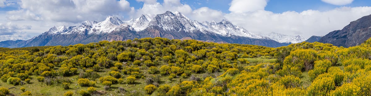
A short distance further along the track the views of Waterfall Bay revealed themselves. I’m sure after rain there would be cascading waterfalls over these cliffs but not today. Regardless, the views were impressive particularly at the Waterfall Bluff Lookout at the end of the trail.
From Waterfall Bluff Lookout we retraced our journey back to the car. A short but very scenic walk.
Information on Parks Tasmania signage along the way
Shaped by the sea
For thousands of years, this section of coastline has been exposed to the sea’s erosive powers. Strong south-westerly winds generate pounding waves that attack weaknesses in rock and erode the coastline, forming arches, blowholes, bays, beaches and caves.
You are standing at the back of Remarkable Cave. Above you was part of the cave’s roof which collapsed long ago its debris washed out to sea, save for the few large boulders and sea-smoothed rocks, beneath you. Straight ahead lies the remaining long cave tunnel leading out to sea.
Why so remarkable? Sculpting Tasmania
Can you see the shape of Tasmania silhouetted at the end of the tunnel? Listen to the energy of the sea as it continues to sculpt the cave… the rumble of the ocean surf outside… the rush of water being sucked through the tunnels and slapping against the cave wall.
Dolerite meets sandstone
The cave is made of different types of sandstones, which were formed as sand particles settled on broad, windswept plains over millions of years, compacting to become rock.
Some of these sandstones have been distorted and folded by earthquake activity, creating fractures along which the cave tunnels have formed. Nearby is another younger rock called dolerite. Dolerite formed deep inside the Earth, beginning as molten rock, during the age of the dinosaurs.
It was then forced toward the Earth’s surface and injected into the sandstones, where it cooled to become dolerite.
Look beside the walkway, or cliffs nearby, and see if you can see where dolerite ends and sandstone begins.
Two openings
Unlike most sea caves, Remarkable Cave has two entrances, which have eroded along fractures created by ancient earthquakes. Many of these fractures can be seen in the cave roof. If you move to the far end of this platform and look down the main tunnel, you may be able to see light coming in from the other cave entrance, halfway along on the left. Can you feel and smell the cool, damp, salt-laden air rushing in through the cave’s tunnels?
Special effects
Intense heat and pressure sometimes produce special effects in rocks. Beautifully folded patterns, created by earthquakes when the sandstone was forming have been made more obvious because dolerite baked some of the sandstone as it cooled. This effect is rare and remarkable and is best seen on the outside wall of the cave, from the Maingon Bay Lookout.
The local landscape features, geology, scenic highlights, flora, fauna, indigenous history, white history and other walks in the area (Gemini)
Landscape Features and Geology: A Dolerite Masterpiece
Cape Raoul’s dramatic topography is sculpted by dolerite, a fine-grained, dark igneous rock formed millions of years ago when molten magma cooled slowly underground. This resistant rock has weathered the relentless battering of the Southern Ocean, resulting in:
Towering dolerite columns: Reaching over 300 metres, these columns, known as the Tessellated Pavement, rise majestically from the churning sea, resembling a giant’s causeway.
Sea-sculpted arches and caverns: The relentless waves have carved out impressive features like the Cathedral Arch, a natural bridge framing the vast ocean vista, and the Doomed Rock, a precariously balanced dolerite block.
Windswept headlands: The cape’s exposed position allows for panoramic views of the rugged coastline, offshore islands, and the vast expanse of the Southern Ocean.
Scenic Highlights: A Feast for the Senses
Cape Raoul offers a plethora of scenic wonders:
Sunrise over the ocean: Witnessing the first rays of light illuminate the Tessellated Pavement and paint the sky in fiery hues is an unforgettable experience.
Furneaux Group islands: On clear days, these islands, remnants of a sunken landmass, create a breathtaking backdrop against the azure ocean.
Wildlife encounters: Look out for whales breaching in the distance, seals basking on sun-drenched rocks, and seabirds soaring on the thermals.
Diverse vegetation: From salt-tolerant coastal scrub clinging to cliff faces to pockets of lush rainforest in sheltered gullies, the plant life adds vibrant colour and texture to the landscape.
Local Flora: Adapting to the Harshness
The harsh coastal environment and dolerite-derived soils have fostered a unique plant community:
Coastal heathland: Dominated by low-lying shrubs like tea-tree (Leptospermum scoparium) and coastal rosemary (Olearia axillaris), adapted to wind and salt spray.
Scrub communities: Diverse pockets of scrub harbor wattles (Acacia spp.), banksias (Banksia marginata), and sheoaks (Allocasuarina verticillata).
Rainforest pockets: In sheltered gullies, pockets of cool temperate rainforest harbor towering eucalypts (Eucalyptus obliqua), tree ferns (Dicksonia antarctica), and lush understory plants.
Cape Raoul provides habitat for a diverse range of fauna:
Seabirds: Witness gannets plunge-diving for fish, shearwaters gliding effortlessly on the wind, and penguins waddling ashore after a day at sea.
Land birds: Listen to the melodious calls of honeyeaters flitting amongst the flowers and spot parrots squawking overhead.
Marine mammals: Look out for pods of playful dolphins, majestic whales breaching in the distance, and seals hauled out on secluded rocks.
Reptiles and amphibians: Keep an eye out for geckos basking in the sunshine and frogs chirping in the damp gullies.
Indigenous History: A Deep Connection to Country
The Palawa people, the traditional owners of Lutruwita (Tasmania), have a deep and enduring connection to Cape Raoul. Archaeological evidence suggests they inhabited the area for over 40,000 years, utilizing its abundant resources for food, shelter, and spiritual connection.
Sadly, the arrival of European colonizers in the 18th century resulted in the dispossession and marginalization of the Palawa people. However, their cultural heritage and deep understanding of the land continue to inspire respect and a commitment to reconciliation.
White History: A Legacy of Exploration and Exploitation
While Cape Raoul served as a navigational aid, its rugged terrain and harsh environment did not attract extensive settlement. However, its resources were not entirely overlooked.
Seal hunting: In the early 19th century, sealers exploited the abundant fur seal populations around the cape, decimating these colonies within a few decades.
Timber felling: Dolerite columns were quarried for building materials in the late 19th century, leaving scars on the landscape that are still visible today.
Tourism: With the development of Tasmania as a tourist destination in the 20th century, Cape Raoul became a popular site for scenic walks and wildlife observation. This led to the creation of the Tasman National Park in 1937, offering protections for the natural and cultural heritage of the area.
However, the colonial narrative surrounding Cape Raoul often ignores the devastating impact it had on the Palawa people. Dispossession of their land, massacres, and forced removal from their traditional ways of life inflicted immense suffering and loss. Today, there is a growing recognition of this dark chapter in Tasmanian history, and efforts are underway to acknowledge and respect the Palawa perspective and ensure their stories are shared.
Other Walks within Cape Raoul: Exploring Further
The Cape Raoul Track, a renowned 14km round trip hike, offers diverse experiences:
Tessellated Pavement: Witness the dolerite columns up close and marvel at the power of the ocean that sculpted them.
The Arch and Lookout: Enjoy panoramic views of the coastline, offshore islands, and the vast Southern Ocean.
Shipstern Bluff: For experienced hikers, a detour leads to this world-renowned surfing spot with breathtaking coastal vistas.
Several shorter walks cater to different abilities and preferences:
The Remarkable Cave Track leads to a stunning sea cave adorned with colourful formations.
The Waterfall Bay Track offers a sheltered walk through coastal scrub to a secluded beach.
The Doomed Rock Track provides a shorter option with dramatic clifftop views.
Exploring these trails offers a deeper understanding of Cape Raoul’s diverse landscape, geology, and ecological significance.
Clickable icons on this world map will open the related trip report
A detailed, searchable trip list with links to reports, photo galleries and other content
![]()