
Monday 13/03/2023 Mortimer Camping and Picnic Area – Ferres Walking Track – Nichols Hut Track – Helmet Track – Four Brothers Rocks – Burgess Road – Windy Point Road – Triangle Road
Bunyip State Park, VICTORIA
Wurundjeri Country
Participants: Stephen Davies (Photos, Report), Sue Davies
We found ourselves in the area trying to find somewhere to stay overnight during a Victorian Long Weekend holiday. We ended up at Kurth Kiln Scout Loop campground with a lot of other people and were happy to depart in the morning. Crowded camping with a very noisy neighbour is not to our liking!
Max elevation: 432 m
Total climbing: 892 m
Total descent: -895 m
Average speed: 4.75 km/h
Total time: 03:57:33
This morning we drove back down through the delightful village of Gembrook to the Mortimer Camping and Picnic Area. This walk had been suggested to us by some friends who were familiar with the area.
The campsite was crowded and I think we’re a little lucky to even find a spot to park. As Google was trying to tell us to drive another 8km to start the walk, we were happy to find a park ranger doing some chores and he confirmed that we were indeed in the right place to start the Four Brothers Rocks loop walk.
Mortimer Camping and Picnic Area is a delightful grassy area under some magnificent Mountain Ash, the tallest flowering trees in the world. The Ferres Walking Track starts in the back corner and from here heads through lots more forest but with loads of understory plants generally around 1 to 2m high, in most places, this looks pretty messy. Today, at 10:00am, we were too late starting to catch any birdlife apart from lots of small wrens and the very occasional laughter of distant kookaburra.

Start of Nicholls Hut Track
About 2km in we passed by a small dammed creek, then Link Road and Tree Fern Track. From the Tree Fern Track junction, Nicholls Hut Track climbs steeply, about 200m in the next kilometre. This had a lot of loose surface gravel so there were a few little slips from my joggers, even whilst being very careful with foot placements. The thought of walking back down this track was not at all appealing, as there were guaranteed to be many slides.
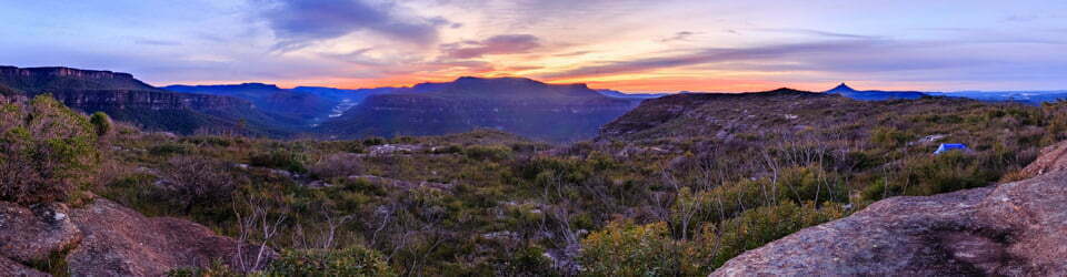
At the top of the hill, we were somewhat dismayed to see other people and a carpark with several cars. Maybe we should have listened to Google! We were stunned when two people from the carpark, returned to their car after about 100m because they couldn’t see Four Brothers Rocks from the track. They (presumably a grandfather and grandson) thought the 500m from the car park was a little too far! We continued the 400m or so to Four Brothers Rocks. We were a little underwhelmed, to say the least, most likely because we had been walking amongst many more dramatic granite tors at Wilsons Promontory last week. The views from the rocks also proved a little underwhelming, again, likely because we have seen many better recently. We found a great log under some shade at the top, so sat back for a short while for lunch before continuing.
To complete our planned circuit we returned via Burgess Road, Windy Point Road and Triangle Road. This was great, as it meant we avoid that steep, slippery-looking descent. As the gravel Burgess Road leads to the Four Brothers Rocks, we were not surprised to be passed by two cars. We were surprised, however, by a swamp wallaby that had been having a drink in a large pool in a road cutting darted across our path just in front of us.
Once onto Windy Point Road, you are back on a fire trail and the walking becomes very pleasant again. All the while walking amongst very tall, straight-trunked trees with lots of thick understory. For some way along this track, we noted all the trees had been burnt and blackened on one side of the road and were untouched on the other, it would appear to be the magnificent efforts of volunteer firefighters. Along this section, we passed a horse rider and near the bottom a family of four making their way up the track.
We had great walking weather for this hike, it was cool and we didn’t see a cloud all day.
As the carpark was now full and we found cars parked way too close to us we decided to head back into Gembrook for the afternoon. In the small park just through town, we were at one stage puzzled by a strange sound, then noticed people sitting in historic train carriages. Just before it was too late we jumped out of the van and watched the vintage steam train leave the station for its 90-minute trip back to … In the park, we also found by far the most technologically advanced toilet facilities we had ever seen in Australia. It told you what to do and automatically opened and closed doors, and only ten minutes were allowed! We certainly had an unexpected experience whilst in Gembrook.
We returned to Mortimer Picnic and Camping area as most of the throngs of long weekenders had left, leaving a much more peaceful evening under the towering Mountain Ash.
The local flora, fauna, geology, history and some other walks (ChatGPT)
The Bunyip State Park was once covered in dense forests, home to a wide variety of native flora and fauna. The forests were dominated by towering Mountain Ash trees, which could reach heights of up to 100 meters. These trees provided habitats for many species of birds, including the stunning Lyrebird, which could mimic the calls of other birds and even human voices.
The park was also home to many species of marsupials, such as wallabies, kangaroos, and possums, who thrived in the lush undergrowth of ferns and shrubs. There were also several species of reptiles, including the venomous tiger snake and the harmless blue-tongued lizard.
The geology of the park is also fascinating. It was formed by volcanic activity millions of years ago, resulting in the unique landscape of rolling hills, rocky outcrops, and deep gullies. The volcanic rocks that form the park’s geology are believed to be over 500 million years old, and they contain many fossils of ancient marine creatures.
The park also has a rich cultural history, with evidence of Aboriginal occupation dating back over 6,000 years. The Wurundjeri people, who were the traditional owners of the land, used the park for hunting, gathering, and spiritual ceremonies. The park was named after the Bunyip, a mythical creature from Aboriginal folklore, which was said to inhabit the nearby swamps and billabongs.
One of the most popular walks in the park is the Mortimer Nature Trail, which takes you through a beautiful section of the forest. Along the way, you can spot the stunning Pink Heath, which is endemic to the area and blooms in late winter and early spring. The trail also takes you past several impressive waterfalls, including the spectacular Mortimer Falls.
Another popular walk is the Bunyip Ridge Track, which offers stunning views over the surrounding countryside. The track takes you through open woodland, where you can spot the Eastern Grey Kangaroo grazing on the grassy slopes.
Sadly, the park has undergone significant changes over the past few decades. Large areas of forest have been cleared for agriculture, and the park has suffered from wildfires and invasive species. The park’s management is now focused on restoring the park to its former glory, with efforts to reforest cleared areas and control invasive species.
Clickable icons on this world map will open the related trip report
A detailed, searchable trip list with links to reports, photo galleries and other content
![]()