
19/02/2016 – 22/02/2016 Mount Summers circuit – Sharplin Falls
Canterbury District, NEW ZEALAND
Distance: 31.5km Total Ascent: 2340m Total Descent: 2340m Time: 18 hours
(excluding side trips)
Participants: Stephen Davies (Photos), Sue Davies (Report)
Day 1: Friday 19/02/2016 Sharplin Falls – Pinnacles Hut
Max elevation: 888 m
Total climbing: 658 m
Total descent: -239 m
Average speed: 2.66 km/h
Total time: 03:09:53
We drove from Twizel to Staveley in search of sunshine. We phoned DOCs when they opened at at 8:30am for them to confirm that we would not be going to Mueller hut today with a forecast of heavy rain and gale force winds.
We arrived at the Sharplin Falls carpark around 12:30pm, did our final packing and set off on the Mt Somers track.
The climbing started straight away. We followed the Bowers stream up and down and up and down! At times it was like the adventure playground to French ridge hut with tree roots everywhere to climb over.

Sue root climbing
We arrived at the Pinnacles hut in just over three hours and enjoyed a late lunch. It was a first for us to be sharing the hut with a hunter who went out to shoot feral deer. We had never seen a rifle in a mountain hut before (disarmed of course).
The hut was in a lovely location with interesting textured rock formations (the pinnacles) in the cliffs above the hut. Steve shot a star trail series at night. We thought it was not high enough for Kea to be around. He missed shooting at French Ridge for fear that the inquisitive birds might dismantle his camera.
Day 2: Saturday 20/02/2016 Pinnacles hut – Woolshed hut
Max elevation: 1182 m
Total climbing: 713 m
Total descent: -786 m
Average speed: 3.54 km/h
Total time: 07:45:14
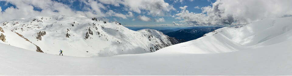
We climbed up to the waterfall the next morning before setting off to Woolshed creek hut. It was an enjoyable path, unlike the previous day it was fairly straight forward with good views most of the way. We could even see the snowy peaks of Mt Cook in the distance.

View past Pinnacles Hut
We arrived at the spacious hut in time for lunch.
We enjoyed chatting to Clara, a civil engineer from Italy who is working in Christchurch. The reality of life for young people in Italy was so interesting to hear about.
In the afternoon we walked to the watercave for a refreshing swim. We swam through the cave to another pool that was fed by a waterfall. It felt fantastic!
The Woolshed creek hut was filling quickly as it was Saturday afternoon. A group of Kiwi trampers with three young boys were a rowdy addition to the group. They definitely make their presence felt at night after copious bottles of red wine were consumed.
Day 3: Sunday 21/02/2016 Woolshed hut environs
Max elevation: 844 m
Total climbing: 80 m
Total descent: -87 m
Average speed: 2.91 km/h
Total time: 00:55:29
The hut cleared out fairly quickly in the morning. It was a crisp fine day. We climbed the hill above the hut for some goid views. We had decided to stay another night at Woolshed creek to explore some of the swimming holes near the hut. Emerald pools was our first and was very invigorating!
In the afternoon we returned to the water caves for another enjoyable swim. Steve had another swim at the waterfall claiming the water was actually warm. This claim was dubious at best.
Max elevation: 873 m
Total climbing: 484 m
Total descent: -480 m
Average speed: 3.61 km/h
Total time: 01:46:50

“Woolshed Creek” Falls
That night remarkably we had the hut to ourselves. We both slept well in our separate bedrooms.
Day 4: Monday 22/02/2016 Woolshed hut – Sharplin Falls
Max elevation: 1137 m
Total climbing: 991 m
Total descent: -1338 m
Average speed: 3.21 km/h
Total time: 07:15:03
Today we had to walk out via the south face which was an eight hour hike. This was further than we had walked in the preceding three days!
We awoke to cool damp weather and fog, however we were optimistic it would lift before we reached the south face.
The vegetation was very wet and our clothing was soon soaked. It was a substantial climb from the hut and we were shrouded in mist most of the day. For a change on this trip we were quite cold as we were wet for the whole day. We were very happy to see Acland shelter where we stopped for lunch and made a hot drink.

Steve saturated from walking through wet grass
The south face was actually a very sound track and we made good progress, faster than the estimated times.
We would leave the summit for another day as the mist continued to hang around.
We reached the car by 4:00pm and it had taken us close to six hours to walk out rather than eight. Our “Tour de Mount Somers” was very enjoyable and we had managed to easily make a two day trek into a four day leisurely walk.

View over the Canterbury Plains
Clickable icons on a world map which open the related trip report
A detailed, searchable trip list with links to reports, photo galleries and other content
![]()