
Monday 28/11/2022 Beachcomber Caravan Park – South Tuross Beach – Blackfellows Point – Jabarrah point – Potato Point Beach – Potato Point – Jemisons Point – Lake Tarourga – Brou Beach – Lake Brou
Eurobodalla National Park, NSW
Yuin Country
Participants: Stephen Davies (Photos), Sue Davies (Report)
Overcast skies greeted us in the morning but the threat of afternoon rain made us head off soon after breakfast. We had hoped to make it to Dalmeny and the possibility of coffee and treats if we made it that far.
As it turned out this goal was more than a little optimistic! From our campground, we attempted to walk around Blackfellows Point (shocking antiquated racist names in this area) but we didn’t get too far before our progress was stopped by a deep impassable gully. We headed back to Blackfellows Road, past Piccaninny Beach, Blackfellows Beach and Blackfellows Bridge. It was all a bit too much.
Max elevation: 24 m
Total climbing: 302 m
Total descent: -306 m
Average speed: 3.98 km/h
Total time: 04:56:50
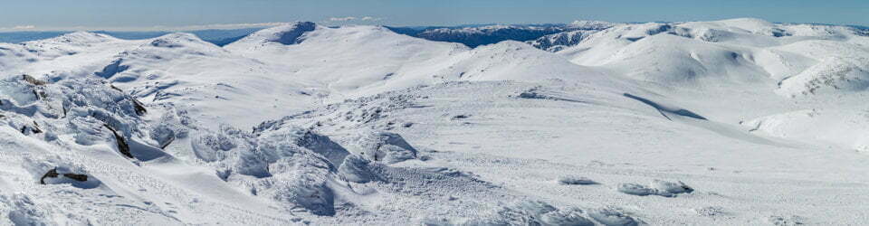
In the town of Potato Point, we found a fire trail (closed to vehicles) leading to Jemison’s Point. It appeared that this had been a popular four-wheel drive route judging by the condition of the road and an unfortunate amount of rubbish along the way. After enjoying some stunning views from the Point we headed down to Brou Beach for a great deal of soft sand walking.
Soon after reaching the beach, we enjoyed views of Lake Tarourga. This walk would probably be best to complete at low tide because the beach walking was hard going! There are also two other smaller lakes that are not visible from the beach. Brou Lake is a large expansive lake that flowed into the ocean and was impassable at this time of day (probably most of the time). Walking closer to the lake I noticed lots of birds screeching before I saw the signs about this being an endangered shorebird nesting site. I was even swooped a few times. It’s likely these birds rarely saw walkers as not many people would be willing to do that walk! Once we realised we were in their territory we retreated and found a spot for lunch before retracing our steps back to camp and coffee!
Our first attempt to make it around “Blackfellows Point” (yes that is the official name) was thwarted early on by a deep gully that was impassable. We headed back and walked a short section of the road, passing Picaninny Beach (honestly, we could not believe these offensive names were still being used in 2022). Steve was distracted by the white butterflies. We walked along Potato Point beach before leaving the beach and crossing the newly constructed “Blackfellows Bridge”.

Small lake behind Brou Beach
Once in the town of Potato Point, we walked a short road section before joining a trail (closed to vehicles) that lead to Jemisons Point. We then descended onto Brou beach for a long stint of soft sand walking. There were several freshwater lakes beside the beach, the first being Lake Tarourga, the next two were unnamed and much smaller. The final lake, Lake Brou was quite large and the channel to the ocean prevented us from walking any further. Close to the channel, there was a seabird nesting site and we seemed to have upset the parents as I doubt they would see many other walkers. The nest sites were flagged and there was a sign advising that these were the nests of endangered shore birds. I was even swooped a few times so we quickly retreated and headed back down the beach.

shorebirds nesting area at Lake Brou entrance
The return trip down the beach seemed less of a slog and we walked the road back to the campground. Stephen stopped at Blackfellows Bridge, on Potato Creek, where he observed and spent time photographing a family of Willie Wagtails (Rhipidura leucophrys).

Willie Wagtail (Rhipidura leucophrys) at Potato Creek
Clickable icons on a world map which open the related trip report
A detailed, searchable trip list with links to reports, photo galleries and other content
![]()