
Tuesday 17/10/2023 Rosea Carpark – Mt Rosea Track – Gate of the East Wind – Mount Rosea (1009m)
Grampians National Park, VICTORIA
Gariwerd Country
Participants: Stephen Davies (Photos, Report), Sue Davies
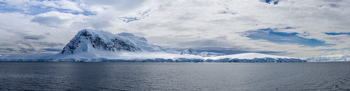
We were very pleased this very chilly morning to see nothing but blue sky, after five days of cold, heavily overcast and windy weather this was a pleasant change. Our first target today was Mount Rosea, starting with a twenty-minute drive from Halls Gap. We were at the Roses Carpark and walking by 9:30am with no one else or any other vehicles in sight. The first couple of kilometres of this gravel track is relatively level, wide and easy walking through a forest with a heath understory. It then gradually changes into a rougher track with plenty of rocks and slabs as it begins its climb to the ridge above. It was along this section I spied three small yellow canary worms on the track.
Max elevation: 991 m
Total climbing: 771 m
Total descent: -771 m
Average speed: 3.21 km/h
Total time: 04:35:57
In the distance, we noted more peaks and cliff-lines and a thickening of the haze below. As we continued our climb the track was still uneven and rocky underfoot with highly weathered rock pedestals of varied shapes and sizes appearing nearby, a testament to the extensive erosion of the sandstone over thousands of years. With most of the exposed rock covered in lichen, its surface appears grey with occasional whitish colonies of lichen splattered across numerous surfaces. One good indicator of the position of the track, apart from the yellow triangular markers placed at strategic points, is how a multitude of foot traffic has worn the lichen down to reveal some redness below.
Once up on the ridge, the track starts heading southeast along the ridge line and becomes an even more interesting walk. There are plenty of intriguingly shaped erosional features with boulders, narrow passageways, pagodas and tunnels to negotiate. There are several places where you need to look carefully as to which way to go, and as we didn’t always notice the yellow markers where they might have been most useful, we based some of our direction findings on the observation of those reddish, worn surfaces. We weren’t always successful and a couple of times found ourselves backtracking a bit to double-check.

The track near Gate of East Wind
There is a deep gully at “Gate of the East Wind” and luckily for everyone, there is also a steel bridge across the gap, without which there would be a need for a detour. At the end of the gully, there is a long drop through the cliff-line to the trees below and good views along that cliff-line near, but not too close to the edge. It was here we encountered the first other walker of the day.
On reaching the summit of Mount Rosea we found a steel summit platform with a dial naming the surrounding peaks and places. As we lingered for a snack a couple of other groups of people arrived.

View from Mount Rosea
The return was just as enjoyable as it always looks different going in the opposite direction. At one point we missed a sharp turn in the track, walking over two “stepping stones” that were intended as a “not this way” barrier! The correct way was easily seen once we returned to the “stepping stones” from the opposite direction.
Once back to our campervan, it was time for a late lunch before driving off to complete the day with a 4km walk to Sundial Lookout.
From Grampians National Park Visitor Guide
Environment, culture and heritage
Aboriginal cultural heritage
The park, traditionally known as Gariwerd, has an Aboriginal cultural history dating back at least 22,000 years. The landscape holds this heritage and protects many important cultural sites, including the largest collection of rock art in south-eastern Australia.
Begin your cultural journey at Brambuk, or visit one of five easy to access rock art shelters open to the public; Ngamadjidj, Gulgurn Manja, Billimina, Manja and Bunjils (Black Range Scenic Reserve near Stawell).
Post settlement history
The Grampians was named after the Grampian Mountains in Scotland by Major Thomas Mitchell on his 1836 expedition. Since this time the area has seen much change through resource industries such as forestry, stone quarrying, gold mining and water harvesting. People have been drawn here for thousands of years and tourism established its roots in the early 1900s. More than 1.3 million people from all over the world visit the park annually.
Geology
The four distinct sandstone ranges of the Grampians began forming approximately 430 million years ago. Over time, geological processes such as pressure, heat, folding, faulting and erosion have slowly shaped the mountains we see today. Geology is fundamental to soil composition and influences where flora found here.
Plants
The park protects one third of Victoria’s flora species and is the most important botanical reserve in the state. Close to 970 native species occur and over 40 are found nowhere else in the world. The area is known for its colourful spring wildflower displays and popular walks include Heatherlie area, Sundial Peak, The Piccaninny and Mt Zero.
Wildlife
The park provides habitat for at least 230 bird, 40 mammal, 30 reptile, 11 amphibian and 6 native fish species. There are 50 known species in the park classified as threatened, including Brush-tailed Rock Wallabies, Smokey Mice and Powerful Owls. Halls Gap and Fyans Valley are one area to see Eastern-grey Kangaroos, Emus and to hear kookaburras. Usually at dawn and dusk.
The local flora, fauna, geology and history (Bard)
Flora
Grampians National Park, also known by its Aboriginal name Gariwerd, is a national park located in the Grampians mountain range in western Victoria, Australia. The park is home to a diverse range of flora, including over 900 species of vascular plants.
The park’s forests are dominated by eucalypts, such as the river red gum (Eucalyptus camaldulensis), swamp gum (Eucalyptus ovata), and manna gum (Eucalyptus viminalis). Other common trees include the black wattle (Acacia mearnsii), silver banksia (Banksia marginata), and mountain ash (Eucalyptus regnans).
The park’s understorey is home to a variety of shrubs, herbs, and grasses. Some of the most common shrubs include the wattleseed (Acacia acuminata), hop bush (Dodonaea viscosa), and prickly bush-pea (Pultenaea scabra). Common herbs include the kangaroo apple (Solanum aviculare), billy buttons (Craspedia chrysantha), and blue leschenaultia (Leschenaultia biloba).
The park’s flora is adapted to the region’s Mediterranean climate, with hot, dry summers and mild, wet winters. Many of the plants are drought-tolerant and have deep roots to reach water stored in the soil. Others are fire-tolerant and have mechanisms to regenerate quickly after fires.
Fauna
Grampians National Park is home to a variety of fauna, including over 200 species of birds, 60 species of mammals, and 40 species of reptiles.
Some of the most common birds in the park include the laughing kookaburra (Dacelo novaeguineae), kookaburra, eastern grey kangaroo (Macropus giganteus), and common wombat (Vombatus ursinus). Other notable species include the emu (Dromaius novaehollandiae), wedge-tailed eagle (Aquila audax), and peregrine falcon (Falco peregrinus).
Some of the most common mammals in the park include the echidna (Tachyglossus aculeatus), platypus (Ornithorhynchus anatinus), common brushtail possum (Trichosurus vulpecula), and sugar glider (Petaurus breviceps). Other notable species include the koala (Phascolarctos cinereus), rock-wallaby (Petrogale assimilis), and dingo (Canis dingo).
Some of the most common reptiles in the park include the eastern brown snake (Pseudonaja textilis), tiger snake (Notechis scutatus), and red-bellied black snake (Pseudechis porphyriacus). Other notable species include the bearded dragon (Pogona barbata), goanna (Varanus giganteus), and tortoise (Chelodina longicollis).
Geology
Grampians National Park is located in the Grampians mountain range, which is made up of sandstone and quartzite rock. The rock was formed over 400 million years ago, when the region was part of a vast ocean. Over time, the ocean receded and the land was uplifted, forming the mountains.
The sandstone and quartzite rocks of the Grampians are resistant to erosion, which is why the mountains have remained relatively unchanged for millions of years. However, the rocks have been weathered and eroded over time, forming the park’s distinctive rock formations, such as The Pinnacle and The Balconies.
Indigenous History
The Grampians National Park is the traditional home of the Djab Wurrung and Jardwadjali people. These Aboriginal groups have lived in the region for over 22,000 years.
The Djab Wurrung and Jardwadjali people have a deep spiritual connection to the land of Gariwerd. The park’s many rock art sites are testament to the long and rich history of Aboriginal culture in the region.
The Djab Wurrung and Jardwadjali people were forcibly removed from Gariwerd in the 19th century. However, they have maintained their connection to the land and continue to fight for its protection.
White History
The first Europeans to visit the Grampians were explorers Hamilton Hume and William Hovell in 1824. The first settlement in the region was established in 1836.
In the early years of European settlement, the Grampians were used for grazing sheep and cattle. However, the region’s sandstone and quartzite soils are not well-suited for agriculture. As a result, the Grampians became a popular destination for recreation and tourism.
In 1984, the Grampians National Park was established to protect the region’s natural environment.
Clickable icons on this world map will open the related trip report
A detailed, searchable trip list with links to reports, photo galleries and other content
![]()