
Sunday 29/05/2022 Mount Samaria Road – Summit Link Track – Wild Dog Creek Campsite – Wild Dog Creek Falls
Mount Samaria State Park, VICTORIA
Taungurung Country
Participants: Stephen Davies (Photos, Report), Sue Davies
The track to Wild Dog Falls starts from a small Carpark on Mount Samaria Road at the bottom of the Mount Samaria Summit Link Track. The forest here is varied and the track is easy to follow. It is only about 800m until you walk into Wild Dog Creek Campsite. This is an excellent campsite with a long drop toilet, two picnic tables and a stone-lined fire pit. A fantastic spot to take anyone to for a very peaceful camp with plenty of shade for warmer weather, however, we didn’t see where you might collect water.
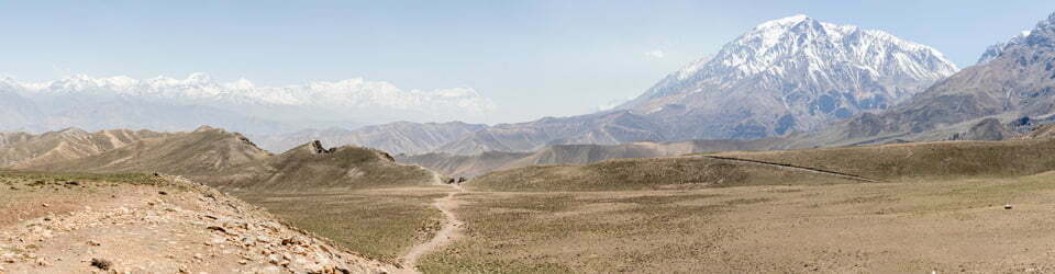
From the campsite, there are several tracks heading off in different directions with helpful signs. We continued towards the waterfall still through a forest consisting of many trees and many plant species. We were fortunate to see a variety of types of fungal colonies.
As you get near the waterfall the track falls away quite sharply and has many wooden-faced steps to negotiate, some with quite a drop. There is a viewing platform a little back from Wild Dog Creek Falls. From here you can see the water from Wild Dog Creek flowing over the top of the falls. Much more prominent is a rocky point immediately in front of you. There is no view downward, only over the edge!
Quite disappointing although the view down to the waterfall itself was, the dog-legged valley was very pleasant and at this point, we headed back. Just as you leave the viewing platform there is a small track that leads around the side of the valley. Hoping to see more of the falls we followed this but there are too many trees to see much more than a glimpse. We continued on this “side” track and missed all the stairs we had descended to the falls, instead, we gradually climbed back to Wild Dog Creek Campsite on one of those other tracks I mentioned earlier.
On our return, I spent a bit of time taking focus-stacked photos of fungi with my camera on a tripod. I hope my effort was worthwhile. I’ll let you be the judge by the photos.

Another walk was completed without sighting anyone else.
I should also note that we stayed in Spring Creek Sawmill Campground overnight as the only occupants. This is a great, secluded campsite with plenty of tall trees around, picnic tables and a well-hidden long drop toilet out the right-hand side as viewed from the entry track off the road. We enjoyed a very peaceful, dark, clear night and awoke to a temperature of 2 degrees.
The local flora, fauna, geology and history (ChatGPT)
Mount Samaria State Park is located in Victoria, Australia and has a rich diversity of flora, fauna, geology and history. The park was established in 1998 and covers an area of approximately 4,800 hectares.
The flora in the park includes a variety of tree species such as Mountain Ash, Sweet Gum, Blackwood and Sassafras, as well as an array of shrubs and wildflowers like the native orchids, waratahs and ferns.
The fauna in the park is diverse, with species like the Swamp Wallaby, Echidnas, Wombats and Tasmanian Devils, as well as a variety of bird species like the Wedgetail Eagle, the Kookaburra, and the Rose Robin.
The geology of Mount Samaria State Park is characterized by a range of rock formations, including granite, sandstone and shale, with several scenic peaks and valleys, such as Mount Samaria, Mount Wombat and LittleSamaria Creek.
The history of the park dates back to the indigenous Gunai people, who have lived in the area for thousands of years and have a rich cultural heritage associated with the park. European settlement in the area began in the mid-19th century, with logging and mining activities being carried out in the park. In 1998, the park was established to protect its unique natural, cultural and recreational values, and it remains a popular destination for hiking, camping and wildlife viewing.
Clickable icons on a world map which open the related trip report
A detailed, searchable trip list with links to reports, photo galleries and other content
![]()