
Tuesday 21/03/2023 Marlo Western Boundary Track – Marlo Wetland Track – Marlo Centre Track – Marlo South Boundary Track – Marlo-Conran Road – French’s Narrows Carpark – French’s Narrows – West Cape Road – Salmon Rocks Boat Ramp – Salmon Rocks Track – Salmon Rocks – Cape Conran Road – Sailors Grave – Cape Conran Nature Trail – Cowrie Bay – Yeerung River Road – Yeerung River Walking Track – Estuary View Trail – Pearl Point Track
Marlo Coastal Reserve & Cape Conran Coastal Park, VICTORIA
Brabuwooloong Country
Participants: Stephen Davies (Photos, Report), Sue Davies
Today we completed five short walks between Marlo and Conran Coastal Park. Early in the day, we checked out a small section of Marlo State Forest next to our campsite. Then after a very short drive, we walked across French’s Narrows at the mouth of the Snowy River. Soon after another short drive to West Cape in Cape Conran Coastal Park, we walked across the Cape to Salmon Rocks with great views along the coast and half a dozen surfers enjoying some waves.
After lunch and another short drive, we walked through burnt-out country along the Cape Conran Nature Trail and finally after yet another short drive we circumnavigated the Yeerung River estuary through healthy, unburnt bushland.
8:30am Marlo Western Boundary Track – Marlo Wetland Track – Marlo Centre Track – Marlo South Boundary Track
Marlo State Forest, VICTORIA
Brabuwooloong Country
Max elevation: 6 m
Total climbing: 38 m
Total descent: -44 m
Average speed: 5.25 km/h
Total time: 00:49:00
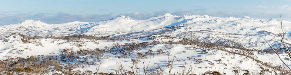
A small section of Marlo State Forest sits next to Marlo Ocean Views Cabin and Caravan Park. We started our day with a short walk through the forest. This morning we only saw a couple of small birds but if you were more fortunate than us you might see Gang-gang Cockatoos, Australian King-Parrots, Yellow-tailed Black-Cockatoos or Musk Lorikeets which are known to be visitors.

Marlo State Forest map
The trails are wide and would be wonderful for a run.
Information on signage along the way
Colourful parrots call overhead
Gang-gang Cockatoo Callocephaion fimbriatum
The adult male has a distinctive scarlet red head and crest, with the rest of the body slate-grey. The adult female has a dark grey head and crest, with the feathers of the underparts edged pink and yellow.
Habitat: In winter, Gang-gangs will move to lower altitudes into drier, more open forests and woodlands. In summer they are found in tall mountain forests and woodlands, with dense shrubby understoreys. They require tall trees for nest hollows.
Diet: Mainly seeds of native trees and shrubs, with a preference for eucalypts and wattles. They will also eat berries, fruits, nuts and insects and their larvae.
Voice: Unmistakable ‘creaky door’ screech.
Australian King-Parrot Alisterus scapularis
The male is the only Australian parrot with a completely red head. Females have a completely green head and breast. They are normally encountered in pairs or family groups.
Habitat: Usually found in rainforests or wet sclerophyll forests (vegetation characterized by hard, leathery, evergreen foliage that is specially adapted to prevent moisture loss).
Diet: Mostly forages in trees for seeds and fruit. Voice: Loud, high-pitched whistle, with a rolling “carr-ack” call in flight.
Yellow-tailed Black-Cockatoo Calyptorhynchus funereus
A large cockatoo is easily identified by its mostly black plumage. Most body feathers are edged with yellow. It has a yellow cheek patch and yellow panels on the tail. The female has a larger yellow cheek patch and a pale grey eye-ring (pink in males), white upper bill (grey-black in males) and black marks in the yellow tail panels.
Habitat: A variety of habitats but favours eucalypt woodland. Small to large flocks can be seen in these areas, either perched or flying on slowly flapping wings.
Diet: Feed in small to large, noisy flocks. The favoured food is the seeds of native trees and pinecones. Also, feed on the seeds of ground plants. Some insects are also eaten.
Voice: Wailing ‘kee-ow’
Musk Lorikeet Glossopsitta concinna
A medium-sized, sturdy lorikeet. Sometimes seen in large flocks when trees are flowering. Often in mixed flocks with other parrots and birds.
Habitat: Tall, open, dry forest and woodlands dominated by eucalypts and are usually found in the canopy. They are considered nomadic, following the flowering or fruiting of food trees. They travel widely for food.
Diet: Feed in all levels of the canopy eating. mainly pollen and nectar from eucalypts using their specialised brush-tipped tongues. They also eat seeds, fruits and insects and their larvae.
Voice: Metallic screech
10:15am Marlo-Conran Road – French’s Narrows Carpark – French’s Narrows – Point Ricardo
Marlo Coastal Reserve, VICTORIA
Brabuwooloong Country
Max elevation: 29 m
Total climbing: 53 m
Total descent: -50 m
Average speed: 4.42 km/h
Total time: 00:28:48
A second short walk for the morning had us descend from the road to French’s Narrows, which is a lagoon adjacent to the mouth of the Snowy River. This is s natural fish hatchery and a wonderland for bird life. However, this morning our timing seemed a little off and we failed to sight very many birds.

French Narrows
A bridge takes you across French’s Narrows after which you can continue onto the beach. As we were here near the high tide we decided against walking along the beach to the mouth of the Snowy River.
Information on signage along the way
A Fish Nursery
The quiet, brackish waters of the Snowy River estuary are a perfect habitat for many species of fish and other aquatic animals.
Bream, mullet and flathead are some of the many fish species that live and breed here, feeding on the rich food supply of crabs, prawns, and other small invertebrates. Some species such as the Common Galaxias deposit their eggs in the adjacent salt marsh during high tides.
Waterside nesters
Many bird species thrive here too, feeding on the rich diversity of fish and invertebrates. Some species nest very close to the water, despite the hazards of floods and other disturbances.
The Azure Kingfisher lives in and around tidal estuaries and has the unusual habit of nesting in burrows in creek banks. These brightly coloured birds thrive on a varied diet of small mammals, birds, insects, fish and frogs.
Lewin’s Rail also nests near the water, making compact cup-shaped nests of grass and rushes. They are secretive birds and prefer to live in the coastal swamp woodlands. Predation and habitat loss have made them vulnerable.
Sand Dunes: a work in progress
New sand dunes are formed when onshore winds shape the sand into drifts.
Hardy species of pioneer plants weather the toughest of conditions as they trap the moving sand and begin binding the soil together. These include Hairy Spinifex, Sea Rocket, Coastal Saltbush and the Native Geranium.
As the soil quality and fertility of the dune gradually improves, secondary plants such as Coast Everlasting, Cushion Bush and Coast Wattle are able to grow. Over many years, new sand dunes begin to form, providing the original dune with enough shelter to sustain larger species such as the Coast Tea-tree, Coast Beard-heath and Coast Banksia.
Risky nesting Scurrying about amongst the dunes and beaches, you will see the ever-busy Hooded Plover. It is often seen in pairs or small groups near the water’s edge, in search of sandhoppers, shellfish and other invertebrates. They also search around beach-cast seaweed, which provides a particularly good food supply.
Breeding time is from August to April. Hooded Plovers lay their eggs on narrow strips of sand between high tide and tine dunes, often returning each year to the same location. This precarious nesting makes them vulnerable to storms when the eggs can be washed away. But a much greater threat is people, dogs and horses that can unwittingly disturb or destroy nests.
11:20am West Cape Road – Salmon Rocks Boat Ramp – Salmon Rocks Track – Salmon Rocks
Cape Conran Coastal Park, VICTORIA
Brabuwooloong Country
Max elevation: 28 m
Total climbing: 89 m
Total descent: -84 m
Average speed: 3.87 km/h
Total time: 00:48:29
Onto our third short walk of the morning. The highlight here was the lichen-covered rocks along the foreshore, which provide a good foreground for your photos.
zz017
Information on signage along the way
Welcome to Cape Conran Coastal Park and Beware Reef Marine Sanctuary
Cape Conran Coastal Park is a natural area of outstanding beauty.
Windswept beaches, sand dunes and rocky headlands backed by woodlands, heathlands and wetlands and all rich with wildlife.
There are miles of sandy beaches and rockpools to explore and boardwalks, bushwalks and lookouts provide opportunities for understanding the coastal environment.
The reserve offers a range of day visitor facilities with bush camping, wilderness retreats and cabin accommodation situated just behind East Cape Beach.
Take time to enjoy this magnificent place – there’s lots to see and do including nature walks, spectacular views, and great snorkelling. Good fishing and boating, ideal camping and picnicking are also included in the Cape’s special attractions.
Walk along one of the many walking tracks or stroll along the ocean beaches, surf the waves at nearby East Cape or Salmon Rocks beaches, or swim in the tranquil waters of the Yeerung River.
Canoe in the Yeerung River, fish offshore in the surf or try your luck in the nearby Snowy Estuary. Discover the underwater beauty of the wilderness coast and the adjacent Beware Reef Marine Sanctuary by snorkelling or scuba diving.
Beware Reef Marine Sanctuary
Beware Reef, located approximately 5km offshore from Cape Conran, is a marine sanctuary of approximately 220ha. Please note that all marine life and artefacts are protected. Fishing and taking within the sanctuary (see map) is prohibited.
The sanctuary is known for its representation of reef environments in Victoria and casual visitors can look out for the seals that hang around on the exposed reef for much of the year.
A diver’s paradise
Around the edge of Beware Reef is a thick rim of Bull Kelp fronds, guarding the treasures below. Where there is enough light, the upper reef is covered in a dense canopy of brown seaweeds, interspersed with meadows of bright green and red seaweeds.
On one side of the reef lie the remains of old shipwrecks, including the Ridge Park (1878), the Albert San (1915) and the SS Auckland, a steamship wrecked on the reef in 1871. On another side is a pink garden of encrusting coralline algae, kept free of large kelps by the voracious appetite of the Black Sea urchin, hiding during the day under ledges.
At night large Maori Octopuses lurk amongst the kelp stalks. Lower down the reef steep walls plunge to the bottom almost thirty metres below. These are covered with filter-feeding animals, such as large finger sponges, brilliant red sea fans, sea tulips, long sinuous sea whips and carpets of orange anemones. Pink and blue brittle stars stick their spiny arms out of crevices. Green, orange and white feather stars are abundant between the rocks with their tentacles extended into the water to capture passing plankton.
1:20pm Cape Conran Road – Sailors Grave – Cape Conran Nature Trail – Cowrie Bay
Cape Conran Coastal Park
Max elevation: 146 m
Total climbing: 664 m
Total descent: -577 m
Average speed: 6.18 km/h
Total time: 01:37:28
Our first-afternoon walk of the day had us walking through banksia forest mainly comprising of banksia serrata (old man). Most of this area was burnt by bushfires several years ago and requires many years more regrowth before it recovers fully. There has been a lot of safety work done along the way with many dangerous trees chopped down. As the regrowth is yet to regain much of its original height, at the moment you get plenty of clear views over the landscape off into the distance.

View across Cowrie Bay
There were a few more people around this park than we had become accustomed to in the other Victorian parks, while not at all crowded we didn’t have the place to ourselves.
The highlight for us was the first part of the walk along the beach. We had been aiming for the Koori Nature Trail Boardwalk but this has been largely destroyed by severe storm damage and is closed. However, at the end of the beach, we noted, and were very happy to see, a lot of natural flotsam and jetsam washed up. Best of all we could not see any human waste and plastic in particular for once. There were plenty of sponges and seaweeds. In the tidal zone amongst the rocks were dense colonies of small shellfish and the greatest concentrations of small starfish I think I have ever seen.
3:20pm Yeerung River Road – Yeerung River Walking Track – Estuary View Trail – Pearl Point Track
Cape Conran Coastal Park
Max elevation: 73 m
Total climbing: 98 m
Total descent: -88 m
Average speed: 4.81 km/h
Total time: 00:55:36
Our final short walk of the day had us complete a circuit around the Yeerung River Estuary. From the carpark we headed toward the beach, the is a good lookout platform there but it is closed. Once down on the beach, we could clearly see why there had been a large landslide directly below it, then key, outer supports clearly resting on a very insecure footing. From that perspective, it seems unlikely it will be repaired.
After a couple of hundred metres along the beach around the closed mouth of the river, we needed to climb a couple of metres up an eroded bank at the back of the beach to get onto the Estuary View Trail. Notable along this track was the fact that it had escaped the recent fire we had seen along the nearby Cape Conran Nature Trail.

Yeerung River from the east
Once back to Pearl Point Track there is a damaged concrete bridge to cross. Like several other built features along this section of the coast, these have been damaged by some severe storms. The steel poles at the sides of the Pearl Point Track Bridge had all been bent near their bases and most only had 10cm left. No wonder the bridge is now only open to foot traffic.
Once back to the car, we felt our day was complete and headed off to Banksia Bluff Campground where we stayed the night.
The local flora, fauna, geology, history and some other walks (ChatGPT)
Cape Conran Coastal Park is a natural wonderland located in the East Gippsland region of Victoria, Australia. The park is renowned for its diverse flora, fauna, and unique geological formations, making it a popular destination for nature lovers, hikers, and outdoor enthusiasts.
Flora: The park is home to a variety of vegetation, including coastal heathlands, woodlands, and dense eucalyptus forests. The heathlands are particularly notable, as they contain several rare and endangered plant species, such as the purple pea-flowered Glycine species and the heath-leaf banksia. The park’s woodlands are dominated by tall eucalyptus trees, including the Messmate, Manna Gum, and Blackwood species.
Fauna: Cape Conran Coastal Park is also home to a rich diversity of wildlife. Kangaroos, wallabies, wombats, and echidnas are common sights in the park, while bird enthusiasts are treated to sightings of numerous species, including the striking Eastern Yellow Robin, Superb Fairy-wren, and the Yellow-tailed Black Cockatoo.
Geology: The park’s rugged coastline is characterized by towering cliffs, rocky outcrops, and sandy beaches, which offer breathtaking views of the surrounding landscape. The park’s geological history is diverse, with evidence of ancient volcanic activity, glacial deposits, and oceanic erosion visible throughout the park.
History: The park was named after the Conran family, who were among the earliest European settlers in the region. Prior to European colonization, the park was the traditional land of the Brabuwooloong people, who used the park’s resources for food, shelter, and cultural practices. Evidence of their presence can be found throughout the park, including shell middens, stone tools, and rock art.
Walks: Visitors to the park could explore its stunning scenery via a network of walking trails. One popular walk was the Point Ricardo Walk, which offers panoramic views of the rugged coastline and the surrounding wilderness. The walk passed through a range of ecosystems, including heathlands, woodlands, and wetlands, and provides opportunities to spot a variety of wildlife. Another popular walk is the East Cape Walk, which led visitors through a dense eucalyptus forest to a secluded beach, where they could relax and enjoy the stunning coastal scenery.
Clickable icons on this world map will open the related trip report
A detailed, searchable trip list with links to reports, photo galleries and other content
![]()