
15/09/2020 – 16/09/2020 Troy Walls Lookout – Mount Ayre – Shoalhaven River – Hermit Flat – Louise Reach – Barbers Creek – Long Point Bend
Bungonia National Park, NSW
Gundungurra country
Distance: 25km Total Ascent: 650m Total Descent: 650m Time: 9 hours
Participants: Stephen Davies (Photos, Report), Sue Davies
After our Clyde River (Morton National Park) exploration trip was cut short by two days we decided yesterday afternoon to head up to Bungonia National Park for three days before some expected rain was due by the weekend. One day at home was more than enough turnaround time.
Day 1: Tuesday 15/09/2020
Troy Walls Lookout – Mount Ayre – Shoalhaven River – Hermit Flat – Louise Reach – Barbers Creek – Long Point Bend
Max elevation: 564 m
Total climbing: 733 m
Total descent: -1149 m
Average speed: 3.64 km/h
Total time: 04:24:23
We were away just after 7:00am and arrived at Troy Walls Lookout ready to walk about 9:00am.
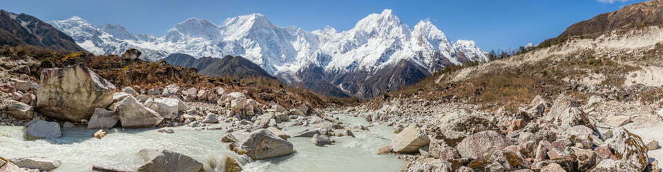
The overcast sky had cleared by the time we were underway from the lookout. We didn’t find the track as marked on the topographic map leaving the lookout in the mapped direction so found ourselves heading out along Molly O’Neill Nature Walk, which runs parallel to the road, back into a campsite before joining the trail a bit further on. From here it was clear sailing on a very prominent well used and marked trail all the way to Hermit Flat on the Shoalhaven River just over 400m below our starting elevation. Around Mount Ayre and down the steep, rocky White Track care must be taken with your footing, since as soon as one loses focus a few loose stones will move under your boots and have you suddenly off balance or worse, not a good position to in with a loaded pack. All up with great care we took about a hundred minutes to reach Bungonia Creek from Troy Walls Lookout. Along the way down we were treated to the best of some spring blossoms from a variety of different species.
Last time we were down this way Sue slipped on rocks whilst crossing Bungonia Creek and injured a couple of fingers, so we were pleased to see that someone had constructed a log crossing to keep our boots dry.
For about a kilometre past Bungonia Creek the hills rise steeply from close to the river leaving a narrow bank. About a month ago there was a major rainfall event of around 300mm in the area and consequent flooding. The force of the floodwaters had flattened many hundreds of trees, leaving an obstacle course behind. With careful observation and a couple of short backtracks we worked our way through this maze. At the end point of flattened tree section was a particularly impressive wall of broken timber about 3m high and 15m long. Past this point, where the river is wider, there was much less flood debris and easier walking.

Flood debris along Shoalhaven River
Continuing along the river today it was really warm as we passed the campsite at Barbers Creek and around the bottom of Long Point to our objective on it’s northern side. About 1:30pm we picked a spot on the sand near the river as our campsite, our first priority being to jump in for a swim to cool off.
Sue had a lazy afternoon sitting in the shade on her ground chair reading her book whilst I wandered another half hour downstream just to see what was around the corner. Around 400m from our campsite there was better access to the river, sandy shore, sandy bank and sandy river bed with no fallen trees in the way. Close to the riverbank were many good size carp. I also spotted a lyre bird coming around the bottom of Long Point. There were also plenty of wombat scats, lizard tracks and wallaby prints in the sand.
Timelapse from our campsite on the Shoalhaven River at below Long Point
Day 2: Wednesday 16/09/2020 Long Point Bend – Barbers Creek – Louise Reach – Hermit Flat – Shoalhaven River – Mount Ayre – Troy Walls Lookout
Max elevation: 563 m
Total climbing: 1261 m
Total descent: -845 m
Average speed: 3.17 km/h
Total time: 07:10:04
As we planned to spend Wednesday night in the Bungonia Campground we were in no hurry to depart camp. Spreading out our gear moistened by overnight condensation initially proved futile, as the sun had not yet risen above Rainbow Ridge to our east our sleeping bags became distinctly wetter.
Whilst in the slow start mode we both headed further downstream to where I had been yesterday afternoon. This time we spotted a Monitor Lizard and had a chat with a young local couple who had arrived and set up camp late yesterday.
With the sun now over Rainbow Ridge our gear had mostly dried by the time we returned and started packing up. We were on our way out around 10:00am following the same route out as we had on out the way in, not that there is really any other option apart from organising a car swap and walking up Long Point Track to Long Point Lookout.
We enjoyed some good birdsong on our way out, saw plenty more carp near the river bank and a couple more Lace Monitors. We seemed to get through the fallen trees section faster by staying further away from the river. At Bungonia Creek it was time to cool off before starting the steep climb out. The water was very refreshing and did a great job of lowering our body temperature just a little. We also had lunch here and met a group of three who were down from Canberra on a day trip.

Shoalhaven River from Bungonia Creek
There was no problem warming up and drying off again as started up the White Track. A few times leap frogging our Canberra friends between water stops, finally to capture them admiring the views from the seat near Mount Ayre.
Our leisurely walk had us looking for a campsite in the campground soon after 3:00pm. It was fantastic to get a hot shower after the sweaty afternoon climb. Being mid-week there were few people about and had the kitchen area to ourselves until after we had finished our meal. There are great facilities here including well spaced campsites, filtered water taps, flush toilets and electric BBQs.
Tomorrow we are planning to do the Red Track and The Slot Canyon.
Clickable icons on a world map which open the related trip report
A detailed, searchable trip list with links to reports, photo galleries and other content
![]()