30/08/1986 – 4/09/1986 Kiandra – Four Mile Creek – Happy Jacks Creek – Cesjacks Hut – Whites River Hut – Guthega Power Station
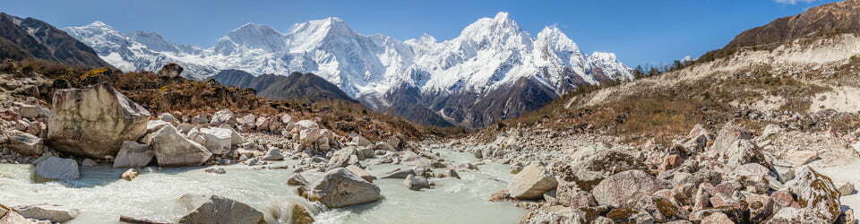
Kosciuszko National Park, NSW
Ngarigo country
Distance: 70km Total Ascent: 2220m Total Descent: 2250m
Participant: Stephen Davies (Report)
This trip was one had I wanted to do for a while and after deciding to run a marathon early next year and try to do it in under three hours this trip was doubling as a training exercise. I wanted to make it difficult so carried a lot of gear, my pack weighing 66 pound (30kg) as I left.
Day 1: Sunday 30/08/1986 Kiandra – Four Mile Creek
This route was reconstructed from memory using Google Earth Pro and GPS Visualizer.
Max elevation: 1584 m
Total climbing: 227 m
Total descent: -133 m
Average speed: nan km/h
I left Dapto about 8:00am after spending yesterday tuning up the car and planting a new garden.
Paused in Cooma around 12:00pm to buy a map and organised a spot to leave the car in West Cooma. The car had gone well after yesterdays work. Waited at West Cooma about 20 minutes for a ride, being picked up by an Italian computer programmer. It was a windy wait but clear and fine.
The weather changed steadily as we drove west. On arrival at Kiandra around 2:30pm it was overcast and sleeting. From here I headed off alone up the ridge alongside the creek. This required following a compass bearing before hitting the power lines and shortly after picking up the orange trail makers. It had become pretty bleak. The snow cover was incomplete but I managed to keep the skis on after the first kilometre. Balling up up was a bit of a problem.
With the day ending I set up my tent next to the small creek separates Four Mile Hut from the track, sheltered behind the ridge and some trees. It was very a well protected spot. Dined on lentils and fresh vegetables. Will be trying to eat all the heavy food as soon as possible as the very heavy pack weight proved pretty torturous.
Day 2: Monday 1/09/1986 Four Mile Creek – Happy Jacks Creek
This route was reconstructed from memory using Google Earth Pro and GPS Visualizer.
Max elevation: 1779 m
Total climbing: 591 m
Total descent: -673 m
Average speed: nan km/h
Ended up very wet with lots of internal condensation overnight, need some more venting. The weather was greatly improved by morning but it was still cloudy and windy with no rain or sleet or snow. Good Starts with hot milk and a tea to start the day and away at 9:40am. Broke a pack strap inside the first ten minutes, obviously the pack was still too heavy!
A detour and quick look up on top of Tabletop Mountain. It was very cold and windy on top with lots of threatening clouds lurking to the west. Followed some tracks set by another group who were heading off to Boobees Hut for the night. Followed the ridge south just a little too much, emphasis on the south. Had to cross Mulligans Creek where it was heading east-west, before travelling directly south.
I gave up for the day just after passing Far Bald Mountain, setting up camp on Happy Jacks Creek just downstream (about 1km) from the power lines.
Day 3: Tuesday 2/09/1986 Happy Jacks Creek – Cesjacks Hut
This route was reconstructed from memory using Google Earth Pro and GPS Visualizer.
Max elevation: 1776 m
Total climbing: 600 m
Total descent: -288 m
Average speed: nan km/h
Had some precipitation overnight, so read for about half an hour as the sun was out helping the tent to dry. Was finally off about 10:00am. There was no trouble following the creek until a crossing of Happy Jacks Creek was required. Wandered about 100m upstream and managing to rock hop across the top of a 2m waterfall. A few hundred metres further on I was at the road. A pretty decent sort of dirt road too!
Continued upstream on the eastern side of Tibeaudo Creek for about 4 or 5km. Then scrambled across to the western bank where the valley narrowed and the creek turned south-east. It was pretty scrubby at the start but clearer a bit higher up. Arrived at Mackays Hut (BM1556) at 1:00pm after being forced to walk the last 100m due to lack of snow.
Lunched on some black bread, cheese, tomato and jam and peanut butter. After an apple I was off again at 2:00pm.
Very soft and sloppy snow made it hard going. Followed the track set by another group (two groups had been into Mackays earlier today) up the first creek to the right beyond the hut.
Eventually worked my way up through the trees to a large saddle before Spencers Peak. From here it was further south along the ridge. Caught a group of three heading out for a Jagungal dash at 3:00pm and another loner.
Continued on around the right hand side of Spencers Peak then really struggled with fatigue as I reached an unnamed hut marked on my CMA map. Cesjacks Hut was another 1km further on and was not marked on my CMA map. Finally arrived at 5:15pm.
The snow was now very crusty in the shade. It had not been a pleasant day of skiing. An English couple and a science lab assistant from Sale in Victoria were there to share with. About 19km for the day.
Day 4: Wednesday 3/09/1986 Cesjacks Hut – Whites River
This route was reconstructed from memory using Google Earth Pro and GPS Visualizer.
Max elevation: 1970 m
Total climbing: 618 m
Total descent: -578 m
Average speed: nan km/h
Getting up and getting ready for the day was much easier and faster from inside a hut, so I was gone by 9:00am. Followed a never ending ridgeline, approximately as marked by the 4WD track.
A fantastic day unfolded as it was much better for travelling, most of the day. The weather was perfect except for a stiff breeze all morning. Some threatening looking clouds over Grey Mare Range managed to arrive about 5:00pm.
There were also fantastic views all day. Managed 17 photos (on HR100 film) so there was lots of stopping, which I didn’t mind, it was a great excuse. Arrived at Mawsons Hut at 12:30pm after about 11km of skiing. As there were two guys inside smoking I had lunch outside, with the usual blackbread and cheddar cheese, with some honey, peanut butter and an apple. Off again at 1:15pm
Crossed “The Kerries” in good time, still with great views but the wind getter distinctly colder, although I was still travelling in a light shirt only. Arrived at Schlink Hut at 3:00pm where left an entry in the logbook before pushing on.
Contoured around the hill after Schlink Pass to a campsite above Whites River Hut, arriving about 4:00pm with Gungartan now under heavy clouds. About 21km skied today.
Day 5: Thursday 4/09/1986 Whites River – Guthega Power Station
This route was reconstructed from memory using Google Earth Pro and GPS Visualizer.
Max elevation: 1751 m
Total climbing: 180 m
Total descent: -577 m
Average speed: nan km/h
On waking I was greeted by an extremely disappointing day, not at all that surprising considering the build up witnessed yesterday. It was cold, windy and there was next to no visibility. It looked very set in. After much delay and consideration I decided it was very unlikely to improve much for some time, probably days, so made the very difficult decision to cut my trip short.
So instead of heading over the Rolling Ground towards my target of Thredbo, all alone and in dangerous conditions, I was now back on the road and on my way out to Guthega Power Station.
From here I managed to score a ride back to West Cooma to pick my car up before driving home safe but very disappointed.
Clickable icons on a world map which open the related trip report
A detailed, searchable trip list with links to reports, photo galleries and other content
![]()