
11/10/2018 – 15/10/2018 Guthega – Twynam Creek – Mount Northcote – Watsons Crags – Mount Twynam
Kosciuszko National Park, NSW
Ngarigo country
Distance: 61km Total Ascent: 3,620m Total Descent: 3,730m
Time: 61 hours
Participants: Stephen Davies (Photos, Report), Caroline Houghton (2 days), Ian Houghton (2 days), Mike Parkinson (3 days), Stephen Poole
Day 1: Thursday 11/10/2018 Guthega – Twynam Creek
Max elevation: 1829 m
Total climbing: 579 m
Total descent: -578 m
Average speed: 4.60 km/h
Total time: 08:54:20
After departing our Twynam Creek campsite for a resupply mission to Jindabyne early this morning we met up with Mike before driving back up to Guthega.
With the winter parking restriction signs now removed we parked right at the Illawong track trailhead with three other vehicles. Final gear checks complete we were away around 2:00pm.
Being Mike’s first snow camping trip in about eight years Stephen and I each grabbed a bit of his gear for the trip in, this meant we could all travel in together at about the same pace.

Mike on the Illawong Track beside the Snowy River
With most of the snow now gone we walked the Illawong trail crossing only a few small patches of snow until past the trees half an hour into our trip. Now onto snow we were able to ski most of the way to Illawong suspension bridge. From here we climbed steadily up to our already established campsite, arriving about 4:00pm.

Day 2: Friday 12/10/2018 Twynam Creek – Mount Northcote
Max elevation: 2142 m
Total climbing: 995 m
Total descent: -994 m
Average speed: 5.41 km/h
Total time: 06:59:19
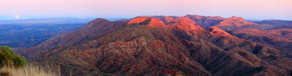
Early morning mist greeted our waking. With a good forecast for the day we had decided on a tour south along the top of the Main Range to a point where we could gain views of Lake Albina, as Mike had not seen it before.
As the morning mist was breaking I was finally able to set up my Anker solar panels again to recharge my depleted battery pack, as we hadn’t seen the sun for two days. We now headed off up toward Little Twynam on newly softening snow. A long steady climb of about 300m then saw us on top of the Main Range just to the south of Mount Twynam. By this time a cold breeze had joined us yet again so we added another layer of clothing before following the snowy leads across to Carruthers Peak. With the morning mist now long gone we had fantastic visibility way off into the distance in all directions. We were also impressed with the extensive range of options for skiing still available for what seems like some time yet.

Mike traversing around Mount Twynam
On Carruthers Peak we sheltered on the western side of the summit for lunch as the wind had eased somewhat and there we were then able to warm up again. Walking was required off the southern side of Carruthers Peak due to an absence of snow along the ridge. From here we skied on snow to the west of Mount Lee after examining a deep crevasse on the saddle between it and Carruthers Peak. Past Mount Lee involved again following snow leads until we reached a viewpoint of Lake Albina just below and to the west of Northcote Pass.
Satisfied with a 20 minute wandering around a couple of vantage points it was time to head back to camp. Consensus was reached that we would head back following a lower route on the eastern side of the Main Range for a bit of variety. In the process of preparing for our descent I removed my skis and carefully placed them on a patch of grass, then whilst adjusting clothing out of the corner of my eye I see one of them heading off down the hill on the snow, again! Instantly recognising it could go a long way with such a great start over a corniced edge I threw myself down the hill at full stretch, this time successfully arresting it’s escape. Ending head down on my back my large DSLR continued downward stopping after hits to my chin and nose absorbed some of it momentum.
Our take off point was straight off the steep eastern side of Northcote Pass alongside the cornice. Stephen and I managed to leave a competent trail of turns down the descent. Mike was a lot more cautious on his lighter skis with failing bindings and traversed the steeper sections.

Mike skiing off Northcote Pass
From here we tried to keep what height we could as we crossed Club Lake Creek and traversed around the lower slopes of Carruthers Peak. We followed the same tactic as we crossed Blue Lake Creek but then slowly gained some altitude as we traversed around Crummer Spur in order to keep above our campsite. When far enough around we found ourselves about 100m above camp once it came into sight, setting us up for an easy run back to camp where we arrived about 4:45pm.
Our return route proved to be very efficient, requiring minimal elevation charge and keeping us entirely on snow. Although I had put skins on my pattern-less skis for one section, I most likely could have completed the entire return leg without them, such was the gradual gradient and agreeable afternoon thawed snow’s consistency.
After a longish day were all happy to be back at camp. In the meantime Ian and Caroline were expecting to arrive at Island Bend ready for their ski to camp tomorrow.
Day 3: Saturday 13/10/2018 Twynam Creek – Watsons Crags
Max elevation: 2183 m
Total climbing: 798 m
Total descent: -801 m
Average speed: 5.79 km/h
Total time: 05:36:58
The early morning mist didn’t start clearing until about 9:20am
Mike had noted on his initial ski in that screws were loosening on one of his bindings. With the front screws now uselessly hanging on it was time for some makeshift repairs. A large cable tie was wrapped right around the loose binding and ski to limit the free movement, but how long would this last!
We departed camp at 10:00am just as we observed Ian and Caroline making their way up the hill from below. As they still had to set up their campsite there wasn’t much point in waiting for them to arrive.
Today we ascended around the northern side of Mount Twynam to avoid the long traverse across the incline of the southern side. Since it doesn’t get the morning sun it remains much harder and more difficult to traverse.
Where would you go? After I emailed this screenshot of our campsite location to Ian, confusion reigned. His responses didn’t make sense to me and my descriptions failed. Would you aim for the tent icon or where the arrow points?

Our campsite location showing my dark yellow tent and direction to selected waypoint (the arrow)
Once around the top of Mount Twynam we watched a kite skier (Robert Wilson) doing his stuff. Robert came over for a chat and informed us he had only been kite skiing since last season and had already kite skied 110km in one day and typically covered 30km to 40km! He had also previously visited this website, which is always fantastic feedback to have, and can now find some photos of himself in action by clicking the Day 3 Photos link below. (He doesn’t have any already, to busy handling the kite?)

Robert Wilson kite-skiing near Carruthers Peak
After Robert “flew” away we proceeded to Watsons Crags where we skied across the tops until about halfway along. Here we stopped and had a nice long lunch on the grass as the wind had eased and we could finally feel some of the sun’s warmth.
At this point we turned back, pausing at the first knoll. Here Stephen and I did two runs off its high point with Mike looking on patiently so as not to risk pulling his loose binding completely off his ski.

Mike and Stephen skiing along Watsons Crags
As we were just starting our return across Mount Twynam we crossed paths with Ian and Caroline who continued out onto the Crags. Once to the eastern side of Mount Twynam we all enjoyed many turns on the way back to camp.
Once there we had a delightful afternoon in the sun on the grass, with, for what seemed like the first time in the last two weeks, no wind.
The curious late afternoon sight of two people walking somewhat awkwardly down the hill just behind us peaked Ian’s curiosity. As he asked if they were OK he discovered the second person was limping due to a sprained ankle. His friend was towing a makeshift sled made using a snowboard, with his companions pack and skis on top whilst he carried his own pack. This was going to be a long painful limp out, we were not sure what the plan was going to be once they reached the snow free walk back to Guthega past Illawong suspension bridge.
For once, it remained calm as the daylight faded, enabling us to sit together on the grass until after dinner as it started to get dark. A very nice change!
Day 4: Sunday 14/10/2018 Twynam Creek – Mount Twynam
Max elevation: 2189 m
Total climbing: 1117 m
Total descent: -1040 m
Average speed: 6.62 km/h
Total time: 06:17:35
Low clouds were drifting up the Snowy River as we settled in for breakfast on the grass. With neighbouring peaks now out of sight and Caroline, Ian and Mike heading out today we spent our morning doing a couple of runs up and down the upper headwater slopes of Twynam Creek. After several runs we were already up to lunch time.
Stephen spotted three red rafts or kayaks entering the Snowy River at the Twynam Creek junction after a portage. It was a mystery to me as to their starting point. As lunch progressed some light rain commenced sending me for the shelter of my tent as Caroline, Ian and Mike put on their wet weather gear and packs before starting their trip back out.

My campsite above Tywnam Creek
As the showers eased mid afternoon Stephen and I headed out again aiming to summit and ski Mount Anton. However, with dark clouds and rain squalls periodically arriving from the north we were not too sure how pleasant this was going to be. As we hit upper Pounds Creek we altered course to Mount Twynam as my skins, having been consistently getting wet for days, were repeatedly sliding off my skis whenever there was any non-vertical component in my climbig.
The ski down Mount Twynam was very poor in slow, boggy and inconsistent snow, so after this the Mount Anton ski no longer held any appeal. Instead we headed back to camp and were quickly back into our tents as a few more showers passed overhead.

Snowgums at our campsite above Tywnam Creek
As the day was drawing to a close the clouds were again descending to fill to valley below.
Day 5: Monday 15/10/2018 Twynam Creek – Guthega
Max elevation: 1821 m
Total climbing: 151 m
Total descent: -340 m
Average speed: 6.34 km/h
Total time: 01:20:52
A cloudy morning with the forecast of poor weather for the immediate future saw us packing up camp early to head home. We were gone by about 8:30am to try to beat the forecast late morning showers.

Stephen crossing the Illawong suspension brdige across the Snowy River
With heavy packs back on and slow snow we resorted to basic parallel turns back to Illawong, snaking our way around snow free sections as we got closer to the Snowy River. We were back to Guthega shortly after 10:00am still dry and ready for the long drive home.
A really big gripe:
Twice on this trip I almost trod or sat in it. Someone else’s pile of faeces that is, in neither case had there been any attempt made to bury it properly, unless they believe snow doesn’t melt! One pile with toilet paper 10m from my tent only surfacing after I’d been there two full days and the second, again with faeces and toilet paper metres away from where we were trying to shelter from the wind on Watsons Crags. If you don’t take it out, it does eventually surface. Please, please, please, leave no trace!
Poo tubes and Ortlieb bags work well.
A detailed, searchable trip list with links to reports, photo galleries and other content
![]()