
26/08/2020 – 30/08/2020 Wog Wog – Goodsell Creek – Corang River – Canowie Brook – Burrumbeet Brook – Yurnga Lookout – Mount Bibbenluke – Mount Owen – Profile Rock – Corang Arch – Corang Peak – Korra Hill
Morton National Park, NSW
Yuin country
Distance: 57km Total Ascent: 2840m Total Descent: 2840m Time: 25 hours
Participants: Stephen Davies (Photos), Sue Davies (Report)
Morton National Park had only recently reopened after the horrifically devastating 2019-2020 Currowan Bushfire. Having walked numerous times in the area over many decades we were keen to revisit the area to observe the extent of the damage and find out how well it was regenerating. With less scrub around than for a long time, it also promised much easier access than usual.
Day 1: Wednesday 26/08/2020 Wog Wog – Goodsell Creek – Corang River
Max elevation: 731 m
Total climbing: 408 m
Total descent: -400 m
Average speed: 3.10 km/h
Total time: 05:25:52
We headed off from home early to avoid an extra camp set up. The radio reported that last night was the coldest this year, so maybe it was the right decision.
We headed off from the Wog Wog campground soon after 9:30am, following final pack adjustments. Sue was christening her new Aarn 30 litre pack with front pouches.
It was a perfect sunny and clear morning as we headed along the track, eagerly anticipating the trip ahead. We had walked this route several times before but we were interested to see the effect of the past summer of devastating bushfires.
It didn’t take long for us to see the extensive damage as we moved through the Goodsell Basin. While the bushfire cleared much of the vegetation, it left the scarred remains of trees and bushes. There were many trip hazard and sharp almost dagger like protrusions which would surely impale a person if the were unlucky enough to fall on it.
Lunch was expired vita weets crackers which were distinctly stale (we had not realised they were out of date when we were packing) so we are looking forward to the next four lunches!
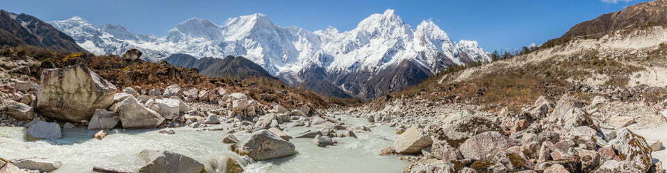
Heading to the Corang River to our usual scenic campsite to find “Private Property No Trespassing” signs. Quite strange for a national park. Further along there was a section of fencing across the trail with the same sign but no explanation offered.
Wanting to make more progress in the day we continued for another hour along the river to find a stunning spot beside a two metre water fall. The area had been extensively burnt and it was hard to avoid getting black soot all over us.

Falls on Corang River just below Canowie Brook junction
Note to self; sleeping beside a waterfall is very noisy but the plus was it drowned out the sound of Steve’s snoring!

Timelapse from near campsite on Corang River just below Canowie Brook junction
Day 2: Thursday 27/08/2020 Corang River – Canowie Brook – Burrumbeet Brook – Yurnga Lookout – Corang River below Mount Bibbenluke
Max elevation: 825 m
Total climbing: 463 m
Total descent: -375 m
Average speed: 2.93 km/h
Total time: 04:26:59
More sunshine greeted us in the morning after a very cold night. There was frost on the tent when we awoke. After a slow start we followed Canowie Brook and then on to Burrumbeet Brook with panoramic views surrounding us including Profile Rock.
We knew there was a toilet nearby but unfortunately it had been burnt out in the fires.
We climbed up to Yurnga Lookout for fabulous views of Pigeon House and phone reception.

Mount Owen and Pigeon House Mountain from near Yurnga Lookout
Much of the wooden boardwalk was burnt out with exposed metal fasteners which were quite hazardous.
We were very happy to arrive at the lovely campsite on the upper Corang River under Mount Bibbenluke. Here we had good views of Mount Tarn and Mount Bibbenluke.
We experienced very high winds at night requiring extra pegging of the tent.
Day 3: Friday 28/08/2020 Corang River below Mount Bibbenluke – Mount Bibbenluke – Mount Cole – Corang River below Mount Bibbenluke
Mount Bibbenluke
Max elevation: 859 m
Total climbing: 273 m
Total descent: -273 m
Average speed: 2.60 km/h
Total time: 02:16:48
The winds eased overnight.
We explored around Mount Bibbenluke and found a path to the top amongst the sandstone pagodas on it’s eastern end end. The heat of the recent fires was so intense it has sheared off the outer layer of the sandstone. More phone reception!
Mount Cole
Max elevation: 826 m
Total climbing: 458 m
Total descent: -461 m
Average speed: 2.94 km/h
Total time: 01:55:32
Back to camp for lunch and in the afternoon we headed along the trail to Mount Cole. Much of the area was extensively burnt with wooden pathways obliterated, the intensity of the fire was evident but the regrowth was heartening. The eucalypts six months on are bursting with new epicormic growth.

Mount Tarn
Back to camp for a relaxing afternoon and we were surprised to be joined by three other people one of who had an exposed bolt from the burnt walkway go through his boot and into his foot.
Day 4: Saturday 29/08/2020 Corang River below Mount Bibbenluke – Yurnga Lookout – Burrumbeet Brook – Canowie Brook – Profile Rock
Max elevation: 825 m
Total climbing: 649 m
Total descent: -715 m
Average speed: 3.04 km/h
Total time: 06:43:38
We headed off after a leisurely breakfast after checking that our companion who injured his foot the previous day was alright. We departed at 9:30am and we hadn’t seen him leave his tent. Thankfully he was just having a sleep in.

Donjon Mountain from near Bibbenluke Mountain
On our return leg we saw a huge split rock soon after leaving camp.
Another stunning morning so the views were fabulous from Yurnga Lookout. This time we took the lower track and went to the far end for wonderful views of Mount Owen and Pigeon House beyond. From here, after lunch, we descended into Burrenbeet Brook. There were more walkers out today, not surprising considering it was Saturday and the weather was perfect.
We reached our camp with great views of Profile Rock at Canowie Brook. After a snack we decided to explore and see if we could climb to the top of Profile Rock. We found a gully route up on the north-eastern corner and were very impressed with the expansive views from the top. To complete our side trip we walked around the base of the cliffs on Profile Rock before returning to camp.
Timelapse from near campsite along Canowie Brook
Timelapse from near campsite along Canowie Brook
Day 5: Sunday 30/08/2020 Canowie Brook – Corang Arch – Corang Peak – Korra Hill – Wog Wog
Max elevation: 838 m
Total climbing: 582 m
Total descent: -613 m
Average speed: 3.65 km/h
Total time: 04:44:44
Homeward bound, we packed up camp early to head back to the car at Wog Wog. It was a breezy but clear morning as we ascended the hill towards Corang Arch. After the obligatory photo of Stephen on top of the arch we continued on to Corang Peak. This area has also been quite denuded following the recent bushfires but there were promising signs of regrowth.

Corang Peak and Korra Hill from the west
Then we pushed on for the final walk back to the car with sore feet and blackened clothes. It was an enjoyable walk and we had managed to access some areas which would have been fairly inaccessible pre bushfires.
Clickable icons on a world map which open the related trip report
A detailed, searchable trip list with links to reports, photo galleries and other content
![]()
Thanks so much for sharing your trip. This kind of blog helps give me the confidence to get out and go exploring!