
26/11/2013 – 29/11/2013 Mallacoota – Lake Baracoota – Nadgee Lake – Newtons Beach – Merrica River
Croajingolong National Park, VICTORIA
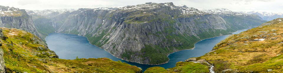
Nadgee Nature Reserve, NSW
Bidwell country
Distance: 69km Total Ascent: 3525m Total Descent: 3520m Time: 26 hours
Participants: Sue Davies (Leader), Steve Davies (Photos), Dave Whitelaw (Report)
Apart from this region being a World Biosphere Reserve, a big feature of this walk was that we had the whole place to ourselves (apart from two National Park rangers) late Monday afternoon saw us rendezvous with John, an old walking buddy from Wagga Wagga, at the NPWS cottage at the Merrica River Crossing near Wonboyn. Steve and Sue’s car was left here at the terminus of our walk; meanwhile the four of us motored south for an hour to the start of the walk at Mallacoota on the Victorian side.
Here we met up with John’s wife Geri, the final member of our party. Alas, despite a comfortable night spent in a van park, a stomach bug was to prevent Geri from joining us the next morning, which proved a good move as it turned out. John dropped out too, so now we were three.
Day 1: Tuesday 26/11/2013 Mallacoota – Lake Baracoota
Max elevation: 45 m
Total climbing: 445 m
Total descent: -447 m
Average speed: 4.14 km/h
Total time: 06:17:08
We met up with our pre-arranged boat operator for an 8.15am start from the Karbeethong jetty for a relaxed 45 minute trip across the inlet to the site of a former hotel. By going this way we were to miss out on some beach walking from the inlet’s mouth, but instead we soon came across a 1km section of drowned track, which averaged 30cm deep in murky tannin coloured water.

Sue & Dave crossing Howe Flat
A few kilometres along the beach and we came to the turn-off to Lake Barracoota, the largest fresh water coastal lake in Victoria and where we were to spend the night. A kilometre inland over a large sand dune “blow-out” brought us to an idyllic camp site beside the lake. Expansive views looking north beyond Gabo Island and south into Croajingalong National Park were obtained from a sand ridge high above the beach. As we looked about for wildlife, we found intriguing sand tracks, one of which was a humble beetle. That evening and the next, Steve set up his camera for star tracking, with impressive results. The day was also marked by the beginning of the tick “invasion” or “the attack of the ticks”, which got onto all of us but which gave Dave a painful “nip” right then. Vaseline was liberally spread over subsequent well fastened ticks to suffocate them, before extracting.
Day 2: Wednesday 27/11/2013 Lake Baracoota – Nadgee Lake
Max elevation: 47 m
Total climbing: 585 m
Total descent: -571 m
Average speed: 3.90 km/h
Total time: 07:41:43

Looking South from near Gabo Island
Back on the beach there followed a 15km walk towards the border, into a strong pleasant north easterly breeze. Points of interest included the remains of the SS Riverina, sighting of whale spouts near Gabo Island, numerous dead shearwater birds, which we saw every day and more ship wreckage especially at the border itself. Some water was collected at Bunyip Hole campsite but we pushed on to Nadgee Lake campsite a couple of kilometres inland. The lake water was salty as the intervening sand bar was over-washed by the ocean. Tired as we were from a long day, we set off in search of water and after one false start, found a shallow pool barely trickling into the lake, 100m away to the east of camp. Apart from the NPWS site, only one other site has permanent water on the walk, while the rest are shown as unreliable. However rain had fallen in the previous week, so we were spared. Not bad, considering this had been planned months before.
Other highlights were two goannas; a green endangered Ground Parrot (we were to see another on day 3); a rare Eastern Bristlebird and a baby seal on the beach with a dodgy eye and which appeared worn out except it could still raise its head and give a couple of hops. It looked forlorn as we departed.
Day 3: Thursday 28/11/2013 Nadgee Lake – Newtons Beach
Max elevation: 69 m
Total climbing: 1356 m
Total descent: -1345 m
Average speed: 3.42 km/h
Total time: 07:33:24
This was mainly inland except near Nadgee Beach, where we ran into two National Park rangers tracking deer with the intent to eradicate them. We’d earlier been informed of helicopter activity and here was the reason, as they were airlifted in and out. One of their first questions, apart from “have we seen deer?” was “have we got any ticks yet?” One fellow had 17 ticks and counting.

Passing through Endeavor Moor
Osprey Lookout with its scenic views of the cliff line, was a short deviation, made longer by our other ramblings on the clifftops. We did another side trip of a few kilometres return, without packs, to permanent water on the Nadgee River and to the 1916 Harry’s Hut, now probably used for research. With water replenished, we pushed on to Newtons Beach campsite, in short-cropped grassy meadows. Here we found a running stream 500m away and the beach for a cooling swim, a similar distance the other way. Sue and Steve found more ticks, including inside the tent and Sue even extracted one in the middle of the night. Steve and Dave had already tweezer-ed more off. That night the skies opened up with rain and the wind blew wildly but it was calm and dry by morning.
Day 4: Friday 29/11/2013 Newtons Beach – Merrica River NPWS cottage
Max elevation: 263 m
Total climbing: 1139 m
Total descent: -1153 m
Average speed: 3.82 km/h
Total time: 04:50:14
A walk along to the north end of the beach brought us to a fabulous sea cavern with two entrances that Steve had read about on a blog site. It didn’t rate a mention in NPWS literature, probably because of risk takers attempting it at higher tides. It was one highlight of the trip and justified our attempts to walk along the beaches at lower tides.

Sue & Dave crossing Howe Flat
A long 220m rise in elevation towards Tumbledown Lookout, up a wide fire trail warmed us up, despite the intermittent drizzling rain. We decided to deviate along the Merrica Entrance Fire Trail and then along the Merrica River Nature Trail for some added scenery. An early lunch while the sun shone (and ’cause of hunger pangs) was in order. After a pleasant running creek and a small waterfall on the nature trail, we were soon at the Merrica River NPWS cottage around midday and still saw no sign of life. A wade across the causeway and we were at the car.
Other interesting wildlife were; two black snakes (one large); three Superb Lyre Birds; two bush rats; a party of skinks having a feast of insects; many swans at Nadgee Lake; Oystercatchers (Pied and Sooty); pelicans; Grey Fantails (flirty and full of display); Yellow-tailed Black Cockatoos; two tortoises on the road out and only one ‘roo near the start, though plenty of scats in the meadows.
We were fortunate to have cooler temperatures for late November especially considering recent heat. All up we walked close to 70km, with the longest day of 21km and shortest 10km (uphill) . It was a rewarding two full and two half-day walk or a hurried three day one and not least because it was during the working week. It’s tough being retired.
Additional information from a National Parks sign at Merrica River Trailhead
“Importance of Nadgee
Nature reserves are natural areas of special scientific interest established to conserve their native plant and animal communities.
Unlike national parks, they do not provide visitor facilities.
Nadgee Nature Reserve, the only coastal wilderness in NSW joins the Cape Howe Wilderness in Victoria. Together, they form part of the largest unmodifed coastal area in south east Australia and are recognised as a World Biosphere Reserve.
The entire catchments of six major coastal streams lie within this wilderness. These catchments are amongst the least disturbed on the eastern seaboard.
Nadgee is home to a significant array of threatened wildlife including the eastern bristlebird, ground parrot, powerful, masked and sooty owls, hooded plover, long-nosed potoroo, yellow bellied glider, southern brown bandicoot, spotted tailed quoll and large-footed mouse eared bat.
Merrica River is the walkers departure point to the Nadgee Wilderness.
The wilderness offers a unique coastal walking experience for skilled hikers, with opportunities to explore remote beaches, tranquil lagoons, diverse heathlands and forest communities teeming with wildlife. In an effort to protect the wilderness coastline, NSW National Parks & Wildlife Service (NPWS) and Parks Victoria use a permit system to manage the number of walkers to minimise visitor impact on these remote areas.
A diverse coastline
The variety of landscapes along the coast is one of the many highlights of the walk. Landscapes include dramatic coastal cliffs, shore platforms, sand and boulder beaches, sea caves, estuaries, coastal lagoons and Cape Howe’s spectacular sand dune formations.
The bare dunes of Cape Howe extend inland for kilometres in some locations. These rolling sand dunes evoke the feel of a desert landscape after walking through adjoining forests and heaths. The mosaic of Nadgee’s landscapes are vital to its biological integrity.
Merrica River Nature Trail
If you only have a day to experience the beauty of Nadgee Nature Reserve, take the 4 kilometre walk to the mouth of Merrica River. Commencing 200 metres past the Rangers Station, the nature trail takes you across a small creek with a waterfall and a rockpool, through tall eucalypt forests and small dense shrubland before opening up onto a stunning white sandy beach.
Merrica River meanders along sandbars flowing through a sandy channel at the southern end of the beach into the expanse of Disaster Bay. Surrounded by red rocky headlands, Merrica River is a place of reflection and solitude.
Distance: 8km return Grade: gentle to moderate Time: 3 hours
Permit system
The maximum number of hikers in the Nadgee Howe Wilderness area is 30 people at a time.
Walkers staying overnight or those who camp using watercraft for access require a permit. Applications for permits are available at the NPWS office, Merimbula or may be downloaded from NPWS website. Bookings are recommended for peak periods.
Wilderness areas are places for nature where people are occasional and respectful visitors.
Taking care
• When nature calls whilst in the bush, please dig a 15cm deep hole and bury faeces (including paper). Make sure you are at least 100m away from all water courses, campsites and tracks.
• Try to avoid using soaps and detergents. If you must use them, ensure you are at least 50m away
from any watercourses even toothpaste pollutes.
• Take all your rubbish out with you; do not bury or burn.
• Carry in – carry out.
Camping
• Fires are not permitted from December through to March. This may be extended during times of drought please check with NPWS.
• Use a fuel stove when cooking. They are faster, easier to use in wet weather and don’t leave scars on the landscape. Gathering and burning wood causes damage to the environment.
• Do not cut, clear or destroy any vegetation.
When walking in wilderness
• Do not expect signs, track markers or surface modification.
• No facilities are provided.
• Keep to the tracks.
• Safety barriers and warning signs are not provided along cliff edges or other hazardous features.
• Walkers are expected to be sufficiently self reliant to deal with any emergency or sudden weather change.
• Plan your walking times so you can set up camp before dark.”
Clickable icons on a world map which open the related trip report
A detailed, searchable trip list with links to reports, photo galleries and other content
![]()
Hi guys,
We just returned from this trip yesterday and followed your path almost exactly thanks to the GPX files we downloaded from this page and used in a mapping app on our phones. We carried paper maps too but it sure was easier in some places to just follow your red line. Thanks very much for the data and useful report!
We had a great time, and didn’t have any trouble finding water at this time of year. If we were to change anything it probably would have been to do a little more on Day 1, perhaps going as far as Lake Wau Waka. Although Lake Barracoota was lovely, it did set up a fairly massive day 2 and we may not be as fit as you 🙂 We also would have liked to camp at North Nadgee beach instead of Nadgee lake, but just couldn’t make it after 21km of beach/rock walking!
So for anyone else considering doing this walk, my suggested itinerary would be:
Mallacoota –> Lake Wau Wauka –> Nadgee Beach –> Newtons Beach –> Merrica River
My biggest regret is not removing my boots on the walk through Howe Flats on day 1 – they ended up wet which caused huge blister problems later on. I noticed you carried yours, what did you have on your feet?
Anyway thanks again for the info.
Ben, Martin & Paul
Hi Ben, Martin & Paul,
Glad to hear you had a great trip and we were of some assistance with info and GPX files.
We use very cheap, lightweight plastic Crocs for water crossings, although our feet did get very cold crossing the Snowy River last week!
Did you encounter many ticks as we did?
Cheers
Steve & Sue